Spojil
| Spojil | |||
| Village | |||
 View along main street towards northeast | |||
|
|||
| Country | Czech Republic | ||
|---|---|---|---|
| Region | Pardubice | ||
| District | Pardubice | ||
| Commune | Pardubice | ||
| Municipality | Pardubice | ||
| Elevation | 221 m (725 ft) | ||
| Coordinates | CZ 50°02′32″N 15°49′22″E / 50.04222°N 15.82278°ECoordinates: CZ 50°02′32″N 15°49′22″E / 50.04222°N 15.82278°E | ||
| Area | 1.75 km2 (0.68 sq mi) | ||
| Population | 342 (2006) | ||
| Density | 195/km2 (505/sq mi) | ||
| Founded | 1785 | ||
| Mayor | Jan Křivka | ||
| Timezone | CET (UTC+1) | ||
| - summer (DST) | CEST (UTC+2) | ||
| Postal code | 530 02 | ||
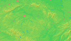
  Location in the Czech Republic | |||
| Wikimedia Commons: Spojil | |||
| Statistics: statnisprava.cz | |||
| Website: www.spojil.com | |||
Spojil is a village in Pardubice Region of the Czech Republic. It is located about 3 km east of city centre of Pardubice and has a population of 342 (2006). Spojil is quite young among Czech villages as it was founded in 1785 in place of two former fish ponds, named Spojil and Strejček. There is only one minor sight, the Assumption chapel, built in 1868.
The village was part of Pardubice city from 1961 until 1991.[1] Nowadays it is an enclave surrounded entirely by the city, situated between the neighbourhoods of Studánka and Staročernsko.
 View along the main street towards SW
 Assumption chapel from 1868
References
- ↑ Historický lexikon obcí České republiky 1869–2005. II. díl, Český statistický úřad, 2006 available online
External links
- Village website (cz)
| Wikimedia Commons has media related to Spojil. |
This article is issued from Wikipedia - version of the 4/7/2016. The text is available under the Creative Commons Attribution/Share Alike but additional terms may apply for the media files.

