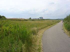
Squantum Point Park
| Squantum Point Park | |
| Metropolitan Park System of Greater Boston | |
 | |
| Country | United States |
|---|---|
| State | Massachusetts |
| County | Norfolk |
| Municipality | Quincy |
| Elevation | 0 ft (0 m) [1] |
| Coordinates | 42°18′00″N 71°02′20″W / 42.30000°N 71.03889°WCoordinates: 42°18′00″N 71°02′20″W / 42.30000°N 71.03889°W [1] |
| Area | 46 acres (19 ha) [2] |
| Opened | 2001 |
| Management | Massachusetts Department of Conservation and Recreation |
|
Location in Massachusetts | |
| Website: Squantum Point Park | |
Squantum Point Park is a state-owned, public recreation area located on the Squantum peninsula of Quincy, Massachusetts. Managed by the Massachusetts Department of Conservation and Recreation, the park occupies the site of the former Squantum Naval Air Station (all that remains of the military installation is 2,700 feet of runway).[3] The park is associated with the development of the Neponset River Reservation.[4]
Activities and amenities
Squantum Point is the eastern terminus of the Quincy RiverWalk, a 2-mile trail along the Quincy side of the Neponset River Estuary.[5] The park provides views of the Boston skyline and opportunities for picnicking, canoeing, bird watching, and shoreline fishing as well as paths for running and in-line skating.[3]
References
- 1 2 "Squantum Point". Geographic Names Information System. United States Geological Survey.
- ↑ "2012 Acreage Listing" (PDF). Department of Conservation and Recreation. April 2012. Retrieved September 25, 2015.
- 1 2 "Squantum Point Park". MassParks. Executive Office of Energy and Environmental Affairs. Retrieved September 7, 2013.
- ↑ "Neponset River Reservation". MassParks. Executive Office of Energy and Environmental Affairs. Retrieved September 7, 2013.
- ↑ "Neponset River Reservation: Quincy Riverwalk". MassParks. Executive Office of Energy and Environmental Affairs. Retrieved September 25, 2015.
External links
| Wikimedia Commons has media related to Squantum Point Park. |
- Squantum Point Park Massachusetts Department of Conservation and Recreation
- NAS Squantum, Massachusetts
- Naval Air Station Squantum (historical) USGS Boston South Quad, Massachusetts, Topographic Map
- River Bank Destruction, Squantum Point , Neponset River
This article is issued from Wikipedia - version of the 11/28/2016. The text is available under the Creative Commons Attribution/Share Alike but additional terms may apply for the media files.
