Taylor Field (Florida)
| Taylor Field | |
|---|---|
|
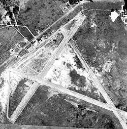
1949 airphoto | |
| IATA: none – ICAO: none | |
| Summary | |
| Serves | Ocala, Florida |
| Coordinates | 29°10′00″N 082°10′00″W / 29.16667°N 82.16667°W |
| Map | |
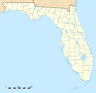
 Location of Taylor Field | |
Taylor Field is a former airport and military airfield located near Ocala, Florida. It was closed in 1962 and replaced by Ocala International Airport-Jim Taylor Field It is now an industrial park.
History
Opened about 1933 as a municipal airport near Ocala. The airport had 2 paved runways, with the longest being the 3,900' northeast/southwest strip. A paved taxiway led to a paved ramp on the north side of the field. Named Taylor Field for the original donor of the property, James Taylor.
Taken over by the United States Army Air Forces in November 1941 as a basic (level 1) pilot training airfield. Assigned to USAAF Southeast Training Center (later Eastern Flying Training Command). Conducted contract basic flying training by Greenville Aviation School.
Flying training was performed with Fairchild PT-19s as the primary trainer. Also had several PT-17 Stearmans and a few P-40 Warhawks assigned. The flight school also operated two auxiliary airfields in the local area. Over 5,000 cadets received primary flight training at the airport during World War II.
Inactivated 8 September 1944 with the drawdown of AAFTC's pilot training program and was declared surplus. Returned to civil control as a public airport until being replaced and closed in 1962. Today there is little evidence of its existence.
See also
References
| Wikimedia Commons has media related to Taylor Field (Airfield). |
![]() This article incorporates public domain material from the Air Force Historical Research Agency website http://www.afhra.af.mil/.
This article incorporates public domain material from the Air Force Historical Research Agency website http://www.afhra.af.mil/.
- Shaw, Frederick J. (2004), Locating Air Force Base Sites History’s Legacy, Air Force History and Museums Program, United States Air Force, Washington DC, 2004.
- Manning, Thomas A. (2005), History of Air Education and Training Command, 1942–2002. Office of History and Research, Headquarters, AETC, Randolph AFB, Texas ASIN: B000NYX3PC

