Phthiotic Thebes
Phthiotic Thebes (Greek: Θῆβαι Φθιώτιδες, Thebai Phthiotides) or Thessalian Thebes (Θῆβαι Θεσσαλικαἰ, Thebai Thessalikai) is an ancient city in Thessaly, Greece, north of the modern village of Mikrothivai.[1][2]
History
The city was located at the northern end of the ancient Krokian Plain, in the northern part of the Pagasetic Gulf. Evidence of human habitation on the site dates back to the Stone Age, but it was not until the 4th century BC that the city is first mentioned by name.[2] In the late 4th century BC, the city was joined (synoecism) with the neighbouring cities of Phylace and Pyrasos. The new conurbation retained the name of Phthiotic or Thessalian Thebes, and became the main city of the Phthiotic Achaean League until it joined the Aetolian League in the late 3rd century BC.[2] Professor John Grainger of the University of Birmingham concluded, from evidence relating to the election of men from Thebes to office in the Aetolian League, that the city became a member of the League in the 220s BCE.[3]
Until the construction of Demetrias by the Macedonians, the city was also the main harbour on the Pagasetic Gulf. As a bastion of the Aetolians, it was besieged and captured by Philip V of Macedon in 217 BC. The inhabitants were enslaved, and the city became a Macedonian colony.[2][4] Polybius tells how Philip laid siege to the city, first building three camps and then joining them up with lines of circumvallation. Though initially the city offered determined resistance the citizens surrendered when a section of the wall that Philip had mined collapsed.[5]
Following Philip's defeat by the Roman Republic in the Second Macedonian War, in 189 BC Phthiotic Thebes again became capital of the restored Phthiotic Achaean League. Under the Roman Empire, the city was moved from the inland site of the old Phthiotic Thebes back to Pyrasos. The old site was not abandoned, but for the remainder of the city's existence, its centre lay at the site of Pyrasos, where the harbour was also located.[2] In Late Antiquity, it became part of the province of Thessaly, of which it was the third-most important city and main harbour. The city's prosperity from the 4th through the 6th centuries is attested by the number of its Early Christian monuments, but was brought to an end in a great fire in the late 7th century that destroyed the city. The city was rebuilt and apparently continued to be of some note in the early Byzantine period—its bishop is last mentioned in the 8th/9th century—but never recovered and was eventually eclipsed by the nearby port city of Halmyros.[1]
Archaeological remains

According to the Oxford Dictionary of Byzantium, the site "is best known because of the many churches excavated there (nine basilicas have been found)". These include:[1]
- Basilica A, a three-aisled basilica from the late 5th/early 6th century, dedicated to Saint Demetrius, which served as the cathedral church.
- Basilica B, or "Elpidios Basilica", also dating roughly to the late 5th/early 6th century.
- Basilica C, also known "Church of the archiereus Peter" based on a mid-6th century inscription, although it dates to the late 4th/early 5th century. It features "elaborate floor mosaics and is part of a vast ecclesiastical complex".
- Basilica D, a 7th-century cemetery church outside the city walls.
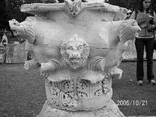
The original acropolis of Phthiotic Thebes was ringed by a Cyclopean wall. The later wall of the lower city is still largely extant, although in a ruined state. It features 40 towers and dates, according to Friedrich Stählin (Das hellenische Thessalien, 1924), to the 4th century BC.[2] Excavations on the acropolis have produced the foundations of a 9x12 m Classical-era temple, possibly dedicated to Athena Polias. This in turn was built with material from an earlier temple.[2] In the lower city, the remains of the ancient theatre and a Hellenistic stoa can still be seen.[2] Most of the finds are in the Archaeological Museum of Volos, with a few in the Almyros Museum.[2]
References
- 1 2 3 Gregory, Timothy E. (1991). "Nea Anchialos". In Kazhdan, Alexander. The Oxford Dictionary of Byzantium. London and New York: Oxford University Press. p. 1446. ISBN 978-0-19-504652-6.
- 1 2 3 4 5 6 7 8 9 T.S. MacKay (1976). "PHTHIOTIC THEBES Achaia Phthiotis, Greece". The Princeton encyclopedia of classical sites. Princeton University Press. Retrieved 20 September 2015.
- ↑ John D. Grainger, The League of the Aitolians (p.239), Brill (1999) ISBN 90-04-10911-0
- ↑ Getzel M. Cohen, The Hellenistic Settlements in Europe, the Islands, and Asia Minor, p. 118, University of California Press (1995) ISBN 0-520-08329-6
- ↑ Polybius • Histories — Book 5
Coordinates: 39°16′08″N 22°45′29″E / 39.26889°N 22.75806°E