Town of Gawler
| Town of Gawler South Australia | |||||||||||||
|---|---|---|---|---|---|---|---|---|---|---|---|---|---|
 | |||||||||||||
| Population | 22,618 (2015 est)[1] | ||||||||||||
| • Density | 550.3/km2 (1,425.3/sq mi) | ||||||||||||
| Area | 41.1 km2 (15.9 sq mi) | ||||||||||||
| Mayor | Karen Redman | ||||||||||||
| Council seat | Gawler | ||||||||||||
| Region | Barossa, Light and Lower North[2] | ||||||||||||
| State electorate(s) | Light | ||||||||||||
| Federal Division(s) | Wakefield | ||||||||||||
 | |||||||||||||
| Website | Town of Gawler | ||||||||||||
| |||||||||||||
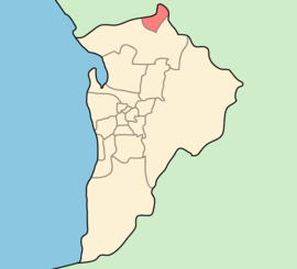
The Town of Gawler is a local government area located north of Adelaide city centre in South Australia containing Gawler and its suburbs. The Corporation of the Town of Gawler was established on 9 July 1857 as the residents were not happy that the town area was covered by three different district councils. The Town of Gawler is located within the officially declared boundaries of the Adelaide metropolitan area.[3] The 2001 census of the Town of Gawler LGA determined that 1.0% of the population were Indigenous Australian, and 76.3% were born in Australia. The current Mayor of Gawler is Karen Redman (elected November 2014) who is the first elected female mayor in the town's history.
Council
The current council as of June 2016 is:[4]
| Ward | Party[5] | Councillor | Notes | |
|---|---|---|---|---|
| Mayor | Independent | Karen Redman | ||
| Unsubdivided | Labor | Adrian Shackley | ||
| Independent | Beverly Gidman | |||
| Independent | David Hughes | Deputy Mayor | ||
| Independent | Ian Tooley | |||
| Independent | Jim Vallelonga | |||
| Independent | Kevin Fischer | |||
| Independent | Merilyn Nicolson | |||
| Independent | Paul Koch | |||
| Independent | Robin Symes | |||
| Vacant | ||||
Suburbs
- Bibaringa (5118)
- Evanston (5116)
- Evanston Gardens (5116)
- Evanston Park (5116)
- Evanston South (5116)
- Gawler (5118)
- Gawler East (5118)
- Gawler South (5118)
- Gawler West (5118)
- Hillier (5116)
- Kudla (5115) and
- Willaston (5118)
See also
References
- ↑ "3218.0 – Regional Population Growth, Australia, 2014–15". Australian Bureau of Statistics. Retrieved 29 September 2016.
- ↑ "Barossa, Light and Lower North" (PDF). Department of Planning, Transport and Infrastructure. Retrieved 24 June 2015.
- ↑ "Adelaide metropolitan boundary (as declared on 11 November 1993)" (PDF). Government of South Australia. Retrieved 24 June 2015.
- ↑ "Council Members". Town of Gawler. Town of Gawler. Retrieved 6 June 2016.
- ↑ "Council Member Register of Interest" (PDF). Retrieved 6 June 2016.
External links
Coordinates: 34°36′S 138°45′E / 34.600°S 138.750°E