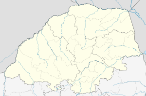
Tshamahansi
| Tshamahansi | |
|---|---|
 Tshamahansi 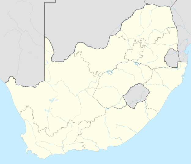 Tshamahansi  Tshamahansi
| |
| Coordinates: 24°04′41″S 28°58′44″E / 24.078°S 28.979°ECoordinates: 24°04′41″S 28°58′44″E / 24.078°S 28.979°E | |
| Country | South Africa |
| Province | Limpopo |
| District | Waterberg |
| Municipality | Mogalakwena |
| Area[1] | |
| • Total | 6.21 km2 (2.40 sq mi) |
| Population (2011)[1] | |
| • Total | 14,274 |
| • Density | 2,300/km2 (6,000/sq mi) |
| Racial makeup (2011)[1] | |
| • Black African | 99.8% |
| • Indian/Asian | 0.1% |
| First languages (2011)[1] | |
| • Tsonga | 75.9% |
| • Northern Sotho | 15.9% |
| • S. Ndebele | 4.3% |
| • Other | 3.9% |
| PO box | 0659 |
Tshamahansi is a large, populated semi-urban rural township in the Mogalakwena Local Municipality of the Capricorn District Municipality of the Limpopo province in South Africa. It's located about 15,1 km north of the town of Mokopane on the N11 road.[2]
References
Municipalities and communities of Waterberg District Municipality, Limpopo | ||
|---|---|---|
District seat: Modimolle | ||
| Thabazimbi | .svg.png) | |
| Lephalale | ||
| Mookgophong | ||
| Modimolle | ||
| Bela-Bela | ||
| Mogalakwena | ||
This article is issued from Wikipedia - version of the 11/19/2016. The text is available under the Creative Commons Attribution/Share Alike but additional terms may apply for the media files.