Tyndale Monument

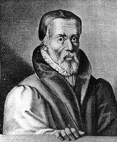
The Tyndale Monument is a tower built on a hill at North Nibley, Gloucestershire, England. It was built in honour of William Tyndale, a translator of the New Testament, who is believed to have been born at North Nibley.
The tower was constructed in 1866 and is 111 ft (34 m) tall. It is possible to enter and climb to the top of the tower, up a spiral staircase of 121 steps. The hill it is on allows a wide range of views, especially looking down to the River Severn A nearby topograph points to some other landmarks visible. The hill on which the monument stands is quite steep. There are two main paths, one which goes up steep steps, or one that follows a rough slope. The tower itself is surrounded by fencing and has floodlights that light up the tower at night. The Cotswold Way long-distance footpath passes the foot of the monument, and then descends the hill into North Nibley.
The door to the tower is normally unlocked on weekends, otherwise you can get the key from the village shop.[1] A deposit is required for borrowing the key and there is a nominal admission charge.[2] Locally, it is commonly called Nibley Monument (or sometimes Nibley Knob) rather than its official name.
There is a plaque on the front of the tower. The text engraved on it reads:

- ERECTED A.D. 1866
- IN GRATEFUL REMEMBRANCE OF
- WILLIAM TYNDALE
- TRANSLATOR OF THE ENGLISH BIBLE
- WHO FIRST CAUSED THE NEW TESTAMENT
- TO BE PRINTED IN THE MOTHER TONGUE
- OF HIS COUNTRYMEN
- BORN NEAR THIS SPOT HE SUFFERED
- MARTYRDOM AT VILVORDEN IN
- FLANDERS ON OCT 6 1536
The monument is a landmark that can be seen for miles, even in places as far as Bristol over 20 miles away. In the town of Thornbury there is a street called Tyndale View where the tower can be seen from approximately 10 miles away.
Further down the Cotswold Edge, at Hawkesbury, is the Somerset Monument, erected in 1846, and the design of the Tyndale tower has features in common with this.
References
- ↑ "Tyndale Monument - Places of Interest". Gloucestershire County Council. Retrieved 29 April 2011.
- ↑ "Wotton-under-Edge and Tyndale monument". Walk Scene. Retrieved 29 April 2011.
External links
Coordinates: 51°39′31.9″N 2°22′21.4″W / 51.658861°N 2.372611°W