Volda (village)
| Volda | |
|---|---|
| Village | |
|
View of the village | |
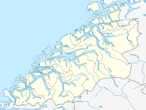
 Volda  Volda Location in Møre og Romsdal | |
| Coordinates: 62°08′45″N 06°04′15″E / 62.14583°N 6.07083°ECoordinates: 62°08′45″N 06°04′15″E / 62.14583°N 6.07083°E | |
| Country | Norway |
| Region | Western Norway |
| County | Møre og Romsdal |
| District | Sunnmøre |
| Municipality | Volda Municipality |
| Area[1] | |
| • Total | 3.6 km2 (1.4 sq mi) |
| Elevation[2] | 9 m (30 ft) |
| Population (2013)[1] | |
| • Total | 6,114 |
| • Density | 1,698/km2 (4,400/sq mi) |
| Time zone | CET (UTC+01:00) |
| • Summer (DST) | CEST (UTC+02:00) |
| Post Code | 6100 Volda |
Volda is the administrative centre of Volda Municipality in Møre og Romsdal county, Norway. The village is located on the northeastern shore of the Voldsfjorden, just less than 10 kilometres (6.2 mi) south of the village of Ørsta. The 3.6-square-kilometre (890-acre) village has a population (2013) of 6,114; giving the village a population density of 1,698 inhabitants per square kilometre (4,400/sq mi).[1][3]
Volda University College is one of 25 university colleges in Norway. Volda University College enrolls about 3,000 students and specializes in education of teachers, animators, documentarists, and journalists. The village is home to the municipal administration, municipal schools, and the regional hospital. It has a shopping center as well as some industry. Volda Church is located in the central part of the village. The local newspaper is Avisa Møre.
The Ørsta-Volda Airport, Hovden lies between the two villages of Volda and Ørsta, along the European route E39 highway which runs through both villages. There are also ferry connections from Volda to Lauvstad and Folkestad, across the Voldsfjorden.
References
- 1 2 3 Statistisk sentralbyrå (1 January 2013). "Urban settlements. Population and area, by municipality.".
- ↑ "Volda" (in Norwegian). yr.no. Retrieved 2013-08-17.
- ↑ Store norske leksikon. "Volda – tettstedet" (in Norwegian). Retrieved 2013-08-17.
