Ware Mounds and Village Site
|
Ware Mounds and Village Site | |
 | |
  | |
| Location | West of the junction of Illinois Route 3 and Illinois Route 146 |
|---|---|
| Nearest city | Ware, Illinois |
| Coordinates | 37°26′47″N 89°24′00″W / 37.44639°N 89.40000°WCoordinates: 37°26′47″N 89°24′00″W / 37.44639°N 89.40000°W |
| Area | 160 acres (65 ha) |
| NRHP Reference # | 77000490[1] |
| Added to NRHP | October 18, 1977 |
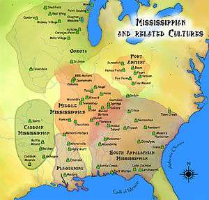
The Ware Mounds and Village Site, located west of Ware, Illinois, is an archaeological site comprising three mounds and a 160-acre (65 ha) village site. The site was inhabited by the Late Woodland and Mississippian cultures from c. 800 to c. 1300. The village is one of the only Mississippian villages known to have existed in the Mississippi River valley in Southern Illinois. As the village was located near two major sources of chert, which Mississippian cultures used to make agricultural tools, it was likely a trading center for the mineral.[2]
The first of the site's three mounds is 200 feet (61 m) in diameter. The graves of indigenous peoples have been found in this mound, which was later used as a cemetery by European settlers. The second mound is 75 feet (23 m) in diameter, while the third is 250 feet (76 m) long and 150 feet (46 m) wide. A fourth mound, which was smaller than the other three, was originally located at the site but was demolished by the construction of Illinois Route 3.[2]
The site was added to the National Register of Historic Places on October 18, 1977.[1]
See also
References
- 1 2 National Park Service (2010-07-09). "National Register Information System". National Register of Historic Places. National Park Service.
- 1 2 Maruszak, Kathleen. National Register of Historic Places Inventory - Nomination Form: Ware Mounds and Village Site. National Park Service, 1976-11.
