Wenderholm Regional Park
| Wenderholm Regional Park | |
|---|---|
|
Wenderholm beach to north | |
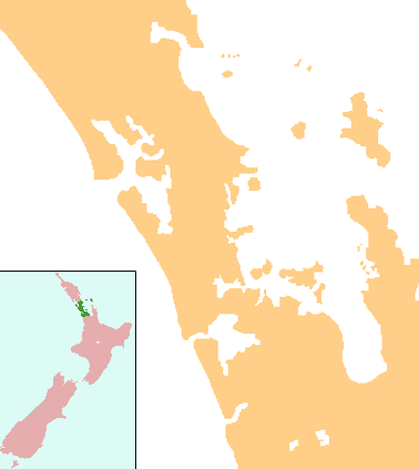
 Map of Auckland Region | |
| Location | Auckland Region, North Island, New Zealand |
| Nearest city | Waiwera |
| Coordinates | 36°32′13″S 174°42′36″E / 36.537°S 174.71°E[1]Coordinates: 36°32′13″S 174°42′36″E / 36.537°S 174.71°E[2] |
| Established | 1965 |
| http://regionalparks.aucklandcouncil.govt.nz/wenderholm | |
Wenderholm Regional Park is the first regional park of the Auckland Region, New Zealand. Situated between the estuaries of the Puhoi River and the Waiwera River, on the east coast of New Zealand's North Island, the park features a homestead known as Couldrey House, and a carved pouwhenua.[3] This park also features the 2 kilometres (1.2 mi) 'Maungatauhoro Te Hikoi' walking track, starting at the carved pouwhenua near the Couldrey House. This walking track allows visitors to see scenic views and birdlife.[4][5] The park has its own resident artist, and part is sectioned off for ecological restoration.
History
For approximately 1000 years Maori lived in the area now encompassed by the park because it featured several natural resources. The Auckland politician and entrepreneur Sir Robert Graham protected many of the ancient trees in the area from felling to be used for timber for ships.[6] He went on to build a homestead in the park (now known as the Couldrey House). Many of the historic trees in the park were given as gifts to Robert Graham from George Grey.[3]
The park has a resident artist, Nic Moon, provided by Auckland Regional Council. Her role is to create works specifically for the site, including some that involve the trees themselves.[6]
Ecological restoration

A 60 hectares (150 acres) section of the park has been set aside since 1965 for an ecological experiment, stopping livestock from grazing and repopulating the forests. This allowed native species of birds which were no longer in the area to be re-introduced in 1999. One of the first species released into the area Petroica australis longipes (North Island robins) has a generally high rate of survival and procreated a good number of young, unfortunately not high enough to compensate for the loss of the adult population.[7] Whales such as Southern Right Whales may appear to rest and calve along the coasts. Dolphins may be visible from the shores as well.
Native trees
The native bush of the park is the Pohutukawa, with the blaze of red in the summer, on the slopes facing north is the Kowhai bush which are covered with yellow blooms in the spring, and the low-laying sandspit.[3][8]
References
- ↑ "Wenderholm Map" (PDF). Auckland Council. Retrieved 15 May 2012.
- ↑ "Wenderholm Map" (PDF). Auckland Council. Retrieved 15 May 2012.
- 1 2 3 "Wenderholm". Auckland Council. Retrieved 1 September 2011.
- ↑ Auckland Regional Park about Maungatauhoro
- ↑ Maungatauhoro Te Hikoi at scoopnews
- 1 2 Gregory, Angela (3 May 2008). "Moon shines in regional park". New Zealand Herald. Retrieved 6 September 2011.
- ↑ Lovegrove, TG; Zeiler,CH; Green,BS; Green,BW; Gaastra,R and MacArthur,AD (2002). "Alien plant and animal control and aspects of ecological restoration in a small 'mainland island':Wenderholm Regional Park, New Zealand". Turning the tide: the eradication of invasive species : proceedings of the International Conference on Eradication of Island Invasives: 155–163. ISBN 2-8317-0682-3.
- ↑ "Hauraki Gulf Review". Retrieved 27 September 2011.
