Črneča Vas
| Črneča Vas | |
|---|---|
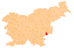
 Črneča Vas Location in Slovenia | |
| Coordinates: 45°49′41.84″N 15°27′31.82″E / 45.8282889°N 15.4588389°ECoordinates: 45°49′41.84″N 15°27′31.82″E / 45.8282889°N 15.4588389°E | |
| Country |
|
| Traditional region | Lower Carniola |
| Statistical region | Lower Sava |
| Municipality | Kostanjevica na Krki |
| Area | |
| • Total | 5.84 km2 (2.25 sq mi) |
| Elevation | 375.7 m (1,232.6 ft) |
| Population (2002) | |
| • Total | 141 |
| [1] | |
Črneča Vas (pronounced [tʃəɾˈneːtʃa ˈʋaːs]; German: Scheerendorf[2]) is a settlement in the Municipality of Kostanjevica na Krki in eastern Slovenia. It lies in the Gorjanci hills close to the border with Croatia. The area was traditionally part of Lower Carniola. It is now included in the Lower Sava Statistical Region.[3]
The local church, built on a hill northwest of the main settlement, is dedicated to Saints Hermagoras and Fortunatus and belongs to the Parish of Kostanjevica na Krki. It has a rectangular barrel vaulted nave with a three-sided apse and dates to the late 16th century.[4]
References
- ↑ Statistical Office of the Republic of Slovenia
- ↑ Leksikon občin kraljestev in dežel zastopanih v državnem zboru, vol. 6: Kranjsko. 1906. Vienna: C. Kr. Dvorna in Državna Tiskarna, p. 70.
- ↑ Kostanjevica na Krki municipal site
- ↑ Slovenian Ministry of Culture register of national heritage reference number ešd 1915
External links
| Settlements | Administrative centre: Kostanjevica na Krki
|  | ||||||
|---|---|---|---|---|---|---|---|---|
| Landmarks |
| |||||||
This article is issued from Wikipedia - version of the 1/3/2016. The text is available under the Creative Commons Attribution/Share Alike but additional terms may apply for the media files.