Adamsburg, Alabama
| Adamsburg, Alabama | |
|---|---|
| Unincorporated community | |
 Adamsburg Location within Alabama | |
| Coordinates: 34°23′56″N 085°40′20″W / 34.39889°N 85.67222°WCoordinates: 34°23′56″N 085°40′20″W / 34.39889°N 85.67222°W [1] | |
| Country | United States |
| State | Alabama |
| County | DeKalb |
| Elevation[1] | 1,467 ft (447 m) |
| Time zone | Central (CST) (UTC-6) |
| • Summer (DST) | CDT (UTC-5) |
| ZIP code | 35967 |
| Area code(s) | 256 |
| GNIS ID[1] | 150061 |
Adamsburg is an unincorporated community located on Lookout Mountain in eastern DeKalb County, Alabama, United States,[1] southeast of the county seat of Fort Payne, and just west of Little River Canyon.
History
Adamsburg was named for Simon Russell Canfield Adams, a minister from Fort Payne who donated land for a school in the community. A post office was established in Adamsburg in 1902, but it has since closed.[2]
Geography
Adamsburg is located at 34°23′56″N 085°40′20″W / 34.39889°N 85.67222°W. Its average elevation is 1,467 feet (447 m) above sea level.[1]
References
- 1 2 3 4 5 "Feature Detail Report for: Adamsburg (DeKalb County, Alabama)". Geographic Names Information System. United States Geological Survey. Retrieved January 8, 2013.
- ↑ Foscue, Virginia. Place Names in Alabama. University: U of Alabama P, 1989.
Municipalities and communities of DeKalb County, Alabama, United States | ||
|---|---|---|
| Cities | 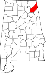 | |
| Towns | ||
| Unincorporated communities | ||
| Ghost towns | ||
| Footnotes | ‡This populated place also has portions in an adjacent county or counties | |
This article is issued from Wikipedia - version of the 12/31/2015. The text is available under the Creative Commons Attribution/Share Alike but additional terms may apply for the media files.