Arundel, Queensland
| Arundel Gold Coast, Queensland | |||||||||||||
|---|---|---|---|---|---|---|---|---|---|---|---|---|---|
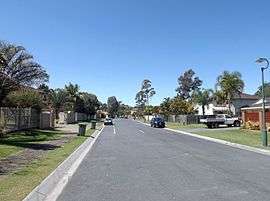 Greenacre Drive, 2015 | |||||||||||||
| Population | 9,575 (2011 census)[1] | ||||||||||||
| Postcode(s) | 4214 | ||||||||||||
| LGA(s) | City of Gold Coast | ||||||||||||
| State electorate(s) | Southport | ||||||||||||
| Federal Division(s) | Fadden | ||||||||||||
| |||||||||||||
Arundel is a suburb in City of Gold Coast, Queensland, Australia.[2] At the 2011 census, Arundel had a population of 9,575.[1]
Geography
Located in the suburb is the Coombabah Lake Conservation Park, bordered by Coombabah Creek and adjacent to the Ivan Gibbs Wetlands Reserve in Coombabah. The Biggera Creek Dam is located in Arundel, for the purpose of flood mitigation.
Education
Arundel State School and A.B.Paterson College are the two schools in Arundel. Nearby Griffith University is situated in the adjacent suburb of Southport.
Amenities
Situated nearby is the Arundel Hills Country Club, which has its own golf course. Other major facilities are located in adjacent suburbs, including Helensvale railway station and Westfield Helensvale (Helensvale), Harbour Town Shopping Centre (Biggera Waters) and Griffith University, Gold Coast University Hospital and the G:link light rail service.
Demographics
In the 2011 census, Arundel recorded a population of 9,575 people, 51.7% female and 48.3% male.[1] The median age of the Arundel population was 36 years, 1 year below the national median of 37. 60.9% of people living in Arundel were born in Australia. The other top responses for country of birth were New Zealand 9.7%, England 5.5%, China 1.3%, South Africa 1.2%, Korea, Republic of 1.2%. 80% of people spoke only English at home; the next most common languages were 1.6% Korean, 1.5% Mandarin, 1.2% Japanese, 0.8% Cantonese, 0.5% Greek.
See also
References
- 1 2 3 Australian Bureau of Statistics (31 October 2012). "Arundel (State Suburb)". 2011 Census QuickStats. Retrieved 6 July 2014.
- ↑ "Arundel (entry 46024)". Queensland Place Names. Queensland Government. Retrieved 18 March 2014.
External links
Coordinates: 38°22′S 142°49′E / 38.367°S 142.817°E