Aztec, Arizona
| Aztec, Arizona | |
|---|---|
| Census designated place | |
 Aztec, Arizona Location of Aztec in Arizona | |
| Coordinates: 32°48′29″N 113°26′34″W / 32.80806°N 113.44278°WCoordinates: 32°48′29″N 113°26′34″W / 32.80806°N 113.44278°W | |
| Country | United States |
| State | Arizona |
| County | Yuma |
| Elevation[1] | 509 ft (155 m) |
| Time zone | Mountain (MST) (UTC-7) |
| • Summer (DST) | MST (UTC-7) |
| Area code(s) | 520 |
| FIPS code | 04-04930 |
| GNIS feature ID | 2582734 |
Aztec is a census designated place situated in Yuma County, Arizona. As of July 2015 it had an estimated population of 52.[2] It has an estimated elevation of 509 feet (155 m) above sea level.[1]
References
- 1 2 "Feature Detail Report for: Aztec". Geographic Names Information System. United States Geological Survey.
- ↑ "Aztec, AZ Profile: Facts, Map & Data". AZ Hometown Locator. Archived from the original on January 24, 2016. Retrieved January 24, 2016.
Municipalities and communities of Yuma County, Arizona, United States | ||
|---|---|---|
| Cities | 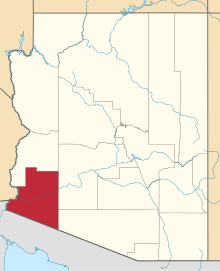 | |
| Town | ||
| CDPs |
| |
| Unincorporated communities | ||
| Indian reservations | ||
| Ghost towns | ||
| Footnotes | ‡This populated place also has portions in an adjacent county or counties | |
This article is issued from Wikipedia - version of the 10/23/2016. The text is available under the Creative Commons Attribution/Share Alike but additional terms may apply for the media files.