Baía de Tarrafal
| Baía de Tarrafal | |
|---|---|
|
Tarrafal Bay | |
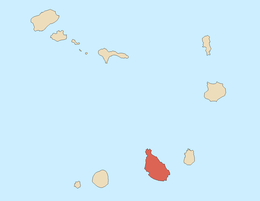
| Location | West of Tarrafal, Santiago, Cape Verde |
| Coordinates | 15°17′01″N 23°45′37″W / 15.2837°N 23.7602°W |
| Max. length | 2 km |
| Max. width | 1 km |
| Average depth | 5 meters |
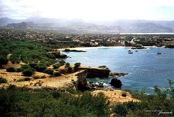
Baía de Tarrafal or Tarrafal Bay is a bay on the northwest coast of the island of Santiago in Cape Verde just west of the town of Tarrafal and inside the Atlantic Ocean. Its length is 2 km and its with is 3 km. Beside the bay in the east is Tarrafal Beach (Praia de Tarrafal) and alongside the northern part the foot of Monte Graciosa.[1] The bay receives its name to the town of Tarrafal. As to other Tarrafals in Cape Verde, the name refers to tamarisk plantations (genus Tamarix) grown in the area.

The bay features a beach 300 meters long located north of the city, the remainder of the bay has its shores with rocky cliffs. Hotels and villas lies in the east and the south of the bay. Ponta Preta is in the north of the bay, southeast on the mountain foot is a lighthouse of the same name The beach featured an abandoned fortress and a kiosk, also a stone house is alongside the beach. The beach are surrounded by Caeverdean palm trees..
The bay are surrounded since the 2010s by a forest of groves especially mango trees.
Fishing is common in the bay.
References
- ↑ "Municipality of Tarrafal" (in Portuguese).
| Wikimedia Commons has media related to Tarrafal Beach. |
Geography, features and topics of Santiago and the surrounding islets | ||
|---|---|---|
| Topics |
|  |
| Mountains |
| |
| Streams |
| |
| Points and promontories |
| |
| Reservoirs |
| |
| Other geographic features | ||
| History | ||
| Communities and settlements | 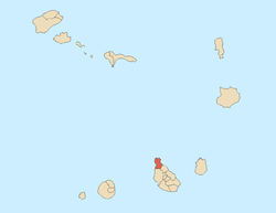 | |
|---|---|---|
| Geographical features | ||
| Landmarks and points of Interests |
| |
| Culture |
| |
Coordinates: 15°17′01″N 23°45′37″W / 15.2837°N 23.7602°W