Beaverville Township, Iroquois County, Illinois
| Beaverville Township | |
|---|---|
| Township | |
|
Fields west of Beaverville | |
 Location in Iroquois County | |
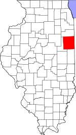 Iroquois County's location in Illinois | |
| Coordinates: 40°58′24″N 87°36′13″W / 40.97333°N 87.60361°WCoordinates: 40°58′24″N 87°36′13″W / 40.97333°N 87.60361°W | |
| Country | United States |
| State | Illinois |
| County | Iroquois |
| Established | September, 1921 |
| Area | |
| • Total | 37.72 sq mi (97.7 km2) |
| • Land | 37.71 sq mi (97.7 km2) |
| • Water | 0.01 sq mi (0.03 km2) 0.03% |
| Elevation | 636 ft (194 m) |
| Population (2010) | |
| • Total | 609 |
| • Density | 16.2/sq mi (6.3/km2) |
| Time zone | CST (UTC-6) |
| • Summer (DST) | CDT (UTC-5) |
| ZIP codes | 60912, 60931, 60964 |
| GNIS feature ID | 0428649 |

Beaverville Township is one of twenty-six townships in Iroquois County, Illinois, USA. As of the 2010 census, its population was 609 and it contained 269 housing units.[1] Beaverville Township formed from portions of Papineau Township and Beaver Township in September, 1921.
Geography
According to the 2010 census, the township has a total area of 37.72 square miles (97.7 km2), of which 37.71 square miles (97.7 km2) (or 99.97%) is land and 0.01 square miles (0.026 km2) (or 0.03%) is water.[1]
Cities, towns, villages
Unincorporated towns
- North Hooper at 40°57′02″N 87°36′25″W / 40.950589°N 87.606977°W
(This list is based on USGS data and may include former settlements.)
Cemeteries
The township contains Saint Mary's Cemetery.
School districts
- Donovan Community Unit School District 3
Political districts
- Illinois' 15th congressional district
- State House District 79
- State Senate District 40
References
- "Beaverville Township, Iroquois County, Illinois". Geographic Names Information System. United States Geological Survey. Retrieved 2010-01-17.
- United States Census Bureau 2007 TIGER/Line Shapefiles
- United States National Atlas
- 1 2 "Population, Housing Units, Area, and Density: 2010 - County -- County Subdivision and Place -- 2010 Census Summary File 1". United States Census. Retrieved 2013-05-28.
External links

Municipalities and communities of Iroquois County, Illinois, United States | ||
|---|---|---|
| Cities | ||
| Villages | ||
| Townships | ||
| Unincorporated communities |
| |
| Footnotes | ‡This populated place also has portions in an adjacent county or counties | |
This article is issued from Wikipedia - version of the 10/29/2016. The text is available under the Creative Commons Attribution/Share Alike but additional terms may apply for the media files.