Browning, Mississippi
| Browning, Mississippi | |
|---|---|
| Unincorporated community | |
 | |
 Browning, Mississippi  Browning, Mississippi | |
| Coordinates: 33°31′05″N 90°07′11″W / 33.51806°N 90.11972°WCoordinates: 33°31′05″N 90°07′11″W / 33.51806°N 90.11972°W | |
| Country | United States |
| State | Mississippi |
| County | Leflore |
| Elevation | 128 ft (39 m) |
| Time zone | Central (CST) (UTC-6) |
| • Summer (DST) | CDT (UTC-5) |
| ZIP code | 38930 |
| Area code(s) | 662 |
| GNIS feature ID | 667634[1] |
Browning is an unincorporated community located in Leflore County, Mississippi. Browning is approximately 2 miles (3.2 km) east of Greenwood and 5 miles (8.0 km) west of Valley Hill on Browning Road near U.S. Route 82.
It is part of the Greenwood, Mississippi micropolitan area
Gallery
-

Browning Community Park sign located in the community
-

Morning Star M.B. Church located in Browning
-

Pleasant Plain M.B. Church located on Browning Road in Browning
-

Browning Well, located on Browning Road in the community
-

Home located in the Browning Community
-

Home located in the Browning Community
References
Municipalities and communities of Leflore County, Mississippi, United States | ||
|---|---|---|
| Cities | 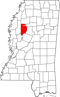 | |
| Towns | ||
| CDP | ||
| Unincorporated communities | ||
| Ghost town | ||
| Footnotes | ‡This populated place also has portions in an adjacent county or counties | |
This article is issued from Wikipedia - version of the 7/30/2016. The text is available under the Creative Commons Attribution/Share Alike but additional terms may apply for the media files.