Cape Meares, Oregon
| Cape Meares, Oregon | |
|---|---|
| Census-designated place (CDP) | |
 Location of Cape Meares, Oregon | |
| Coordinates: 45°29′23″N 123°57′31″W / 45.48972°N 123.95861°WCoordinates: 45°29′23″N 123°57′31″W / 45.48972°N 123.95861°W | |
| Country | United States |
| State | Oregon |
| County | Tillamook |
| Area | |
| • Total | 3.1 sq mi (8.0 km2) |
| • Land | 2.8 sq mi (7.3 km2) |
| • Water | 0.3 sq mi (0.7 km2) |
| Elevation | 249 ft (76 m) |
| Population (2000) | |
| • Total | 110 |
| • Density | 38.8/sq mi (15.0/km2) |
| Time zone | Pacific (PST) (UTC-8) |
| • Summer (DST) | PDT (UTC-7) |
| ZIP code | 97141 |
| Area code(s) | 503 |
| FIPS code | 41-11050[1] |
| GNIS feature ID | 1139352[2] |
Cape Meares is a census-designated place (CDP) and unincorporated community in Tillamook County, Oregon, United States.[3] The population was 110 at the 2000 census.
The community is named after the natural feature of the same name, which in turn was named after John Meares, a British explorer. The Bayocean post office was briefly renamed "Cape Meares" in 1953 but closed the next year.[4]
Geography
According to the United States Census Bureau, the CDP has a total area of 3.1 square miles (8.0 km2), of which, 2.8 square miles (7.3 km2) of it is land and 0.3 square miles (0.78 km2) of it (8.39%) is water. The area is located 246 feet (75 m) above sea-level.[3]
Demographics
As of the census[1] of 2000, there were 110 people, 63 households, and 34 families residing in the CDP. The population density was 38.8 people per square mile (15.0/km²). There were 156 housing units at an average density of 55.0 per square mile (21.2/km²). The racial makeup of the CDP was 89.09% White, 3.64% Native American, 0.91% from other races, and 6.36% from two or more races. Hispanic or Latino of any race were 1.82% of the population.
There were 63 households out of which 9.5% had children under the age of 18 living with them, 46.0% were married couples living together, 6.3% had a female householder with no husband present, and 46.0% were non-families. 39.7% of all households were made up of individuals and 17.5% had someone living alone who was 65 years of age or older. The average household size was 1.75 and the average family size was 2.26.
In the CDP the population was spread out with 10.0% under the age of 18, 2.7% from 18 to 24, 9.1% from 25 to 44, 48.2% from 45 to 64, and 30.0% who were 65 years of age or older. The median age was 57 years. For every 100 females there were 100.0 males. For every 100 females age 18 and over, there were 98.0 males.
The median income for a household in the CDP was $26,346, and the median income for a family was $31,250. Males had a median income of $0 versus $61,250 for females. The per capita income for the CDP was $26,635. There were 31.3% of families and 30.6% of the population living below the poverty line, including no under eighteens and none of those over 64.
References
- 1 2 "American FactFinder". United States Census Bureau. Archived from the original on 2013-09-11. Retrieved 2008-01-31.
- ↑ "US Board on Geographic Names". United States Geological Survey. 2007-10-25. Retrieved 2008-01-31.
- 1 2 "Cape Meares". Geographic Names Information System. United States Geological Survey. 1980-11-28. Retrieved 2010-01-11.
- ↑ McArthur, Lewis A.; McArthur, Lewis L. (2003) [1928]. Oregon Geographic Names (7th ed.). Portland, Oregon: Oregon Historical Society Press. p. 163–164. ISBN 978-0875952772.
Municipalities and communities of Tillamook County, Oregon, United States | ||
|---|---|---|
| Cities | 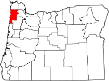 | |
| CDPs |
| |
| Unincorporated communities | ||