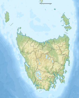
Davey River
| Davey | |
| River | |
| Country | Australia |
|---|---|
| State | Tasmania |
| Region | South-west |
| Tributaries | |
| - left | Lora River (Tasmania), Frankland River (Southwest Tasmania), Crossing River |
| - right | Hardwood River, De Witt River |
| Source | Frankland Range |
| - location | below Coronation Peak |
| - elevation | 227 m (745 ft) |
| - coordinates | 42°53′27″S 145°59′40″E / 42.89083°S 145.99444°E |
| Mouth | Southern Ocean |
| - location | Port Davey |
| - elevation | 0 m (0 ft) |
| - coordinates | 43°12′46″S 145°56′14″E / 43.21278°S 145.93722°ECoordinates: 43°12′46″S 145°56′14″E / 43.21278°S 145.93722°E |
| Length | 53 km (33 mi) |
| National park | Southwest National Park |
| [1] | |
The Davey River is a perennial river located in the south-west region of Tasmania, Australia.
Course and features
The Davey River rises on the western slopes of the Frankland Range, below Coronation Peak, and flows generally south by west through the Southwest National Park, joined by ten tributaries including the Lora, Frankland, Hardwood, Crossing, and De Witt rivers. The river reaches its mouth in Payne Bay, an inner part of Port Davey, and empties out into the Southern Ocean. The river descends 228 metres (748 ft) over its 53-kilometre (33 mi) course.[1]
A section of the lower Davey River gorge is known as Hells Gates,[2][3] - providing confusion with the entry to Macquarie Harbour which has an entrance by the same name - Hells Gates.
See also
References
- 1 2 "Map of Davey River, TAS". Bonzle Digital Atlas of Australia. 2015. Retrieved 30 June 2015.
- ↑ "HELL'S GATES, DAVEY RIVER TASMANIA.". Illustrated Australian News (Melbourne, Vic. : 1876 - 1889). Melbourne, Vic.: National Library of Australia. 20 March 1878. p. 42. Retrieved 3 March 2014.
- ↑ "HELL'S GATES, DAVEY RIVER, TASMANIA.". Illustrated Sydney News (NSW : 1853 - 1872). NSW: National Library of Australia. 20 April 1878. p. 5. Retrieved 3 March 2014.
Further reading
- Binks, C.J. (1989). Explorers of Western Tasmania. Launceston, Tas.: Mary Fisher Bookshop. ISBN 0-7316-7300-X.
- Gee, H and Fenton, J. (Eds) (1978) The South West Book - A Tasmanian Wilderness Melbourne, Australian Conservation Foundation. ISBN 0-85802-054-8
- Neilson, D. (1975) South West Tasmania - A land of the Wild. Adelaide. Rigby. ISBN 0-85179-874-8
- Waterman, Peter (editor) (1981) Davey River catchment Sandy Bay, Tas. : Steering Committee, South West Tasmania Resources Survey. Working paper (South West Tasmania Resources Survey) ; no. 20. ISBN 0-7246-1009-X
External links
This article is issued from Wikipedia - version of the 6/27/2016. The text is available under the Creative Commons Attribution/Share Alike but additional terms may apply for the media files.

