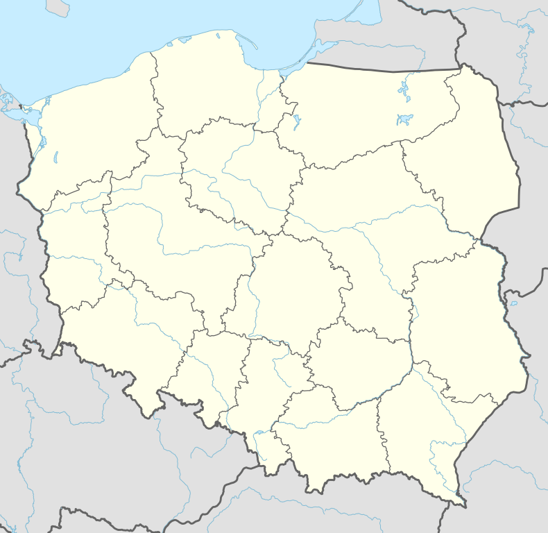
Dziadowa Kłoda
| Dziadowa Kłoda | |
|---|---|
| Village | |
 Dziadowa Kłoda | |
| Coordinates: 51°14′N 17°43′E / 51.233°N 17.717°E | |
| Country |
|
| Voivodeship | Lower Silesian |
| County | Oleśnica |
| Gmina | Dziadowa Kłoda |
| Website | http://www.dziadowakloda.pl/ |
Dziadowa Kłoda [d͡ʑaˈdɔva ˈkwɔda] (German: Kunzendorf) is a village in Oleśnica County, Lower Silesian Voivodeship, in south-western Poland.[1] It is the seat of the administrative district (gmina) called Gmina Dziadowa Kłoda. It lies approximately 24 kilometres (15 mi) east of Oleśnica, and 49 kilometres (30 mi) east of the regional capital Wrocław.
Prior to 1945 it was in Germany. After World War II the region was placed under Polish administration and ethnically cleansed according to the post-war Potsdam Agreement. The native German populace was expelled and replaced with Poles.
References
| Seat |  | |
|---|---|---|
| Other villages | ||
Coordinates: 51°14′N 17°43′E / 51.233°N 17.717°E
This article is issued from Wikipedia - version of the 3/18/2015. The text is available under the Creative Commons Attribution/Share Alike but additional terms may apply for the media files.