Hancock County, Tennessee
| Hancock County, Tennessee | |
|---|---|
 Hancock County Courthouse in Sneedville | |
|
Location in the U.S. state of Tennessee | |
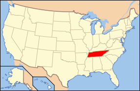
 Tennessee's location in the U.S. | |
| Founded | 1844 |
| Named for | John Hancock[1] |
| Seat | Sneedville |
| Largest town | Sneedville |
| Area | |
| • Total | 223 sq mi (578 km2) |
| • Land | 222 sq mi (575 km2) |
| • Water | 1.2 sq mi (3 km2), 0.5% |
| Population | |
| • (2010) | 6,819 |
| • Density | 31/sq mi (12/km²) |
| Congressional district | 1st |
| Time zone | Eastern: UTC-5/-4 |
| Website |
www |
Hancock County is a county located in the U.S. state of Tennessee. As of the 2010 census, the population was 6,819,[2] making it the fourth-least populous county in Tennessee. Its county seat is Sneedville.[3]
History
Hancock County was created from parts of Hawkins and Claiborne counties. The act establishing the county was passed by the state legislature in 1844, but several Hawkins residents sued to block its creation. In 1848, the Tennessee Supreme Court ruled in favor of the new county. The county seat, Sneedville, was named in honor of attorney William H. Sneed, who represented the county in the court case. The county was named for Revolutionary War patriot John Hancock.[1][4]
Geography
According to the U.S. Census Bureau, the county has a total area of 223 square miles (580 km2), of which 222 square miles (570 km2) is land and 1.2 square miles (3.1 km2) (0.5%) is water.[5]
Adjacent counties
- Lee County, Virginia (north)
- Scott County, Virginia (northeast)
- Hawkins County (east)
- Grainger County (southwest)
- Claiborne County (west)
State protected areas
- Kyles Ford Wildlife Management Area (part)
Demographics
| Historical population | |||
|---|---|---|---|
| Census | Pop. | %± | |
| 1850 | 5,660 | — | |
| 1860 | 7,020 | 24.0% | |
| 1870 | 7,148 | 1.8% | |
| 1880 | 9,098 | 27.3% | |
| 1890 | 10,342 | 13.7% | |
| 1900 | 11,147 | 7.8% | |
| 1910 | 10,778 | −3.3% | |
| 1920 | 10,454 | −3.0% | |
| 1930 | 9,673 | −7.5% | |
| 1940 | 11,231 | 16.1% | |
| 1950 | 9,116 | −18.8% | |
| 1960 | 7,757 | −14.9% | |
| 1970 | 6,719 | −13.4% | |
| 1980 | 6,887 | 2.5% | |
| 1990 | 6,739 | −2.1% | |
| 2000 | 6,786 | 0.7% | |
| 2010 | 6,819 | 0.5% | |
| Est. 2015 | 6,572 | [6] | −3.6% |
| U.S. Decennial Census[7] 1790-1960[8] 1900-1990[9] 1990-2000[10] 2010-2014[2] | |||

As of the 2010 United States Census, there were 6,819 people residing in the county. 98.0% were White, 0.4% Black or African American, 0.3% Native American, 0.1% Asian, 0.1% of some other race and 1.1% of two or more races. 0.2% were Hispanic or Latino (of any race).
As of the census[12] of 2000, there were 6,786 people, 2,769 households, and 1,938 families residing in the county. The population density was 30 people per square mile (12/km²). There were 3,280 housing units at an average density of 15 per square mile (6/km²). The racial makeup of the county was 97.91% White, 0.49% Black or African American, 0.24% Native American, 0.07% Asian, 0.01% Pacific Islander, 0.34% from other races, and 0.94% from two or more races. 0.37% of the population were Hispanic or Latino of any race.
There were 2,769 households out of which 31.00% had children under the age of 18 living with them, 55.10% were married couples living together, 11.00% had a female householder with no husband present, and 30.00% were non-families. 27.70% of all households were made up of individuals and 13.50% had someone living alone who was 65 years of age or older. The average household size was 2.39 and the average family size was 2.91.
In the county, the population was spread out with 23.10% under the age of 18, 8.80% from 18 to 24, 26.90% from 25 to 44, 25.50% from 45 to 64, and 15.70% who were 65 years of age or older. The median age was 39 years. For every 100 females there were 95.10 males. For every 100 females age 18 and over, there were 94.30 males.
The median income for a household in the county was $19,760, which was the lowest median household income of any county in Tennessee[13] and the 27th lowest in the nation. The median income for a family was $25,372. Males had a median income of $23,150 versus $18,199 for females. The per capita income for the county was $11,986. About 25.30% of families and 29.40% of the population were below the poverty line, including 37.50% of those under age 18 and 30.70% of those age 65 or over.
Surnames
Most common surnames in Hancock County as of 2014, by order of incidence:[14]
- 1. Johnson
- 2. Seal
- 3. Collins
- 4. Greene
- 5. Trent
- 6. Lawson
- 7. Gibson
- 8. Ramsey
- 9. Hopkins
- 10. Nichols
Culture
Hancock County is known particularly for its population of people of Melungeon ancestry, who are believed to be of mixed European, African, and Native American heritage. The Vardy Community School, which provided state-mandated education for Melungeon children in the early 20th century, is now a historic site located in the Newman's Ridge area.
Communities
Town
- Sneedville (county seat)
Unincorporated communities
- Alanthus Hill
- Kyles Ford
- Mulberry Gap
- Treadway
- Xenophon
See also
References
- 1 2 William G. Cook, "Hancock County," Tennessee Encyclopedia of History and Culture. Retrieved: 16 October 2013.
- 1 2 "State & County QuickFacts". United States Census Bureau. Retrieved December 2, 2013.
- ↑ "Find a County". National Association of Counties. Retrieved 2011-06-07.
- ↑ Gannett, Henry (1905). The Origin of Certain Place Names in the United States. Govt. Print. Off. p. 148.
- ↑ "2010 Census Gazetteer Files". United States Census Bureau. August 22, 2012. Retrieved April 5, 2015.
- ↑ "County Totals Dataset: Population, Population Change and Estimated Components of Population Change: April 1, 2010 to July 1, 2015". Retrieved July 2, 2016.
- ↑ "U.S. Decennial Census". United States Census Bureau. Retrieved April 5, 2015.
- ↑ "Historical Census Browser". University of Virginia Library. Retrieved April 5, 2015.
- ↑ Forstall, Richard L., ed. (March 27, 1995). "Population of Counties by Decennial Census: 1900 to 1990". United States Census Bureau. Retrieved April 5, 2015.
- ↑ "Census 2000 PHC-T-4. Ranking Tables for Counties: 1990 and 2000" (PDF). United States Census Bureau. April 2, 2001. Retrieved April 5, 2015.
- ↑ Based on 2000 census data
- ↑ "American FactFinder". United States Census Bureau. Retrieved 2011-05-14.
- ↑ Hancock County, Tennessee, Selected Statistical Information, Tennessee Advisory Committee on Intergovernmental Relations, accessed April 26, 2008
- ↑ Most Common Surnames in Hancock County
Further reading
- Johnson, Mattie Ruth (1997). My Melungeon Heritage: A Story of Life on Newman's Ridge. Johnson City, Tennessee: Overmountain Press.
- Price, Henry R. (1966). "Melungeons: The Vanishing Colony of Newman's Ridge." Conference paper. American Studies Association of Kentucky and Tennessee. March 25–26, 1967.
- Winkler, Wayne (2004) "Walking Toward the Sunset: The Melungeons of Appalachia," Macon, Georgia: Mercer University Press
External links
| Wikimedia Commons has media related to Hancock County, Tennessee. |
- Hancock County website and directory
- Hancock County at DMOZ
- The Hancock County Public Library website
- Hancock County, TNGenWeb - free genealogy resources for the county
- Sneedville/Hancock Chamber & Community Partners, Inc. website
 |
Lee County, Virginia | Scott County, Virginia |  | |
| Claiborne County | |
Hawkins County | ||
| ||||
| | ||||
| Grainger County |
Coordinates: 36°32′N 83°13′W / 36.53°N 83.22°W