Hidaka-sanmyaku Erimo Quasi-National Park
| Hidaka-sanmyaku Erimo Quasi-National Park | |
|---|---|
| 日高山脈襟裳国定公園 | |
|
IUCN category Ib (wilderness area) | |
|
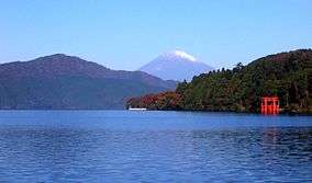
A view from Mount Kamui | |
| Location | Hokkaidō, Japan |
| Coordinates | 42°23′19″N 142°57′6″E / 42.38861°N 142.95167°ECoordinates: 42°23′19″N 142°57′6″E / 42.38861°N 142.95167°E |
| Area | 103,447 ha [1] |
| Established | October 1, 1981 |
| Governing body | Hokkaidō prefectural government[2] |
Hidaka-sanmyaku Erimo Quasi-National Park (日高山脈襟裳国定公園 Hidaka-sanmyaku Erimo Kokutei-kōen) is the largest quasi-national park in Japan.[1] The park includes the Hidaka Mountains and Cape Erimo and is located in southeast Hokkaidō. The park was designated Erimo Prefectural Park in 1950 and Erimo Prefectural Nature Park in 1958 until it was raised to a quasi-national in 1981. It is categorized as a natural monument by World Commission on Protected Areas.[3]
Like all quasi-national parks in Japan, the park is managed by the prefectural government.[2]
Related cities, towns and villages
See also
External links
- J-IBIS (Japanese)
References
- 1 2 List of Quasi-National Parks, Ministry of the Environment Government of Japan , Last access 12 March 2008
- 1 2 "National Park systems: Definition of National Parks". National Parks of Japan. Ministry of the Environment of the Government of Japan. Retrieved 2008-08-29.
- ↑ "THE NATIONAL PARKS AND NATURE RESERVES OF JAPAN". NATIONAL PARKS WORLDWIDE. WORLD INSTITUTE FOR CONSERVATION & ENVIRONMENT. Retrieved 2008-08-29.
- Hidaka Sanmyaku Erimo World Database on Protected Areas, United Nations Environment Programme, World Conservation Monitoring Centre, last access 12 March 2008
This article is issued from Wikipedia - version of the 11/19/2016. The text is available under the Creative Commons Attribution/Share Alike but additional terms may apply for the media files.


