Ina, Illinois
| Ina | |
| Village | |
| Country | United States |
|---|---|
| State | Illinois |
| County | Jefferson |
| Township | Spring Garden |
| Coordinates | 38°9′2″N 88°54′17″W / 38.15056°N 88.90472°WCoordinates: 38°9′2″N 88°54′17″W / 38.15056°N 88.90472°W |
| Area | 2.45 sq mi (6 km2) |
| - land | 2.45 sq mi (6 km2) |
| - water | 0.00 sq mi (0 km2) |
| Density | 1,020.6/sq mi (394/km2) |
| Timezone | CST (UTC-6) |
| - summer (DST) | CDT (UTC-5) |
| Postal code | 62846 |
| Area code | 618 |
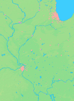
  Location of Ina within Illinois | |
| Wikimedia Commons: Ina, Illinois | |
Ina is the southern-most village in Jefferson County, Illinois, United States. The population was 2,455 as of the 2000 census. It is part of the Mount Vernon Micropolitan Statistical Area.
Geography
Ina is located at 38°9′2″N 88°54′17″W / 38.15056°N 88.90472°W (38.150648, -88.904709).[1]
According to the 2010 census, Ina has a total area of 2.45 square miles (6.35 km2), all land.[2]
Ina was located on high ground adjacent to the Casey Creek/Big Muddy River bottoms. The Big Muddy has since been dammed to form Rend Lake.
History
Many Cherokee families settled in Ina around 1840. They were apparently refugees from the Trail of Tears. In the 1800s, Ina was jokingly referred to as "the Cherokee Reservation."
The main settlement in this area was Spring Garden, about three miles northeast of Ina. Spring Garden prospered from 1848 until the Chicago and Eastern Illinois Railroad was built in 1905. After that, the population and business shifted over to the depots at Ina and Bonnie.
Ina is the home of the Big Muddy River Correctional Center and Rend Lake College.
A famous double murder occurred in Ina in 1924, when Rev. Lawrence Hight and his lover Elsie Sweeten poisoned Sweeten's husband, in July, and Hight's wife in September. Autopsies revealed arsenic. Hight and Sweeten were both sent to prison. Elsie Sweeten was granted another trial and was later acquitted of murder and released from Jail.
Demographics
| Historical population | |||
|---|---|---|---|
| Census | Pop. | %± | |
| 1900 | 317 | — | |
| 1910 | 484 | 52.7% | |
| 1920 | 398 | −17.8% | |
| 1930 | 458 | 15.1% | |
| 1940 | 501 | 9.4% | |
| 1950 | 432 | −13.8% | |
| 1960 | 332 | −23.1% | |
| 1970 | 333 | 0.3% | |
| 1980 | 460 | 38.1% | |
| 1990 | 489 | 6.3% | |
| 2000 | 2,455 | 402.0% | |
| 2010 | 2,338 | −4.8% | |
| Est. 2015 | 2,360 | [3] | 0.9% |
The following population figures for Ina are greatly influenced by the approximately 1850 male inmates who are included from the Big Muddy River Correctional Center, which has been annexed to the original village. (The population of the village outside of the Correctional Center is approximately 600 people.) As of the census[5] of 2000, there are officially 2,455 people, 199 households, and 140 families residing in the village. The population density was 1,020.6 people per square mile (393.3/km²). There were 233 housing units at an average density of 96.9 per square mile (37.3/km²). The racial makeup of the village was 55.15% White, 41.79% African American, 0.45% Native American, 0.24% Asian, 2.12% from other races, and 0.24% from two or more races. Hispanic or Latino of any race were 6.48% of the population.
There were 199 households out of which 26.6% had children under the age of 18 living with them, 57.8% were married couples living together, 10.6% had a female householder with no husband present, and 29.6% were non-families. 25.1% of all households were made up of individuals and 15.6% had someone living alone who was 65 years of age or older. The average household size was 2.46 and the average family size was 2.95.
In the village the population was spread out with 5.1% under the age of 18, 18.7% from 18 to 24, 54.9% from 25 to 44, 16.7% from 45 to 64, and 4.5% who were 65 years of age or older. The median age was 34 years. For every 100 females there were 874.2 males. For every 100 females age 18 and over, there were 1,082.2 males. These last two statistics are heavily influenced by the approximately 1850 male inmates in the Big Muddy River Correctional Center.
The median income for a household in the village was $24,453 and the median income for a family was $32,500. Males had a median income of $33,950 versus $20,625 for females. The per capita income for the village was $8,596. About 10.4% of families and 19.2% of the population were below the poverty line, including 26.4% of those under age 18 and 21.0% of those age 65 or over.
References
- ↑ "US Gazetteer files: 2010, 2000, and 1990". United States Census Bureau. 2011-02-12. Retrieved 2011-04-23.
- ↑ "G001 - Geographic Identifiers - 2010 Census Summary File 1". United States Census Bureau. Retrieved 2015-08-04.
- ↑ "Annual Estimates of the Resident Population for Incorporated Places: April 1, 2010 to July 1, 2015". Retrieved July 2, 2016.
- ↑ "Census of Population and Housing". Census.gov. Retrieved June 4, 2015.
- ↑ "American FactFinder". United States Census Bureau. Retrieved 2008-01-31.