Jdeideh
| Jdeideh جديدة المتن | |
|---|---|
| City | |
 Jdeideh Location within Lebanon | |
| Coordinates: 33°53′0″N 35°34′0″E / 33.88333°N 35.56667°ECoordinates: 33°53′0″N 35°34′0″E / 33.88333°N 35.56667°E | |
| Country |
|
| Governorate | Mount Lebanon Governorate |
| District | Matn District |
| Government | |
| • Time Zone | GMT +2 (UTC) |
| • - Summer (DST) | +3 (UTC) |
| • Area Code(s) | (+961) 1 |
| Area | |
| • Total | 6 km2 (2 sq mi) |
| Highest elevation | 50 m (160 ft) |
| Lowest elevation | 0 m (0 ft) |
| Time zone | EET (UTC+2) |
| • Summer (DST) | EEST (UTC+3) |
| Dialing code | +961 |
- For similarly named places, please see Jdeideh (disambiguation).
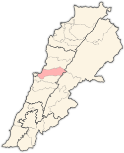
Jdeideh (Arabic: جديدة المتن translit. al-Judaydat), (also Jdayde, Jdaideh and Jdeidet el-Matn), is a coastal municipality and the administrative capital of the Matn District in the Mount Lebanon Governorate.
Jdeideh has an area of approximately 6 km². It is located in the northern suburbs of Beirut city that comprise Greater Beirut. The municipality is formed of three villages of Jdeidet el-Matn, Bauchrieh and Sed el Bauchrieh, with a population of nearly 160,000 inhabitants.[1]
Jdeideh is an important industrial zone and a significant location for commercial and banking activity.
Archaeology

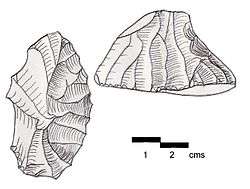
Three archaeological sites were found in the Jdeideh area by Jesuit fathers. Two of these featured finds of Heavy Neolithic flints of the Qaraoun culture.
Jdeideh I is 750 metres (2,460 ft) northeast of the town on the left bank of the Nahr Mout, in fields on a 15 metres (49 ft) contour. It was discovered by Raoul Describes who retrieved knapped tools from several periods including Acheulean, Middle Paleolithic, Upper Paleolithic and Heavy Neolithic. This material is in the Saint Joseph University, Museum of Lebanese Prehistory.[2]
Jdeideh II is 500 metres (1,600 ft) northeast of Tuillerie Medawer (east of Haret ech Cheikh) on low foothills to the left of a descending stream running next to the Aamariyeh road. An Upper Paleolithic assemblage in brown Cretaceous flint was found by Auguste Bergy including a variety of scrapers including a specialist variety also found at Ain Cheikh that were termed Grattoirs de côté.[2]
Jdeideh III is on a wooded hilltop north northwest of Aamariyeh on the southwest slopes that was also found by Bergy. He recovered a Qaraoun culture type, Gigantolithic assemblage of massive choppers, scrapers on flakes and coarse picks.[2]
References
- ↑ Jdeideh's Official Website, URL accessed May 31, 2008.
- 1 2 3 Lorraine Copeland; P. Wescombe (1965). Inventory of Stone-Age sites in Lebanon, p. 94. Imprimerie Catholique. Retrieved 21 July 2011.
