Kakdwip
| Kakdwip কাকদ্বীপ | |
|---|---|
| Subdivision Headquarters | |
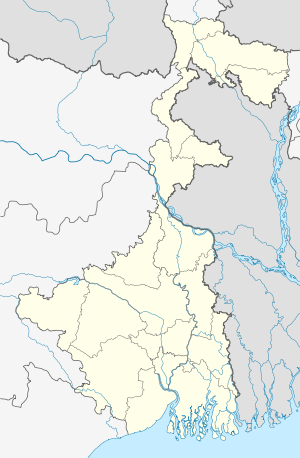 Kakdwip  Kakdwip Location in West Bengal, India | |
| Coordinates: 21°53′00″N 88°11′00″E / 21.8833°N 88.1833°ECoordinates: 21°53′00″N 88°11′00″E / 21.8833°N 88.1833°E | |
| Country |
|
| State | West Bengal |
| District | South 24 Parganas |
| Elevation | 3 m (10 ft) |
| Population (2011) | |
| • Total | 19,368 |
| Languages | |
| • Official | Bengali, English |
| Time zone | IST (UTC+5:30) |
| Vehicle registration | WB |
| Lok Sabha constituency | Mathurapur (SC) |
| Vidhan Sabha constituency | Kakdwip |
| Website |
s24pgs |
| CD Block | |
Kakdwip is headquarters of Kakdwip subdivision in Kakdwip CD Block in South 24 Parganas district in the Indian state of West Bengal.
Demographics
As per 2011 Census of India Kakdwip had a total population of 19,368, of which 9,896 (51%) were males and 9,472 (49%) were females. Population below 6 years was 1,872. The total number of literates in Kakdwip was 14,173 (81.00 % of the population over 6 years).[1]
In the 2001 census, Kakdwip CD Block had a population of 239,381 out of which 122,792 were males and 116,589 were females. Decadal growth for the period 1991-2001 was 25.93% for Kakdwip, against 20.89% in South 24 Parganas district.[2]Decadal growth in West Bengal was 17.84%.[3]
Geography
Kakdwip is located at 21°53′00″N 88°11′00″E / 21.8833°N 88.1833°E .[4]
Climate
Köppen-Geiger climate classification system classifies its climate as tropical wet and dry (Aw).
| Climate data for Kakdwip | |||||||||||||
|---|---|---|---|---|---|---|---|---|---|---|---|---|---|
| Month | Jan | Feb | Mar | Apr | May | Jun | Jul | Aug | Sep | Oct | Nov | Dec | Year |
| Average high °C (°F) | 25.4 (77.7) |
27.7 (81.9) |
31.4 (88.5) |
33.1 (91.6) |
33.4 (92.1) |
32.3 (90.1) |
30.7 (87.3) |
30.8 (87.4) |
31.2 (88.2) |
30.8 (87.4) |
28.1 (82.6) |
25.1 (77.2) |
30 (86) |
| Daily mean °C (°F) | 19.9 (67.8) |
22.7 (72.9) |
27 (81) |
29.3 (84.7) |
30 (86) |
29.5 (85.1) |
28.5 (83.3) |
28.6 (83.5) |
28.5 (83.3) |
27.5 (81.5) |
23.5 (74.3) |
20 (68) |
26.25 (79.28) |
| Average low °C (°F) | 14.5 (58.1) |
17.7 (63.9) |
22.6 (72.7) |
25.6 (78.1) |
26.7 (80.1) |
26.8 (80.2) |
26.4 (79.5) |
26.4 (79.5) |
25.9 (78.6) |
24.2 (75.6) |
19 (66) |
14.6 (58.3) |
22.53 (72.55) |
| Average precipitation mm (inches) | 14 (0.55) |
17 (0.67) |
20 (0.79) |
34 (1.34) |
96 (3.78) |
244 (9.61) |
323 (12.72) |
322 (12.68) |
321 (12.64) |
172 (6.77) |
30 (1.18) |
1 (0.04) |
1,594 (62.77) |
| Source: Climate-Data.org (altitude: 7m)[5] | |||||||||||||
Spirituality and Culture
The place is famous for Yogiraj Shyamacharan Sanatan Mission for the spreading and preservation of Kriya yoga of Lahiri Mahasaya worldwide. Locally known as 'Yogiraj Mission'. The institute campus also hosts a temple of Lahiri Mahasaya. Yogacharya Dr. Ashoke Kumar Chatterjee[6] is the founder-director of this organization.[7]
Bus lines
- Private Bus
- 94 Kakdwip Lot 8 - Namkhana
- SD Series
- SD11 Noorpur - Kakdwip
- SD19 Esplanade – Patharpratima
- SD50 Diamond Harbour – Patharpratima
- SD80 Kakdwip – Raidighi
- STA Bus Routes
- Esplanade – Namkhana
- Nandigram - Howrah - Namkhana
- Digha - Kolkata - Namkhana
- Kotulpur - Howrah - Namkhana
- WBSTC Bus Routes
- SBSTC Bus Routes
- Barddhaman - Kakdwip (non Ac)
- Digha - Kakdwip
- Midnapore - Namkhana
Local Train Route
References
- ↑ "C.D. Block Wise Primary Census Abstract Data(PCA)". 2011 census: West Bengal – District-wise CD Blocks. Registrar General and Census Commissioner, India. Retrieved 26 April 2016.
- ↑ "Provisional Population Totals, West Bengal. Table 4". Census of India 2001 – South 24 Parganas. Census Commission of India. Archived from the original on September 27, 2007. Retrieved 2011-01-20.
- ↑ "Provisional Population Totals, West Bengal. Table 4". Census of India 2001. Census Commission of India. Retrieved 2008-02-05.
- ↑ "Kakdwip, India Page". Falling Rain Genomics.
- ↑ "Climate: Kakdwip - Climate graph, Temperature graph, Climate table". Climate-Data.org. Retrieved 2014-01-14.
- ↑ http://kriyayogashyamacharan.org/yogacharya.php
- ↑ http://kriyayogashyamacharan.org/yssm.php
Cities, towns and locations in South 24 Parganas district | |||||||||||||||||||
|---|---|---|---|---|---|---|---|---|---|---|---|---|---|---|---|---|---|---|---|
| Cities, municipal and census towns |
| ||||||||||||||||||
| Locations other than cities and towns | |||||||||||||||||||
| Related topics |
| ||||||||||||||||||