Kamenik, Šmarje pri Jelšah
| Kamenik | |
|---|---|
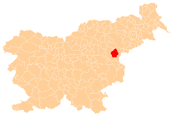
 Kamenik Location in Slovenia | |
| Coordinates: 46°12′9.53″N 15°30′33.79″E / 46.2026472°N 15.5093861°ECoordinates: 46°12′9.53″N 15°30′33.79″E / 46.2026472°N 15.5093861°E | |
| Country |
|
| Traditional region | Styria |
| Statistical region | Savinja |
| Municipality | Šmarje pri Jelšah |
| Area | |
| • Total | 0.99 km2 (0.38 sq mi) |
| Elevation | 336.2 m (1,103.0 ft) |
| Population (2002) | |
| • Total | 46 |
| [1] | |
Kamenik (pronounced [ˈkaːmɛnik]) is a small dispersed settlement in the hills south of Šmarje pri Jelšah in eastern Slovenia. The area is part of the traditional region of Styria and is included in the Savinja Statistical Region.[2]
References
External links
This article is issued from Wikipedia - version of the 9/28/2016. The text is available under the Creative Commons Attribution/Share Alike but additional terms may apply for the media files.