Labelle, Quebec
| Labelle | |
|---|---|
| Municipality | |
 | |
 Location within Les Laurentides RCM | |
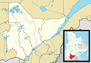 Labelle Location in central Quebec | |
| Coordinates: 46°17′N 74°44′W / 46.283°N 74.733°WCoordinates: 46°17′N 74°44′W / 46.283°N 74.733°W[1] | |
| Country |
|
| Province |
|
| Region | Laurentides |
| RCM | Les Laurentides |
| Constituted | January 27, 1973 |
| Government[2] | |
| • Mayor | Gilbert Brassard |
| • Federal riding | Laurentides—Labelle |
| • Prov. riding | Labelle |
| Area[2][3] | |
| • Total | 216.30 km2 (83.51 sq mi) |
| • Land | 198.79 km2 (76.75 sq mi) |
| Population (2011)[3] | |
| • Total | 2,445 |
| • Density | 12.3/km2 (32/sq mi) |
| • Pop 2006-2011 |
|
| • Dwellings | 1,753 |
| Time zone | EST (UTC−5) |
| • Summer (DST) | EDT (UTC−4) |
| Postal code(s) | J0T 1H0 |
| Area code(s) | 819 |
| Highways |
|
| Website |
www |
Labelle is a village and municipality in the Laurentides region of Quebec, Canada, part of the Les Laurentides Regional County Municipality. Its large "L"-shaped territory surrounds Lake Labelle, and the village is located along the Rouge River and Route 117.
Demographics
Population trend:[4]
- Population in 2011: 2445 (2006 to 2011 population change: 8.3%)
- Population in 2006: 2258
- Population in 2001: 2272
- Population in 1996: 2256 (or 2271 when adjusted for 2001 boundaries)
- Population in 1991: 2090
Private dwellings occupied by usual residents: 1115 (total dwellings: 1753)
Mother tongue:
- English as first language: 0.5%
- French as first language: 97%
- English and French as first language: 0.7%
- Other as first language: 1.8%
References
- ↑ Reference number 32796 of the Commission de toponymie du Québec (French)
- 1 2 Geographic code 78120 in the official Répertoire des municipalités (French)
- 1 2 "(Code 2478120) Census Profile". 2011 census. Statistics Canada. 2012.
- ↑ Statistics Canada: 1996, 2001, 2006, 2011 census
External links
-
 Media related to Labelle, Quebec at Wikimedia Commons
 |
Rivière-Rouge (main part) | La Macaza | Rivière-Rouge (eastern part) | |
| La Minerve | |
Mont-Tremblant Lac-Tremblant-Nord | ||
| ||||
| | ||||
| Amherst, La Conception |
| Cities/towns | |
|---|---|
| Municipalities | |
| Townships | |
| Parishes | |
| Villages | |
| |
This article is issued from Wikipedia - version of the 11/7/2014. The text is available under the Creative Commons Attribution/Share Alike but additional terms may apply for the media files.