Malá Úpa
| Malá Úpa | |||
| Village | |||
 | |||
|
|||
| Country | Czech Republic | ||
|---|---|---|---|
| Region | Hradec Králové | ||
| District | Trutnov | ||
| Little District | Trutnov | ||
| Elevation | 1,041 m (3,415 ft) | ||
| Coordinates | CZ 50°44′40″N 15°49′11″E / 50.74444°N 15.81972°ECoordinates: CZ 50°44′40″N 15°49′11″E / 50.74444°N 15.81972°E | ||
| Area | 26.65 km2 (10.29 sq mi) | ||
| Population | 130 (2006-10-02) | ||
| Density | 5/km2 (13/sq mi) | ||
| Founded | 16th century | ||
| Mayor | Lubomír Mocl | ||
| Timezone | CET (UTC+1) | ||
| - summer (DST) | CEST (UTC+2) | ||
| Postal code | 542 27 | ||
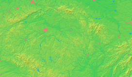
  Location in the Czech Republic | |||
| Wikimedia Commons: Malá Úpa | |||
| Website: www | |||
Malá Úpa (German: Kleinaupa) is a village and municipality in the Czech Republic located in eastern part of the Krkonoše Mountains.
External links
-
 Media related to Malá Úpa at Wikimedia Commons
 - Municipal website
This article is issued from Wikipedia - version of the 4/7/2016. The text is available under the Creative Commons Attribution/Share Alike but additional terms may apply for the media files.

