May, Oklahoma
| May, Oklahoma | |
|---|---|
| Town | |
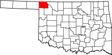
 Location in Harper County and the state of Oklahoma. | |
| Coordinates: 36°37′00″N 99°44′58″W / 36.61667°N 99.74944°W | |
| Country | United States |
| State | Oklahoma |
| County | Harper |
| Area | |
| • Total | 0.2 sq mi (0.5 km2) |
| • Land | 0.2 sq mi (0.5 km2) |
| • Water | 0.0 sq mi (0.0 km2) |
| Elevation | 2,041 ft (622 m) |
| Population (2010) | |
| • Total | 39 |
| • Density | 200/sq mi (78/km2) |
| Time zone | Central (CST) (UTC-6) |
| • Summer (DST) | CDT (UTC-5) |
| ZIP code | 73851 |
| Area code(s) | 580 |
| FIPS code | 40-47000[1] |
| GNIS feature ID | 1095185[2] |
May is a town in Harper County, Oklahoma, United States. The population was 39 at the 2010 census.
Geography
May is located at 36°37′00″N 99°44′58″W / 36.616536°N 99.749363°WCoordinates: 36°37′00″N 99°44′58″W / 36.616536°N 99.749363°W (36.616536, -99.749363).[3]
According to the United States Census Bureau, the town has a total area of 0.2 square miles (0.52 km2), all of it land.
Demographics
| Historical population | |||
|---|---|---|---|
| Census | Pop. | %± | |
| 1920 | 324 | — | |
| 1930 | 258 | −20.4% | |
| 1940 | 239 | −7.4% | |
| 1950 | 143 | −40.2% | |
| 1970 | 91 | — | |
| 1990 | 42 | — | |
| 2000 | 33 | −21.4% | |
| 2010 | 39 | 18.2% | |
| Est. 2015 | 40 | [4] | 2.6% |
As of the census[1] of 2000, there were 33 people, 17 households, and 7 families residing in the town. The population density was 183.6 people per square mile (70.8/km²). There were 27 housing units at an average density of 150.2 per square mile (57.9/km²). The racial makeup of the town was 100.00% White. Hispanic or Latino of any race were 3.03% of the population.
There were 17 households out of which 17.6% had children under the age of 18 living with them, 41.2% were married couples living together, and 58.8% were non-families. 47.1% of all households were made up of individuals and 17.6% had someone living alone who was 65 years of age or older. The average household size was 1.94 and the average family size was 3.00.
In the town the population was spread out with 18.2% under the age of 18, 6.1% from 18 to 24, 30.3% from 25 to 44, 33.3% from 45 to 64, and 12.1% who were 65 years of age or older. The median age was 41 years. For every 100 females there were 120.0 males. For every 100 females age 18 and over, there were 145.5 males.
The median income for a household in the town was $45,625, and the median income for a family was $50,313. Males had a median income of $30,833 versus $19,167 for females. The per capita income for the town was $20,319. None of the population and none of the families were below the poverty line.
May in Pop Culture
May is the hometown of one of the major characters of Stephen King's The Stand, the mentally retarded Tom Cullen, who meets the deaf-mute drifter Nick Andros after Cullen gets drunk and passes out in the middle of the road. Andros mistakenly believes Cullen is dead and careens off his bike. King's version of May is markedly different from the real thing, as he presents it as a small town that includes a number of businesses and homes, when in reality it's just a wide place in the road without a single actual business at all. There is a business May Country Store that serves food fuel and cold beer.
References
- 1 2 "American FactFinder". United States Census Bureau. Retrieved 2008-01-31.
- ↑ "US Board on Geographic Names". United States Geological Survey. 2007-10-25. Retrieved 2008-01-31.
- ↑ "US Gazetteer files: 2010, 2000, and 1990". United States Census Bureau. 2011-02-12. Retrieved 2011-04-23.
- ↑ "Annual Estimates of the Resident Population for Incorporated Places: April 1, 2010 to July 1, 2015". Retrieved July 2, 2016.
- ↑ "Census of Population and Housing". Census.gov. Retrieved June 4, 2016.
