| [3] |
Name on the Register |
Image |
Date listed[4] |
Location |
City or town |
Description |
|---|
| 1 |
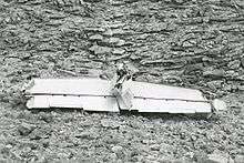
1956 Grand Canyon TWA – United Airlines Aviation Accident Site |
|
000000002014-04-22-0000April 22, 2014
(#14000280) |
Near the confluence of the Colorado River and Little Colorado River
36°10′30″N 111°50′00″W / 36.175°N 111.833333°W / 36.175; -111.833333 (1956 Grand Canyon TWA – United Airlines Aviation Accident Site) |
Grand Canyon National Park |
|
| 2 |
Abandoned Route 66, Ash Fork Hill |
Upload image |
000000001989-05-19-0000May 19, 1989
(#89000380) |
North of Interstate 40 between Ash Fork and Williams
35°13′10″N 112°21′39″W / 35.219444°N 112.360833°W / 35.219444; -112.360833 (Abandoned Route 66, Ash Fork Hill) |
Ash Fork |
|
| 3 |
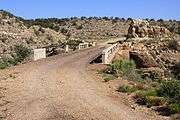
Abandoned Route 66, Parks (1921) |
|
000000001989-05-19-0000May 19, 1989
(#89000377) |
West of Parks
35°15′36″N 111°57′19″W / 35.26°N 111.955278°W / 35.26; -111.955278 (Abandoned Route 66, Parks (1921)) |
Parks |
|
| 4 |
Abandoned Route 66, Parks (1931) |
|
000000001989-05-19-0000May 19, 1989
(#89000378) |
East of Parks
35°15′35″N 111°56′43″W / 35.259722°N 111.945278°W / 35.259722; -111.945278 (Abandoned Route 66, Parks (1931)) |
Parks |
|
| 5 |
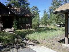
Horace M. Albright Training Center |
Upload image |
000000002013-09-13-0000September 13, 2013
(#13000784) |
Albright Ave. & Center Rd.
35°58′41″N 111°59′26″W / 35.978006°N 111.990509°W / 35.978006; -111.990509 (Horace M. Albright Training Center) |
Grand Canyon National Park |
|
| 6 |
Anderson Mesa Incline |
Upload image |
000000001995-02-24-0000February 24, 1995
(#95000154) |
Address Restricted
|
Flagstaff |
|
| 7 |
Archeological Site No. AR-03-04-03-810 |
Upload image |
000000001995-02-24-0000February 24, 1995
(#95000149) |
Address Restricted
|
Flagstaff |
|
| 8 |
Archeological Site No. AR-03-04-03-811 |
Upload image |
000000001995-02-24-0000February 24, 1995
(#95000150) |
Address Restricted
|
Flagstaff |
|
| 9 |
Archeological Site No. AR-03-04-03-812 |
Upload image |
000000001995-02-24-0000February 24, 1995
(#95000151) |
Address Restricted
|
Flagstaff |
|
| 10 |
Archeological Site No. AR-03-04-05-414 |
Upload image |
000000001995-02-24-0000February 24, 1995
(#95000152) |
Address Restricted
|
Flagstaff |
|
| 11 |
Archeological Site. No. AR-03-04-05-440 |
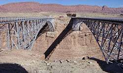
Upload image |
000000001995-02-24-0000February 24, 1995
(#95000153) |
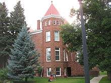
Address Restricted
|
Flagstaff |
|
| 12 |
Arizona Lumber and Timber Company Office |
|
000000001986-04-30-0000April 30, 1986
(#86000900) |
1 Riordan Rd.
35°11′29″N 111°40′00″W / 35.191389°N 111.666667°W / 35.191389; -111.666667 (Arizona Lumber and Timber Company Office) |
Flagstaff |
|
| 13 |
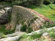
Ash Fork Steel Dam |
|
000000001976-07-30-0000July 30, 1976
(#76000373) |
East of Ash Fork off Old U.S. Route 66
35°13′31″N 112°24′54″W / 35.225278°N 112.415°W / 35.225278; -112.415 (Ash Fork Steel Dam) |
Ash Fork |
|
| 14 |
Ashurst House |
|
000000001984-11-29-0000November 29, 1984
(#84000529) |
417-421 W. Aspen Ave.
35°11′59″N 111°39′12″W / 35.199722°N 111.653333°W / 35.199722; -111.653333 (Ashurst House) |
Flagstaff |
|
| 15 |
Bank Hotel |
|
000000001977-12-07-0000December 7, 1977
(#77000232) |
Route 66 and Leroux St.
35°11′52″N 111°38′57″W / 35.19773°N 111.64924°W / 35.19773; -111.64924 (Bank Hotel) |
Flagstaff |
Also known as McMillan Building[5]
|
| 16 |
Barney Flat Historic Railroad Logging Landscape |
|
000000001995-02-24-0000February 24, 1995
(#95000155) |
Perkinsville Rd., south of Williams in the Kaibab National Forest
35°09′26″N 112°08′52″W / 35.157222°N 112.147778°W / 35.157222; -112.147778 (Barney Flat Historic Railroad Logging Landscape) |
Williams |
Only stump field in the NRHP
|
| 17 |
Big Springs Lookout Tower |
Upload image |
000000001988-01-28-0000January 28, 1988
(#87002478) |
Kaibab National Forest
36°35′36″N 112°20′03″W / 36.593333°N 112.334167°W / 36.593333; -112.334167 (Big Springs Lookout Tower) |
Big Springs |
|
| 18 |
Big Springs Ranger Station |
|
000000001993-06-10-0000June 10, 1993
(#93000519) |
Along Ryan Rd. in the Kaibab National Forest
36°36′12″N 112°20′59″W / 36.603333°N 112.349722°W / 36.603333; -112.349722 (Big Springs Ranger Station) |
Big Springs |
|
| 19 |
Brannen-Devine House |
|
000000001986-04-30-0000April 30, 1986
(#86000912) |
209 E. Cottage
35°11′41″N 111°38′51″W / 35.19462°N 111.64744°W / 35.19462; -111.64744 (Brannen-Devine House) |
Flagstaff |
|
| 20 |
Brow Monument |
|
000000001987-07-13-0000July 13, 1987
(#87001159) |
N. Kaibab Ranger District in the Kaibab National Forest
36°35′27″N 112°23′54″W / 36.590833°N 112.398333°W / 36.590833; -112.398333 (Brow Monument) |
Big Springs |
|
| 21 |
Buck Mountain Lookout Tower |
Upload image |
000000001988-01-28-0000January 28, 1988
(#87002460) |
Coconino National Forest
34°40′01″N 111°24′53″W / 34.666944°N 111.414722°W / 34.666944; -111.414722 (Buck Mountain Lookout Tower) |
Buck Mountain |
|
| 22 |
Bullethead |
Upload image |
000000001992-11-21-0000November 21, 1992
(#92001544) |
Address Restricted
|
Fredonia |
|
| 23 |
C&M Garage |
|
000000001986-04-30-0000April 30, 1986
(#86000908) |
204 S. Mikes Pike St.
35°11′44″N 111°39′15″W / 35.195554°N 111.654186°W / 35.195554; -111.654186 (C&M Garage) |
Flagstaff |
|
| 24 |
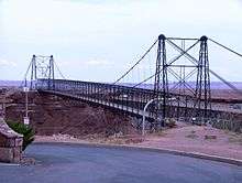
Cameron Suspension Bridge |
|
000000001986-06-05-0000June 5, 1986
(#86001206) |
Carries U.S. Route 89 over the Little Colorado River
35°52′38″N 111°24′40″W / 35.877222°N 111.411111°W / 35.877222; -111.411111 (Cameron Suspension Bridge) |
Cameron |
|
| 25 |
Camp Clover Ranger Station |
|
000000001993-07-16-0000July 16, 1993
(#93000520) |
Off U.S. Route 89 southwest of Williams in the Kaibab National Forest
35°14′13″N 112°13′08″W / 35.236944°N 112.218889°W / 35.236944; -112.218889 (Camp Clover Ranger Station) |
Williams |
|
| 26 |
H.E. Campbell House |
|
000000001986-04-30-0000April 30, 1986
(#86000910) |
215 N. Leroux[6]
35°12′00″N 111°38′54″W / 35.20004°N 111.64833°W / 35.20004; -111.64833 (H.E. Campbell House) |
Flagstaff |
|
| 27 |
Canyon Diablo Bridge |
|
000000001988-09-30-0000September 30, 1988
(#88001664) |
Abandoned grade of Old U.S. Route 66 over Diablo Canyon
35°06′56″N 111°05′41″W / 35.115556°N 111.094722°W / 35.115556; -111.094722 (Canyon Diablo Bridge) |
Winona |
|
| 28 |
Canyon Padre Bridge |
|
000000001988-09-30-0000September 30, 1988
(#88001666) |
Abandoned grade of Old U.S. Route 66 over Padre Canyon
35°09′44″N 111°17′12″W / 35.162222°N 111.286667°W / 35.162222; -111.286667 (Canyon Padre Bridge) |
Flagstaff |
|
| 29 |
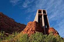
Chapel of the Holy Cross |
|
000000002011-10-06-0000October 6, 2011
(#10000947) |
780 Chapel Rd.
34°49′55″N 111°46′00″W / 34.831944°N 111.766667°W / 34.831944; -111.766667 (Chapel of the Holy Cross) |
Sedona |
|
| 30 |
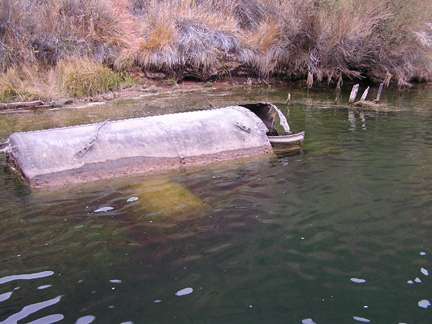
CHARLES H. SPENCER Hulk |
|
000000001989-10-15-0000October 15, 1989
(#89001593) |
Address Restricted
|
Lee's Ferry |
|
| 31 |
Checkered Men |
Upload image |
000000001992-11-21-0000November 21, 1992
(#92001546) |
Address Restricted
|
Fredonia |
|
| 32 |
J.M. Clark House |
|
000000001984-12-05-0000December 5, 1984
(#84000446) |
503 N. Humphreys St.
35°12′11″N 111°38′58″W / 35.20311°N 111.64932°W / 35.20311; -111.64932 (J.M. Clark House) |
Flagstaff |
|
| 33 |
Coconino County Hospital Complex |
|
000000001986-04-30-0000April 30, 1986
(#86000905) |
Ft. Valley Rd.
35°13′30″N 111°39′17″W / 35.225°N 111.654722°W / 35.225; -111.654722 (Coconino County Hospital Complex) |
Flagstaff |
|
| 34 |
Cooper Ridge Lookout Tree |
Upload image |
000000001992-01-13-0000January 13, 1992
(#91001962) |
North of the junction of Alternate U.S. Route 89 and State Route 67 in the Kaibab National Forest
36°44′48″N 112°13′05″W / 36.746667°N 112.218056°W / 36.746667; -112.218056 (Cooper Ridge Lookout Tree) |
Fredonia |
|
| 35 |
Corral Lake Lookout Tree |
Upload image |
000000001992-01-13-0000January 13, 1992
(#91001954) |
Roughly 30 miles (48 km) southeast of Fredonia in the Kaibab National Forest
36°36′18″N 112°15′58″W / 36.605°N 112.266111°W / 36.605; -112.266111 (Corral Lake Lookout Tree) |
Fredonia |
|
| 36 |
Coyote Range |
Upload image |
000000001984-05-14-0000May 14, 1984
(#84000641) |
North of Flagstaff on U.S. Route 180
35°13′52″N 111°39′20″W / 35.231111°N 111.655556°W / 35.231111; -111.655556 (Coyote Range) |
Flagstaff |
Also called the Colton House. Former home of Mary-Russell Ferrell Colton, part of the Museum of Northern Arizona
|
| 37 |
Dead Indian Canyon Bridge |
|
000000001988-09-30-0000September 30, 1988
(#88001603) |
Abandoned grade of U.S. Route 64 over Dead Indian Canyon
35°55′58″N 111°38′27″W / 35.932778°N 111.640833°W / 35.932778; -111.640833 (Dead Indian Canyon Bridge) |
Desert View |
|
| 38 |
DelSue Motor Inn |
|
000000001998-05-04-0000May 4, 1998
(#98000356) |
234 E. Old U.S. Route 66
35°15′03″N 112°11′03″W / 35.250833°N 112.184167°W / 35.250833; -112.184167 (DelSue Motor Inn) |
Williams |
|
| 39 |
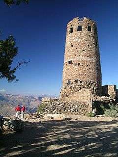
Desert View Watchtower Historic District |
|
000000001995-01-03-0000January 3, 1995
(#94001503) |
East Rim Drive, about 17 miles (27 km) east of Grand Canyon Village, Desert View
36°02′42″N 111°49′34″W / 36.045°N 111.826111°W / 36.045; -111.826111 (Desert View Watchtower Historic District) |
Grand Canyon National Park |
|
| 40 |
Dry Park Lookout Cabin and Storage Sheds |
Upload image |
000000001988-01-28-0000January 28, 1988
(#87002479) |
Kaibab National Forest
36°27′09″N 112°14′15″W / 36.4525°N 112.2375°W / 36.4525; -112.2375 (Dry Park Lookout Cabin and Storage Sheds) |
Big Springs |
|
| 41 |
El Tovar Hotel |
|
000000001974-09-06-0000September 6, 1974
(#74000334) |
Grand Canyon National Park, Route 8A
36°03′27″N 112°08′13″W / 36.0575°N 112.136944°W / 36.0575; -112.136944 (El Tovar Hotel) |
Grand Canyon National Park |
|
| 42 |
El Tovar Stables |
|
000000001974-09-06-0000September 6, 1974
(#74000336) |
Off Grand Canyon National Park Route 8A
36°03′20″N 112°08′28″W / 36.055556°N 112.141111°W / 36.055556; -112.141111 (El Tovar Stables) |
Grand Canyon National Park |
|
| 43 |
Elden Pueblo |
|
000000001986-10-24-0000October 24, 1986
(#86002853) |
U.S. Route 89, north of Flagstaff[7]
35°14′33″N 111°34′05″W / 35.242500°N 111.568056°W / 35.242500; -111.568056 (Elden Pueblo) |
Flagstaff |
|
| 44 |
Dean Eldredge Museum |
|
000000001994-05-03-0000May 3, 1994
(#94000396) |
3404 E. Route 66
35°12′51″N 111°35′56″W / 35.214167°N 111.598889°W / 35.214167; -111.598889 (Dean Eldredge Museum) |
Flagstaff |
Now the Museum Club, a roadhouse and dance club
|
| 45 |
Fern Mountain Ranch |
Upload image |
000000001978-03-29-0000March 29, 1978
(#78000542) |
North of Flagstaff
35°21′08″N 111°44′09″W / 35.352222°N 111.735833°W / 35.352222; -111.735833 (Fern Mountain Ranch) |
Flagstaff |
|
| 46 |
First Baptist Church |
|
000000001991-12-23-0000December 23, 1991
(#91001576) |
123 S. Beaver St.
35°11′43″N 111°39′06″W / 35.19533°N 111.65154°W / 35.19533; -111.65154 (First Baptist Church) |
Flagstaff |
|
| 47 |
First Methodist Episcopal Church and Parsonage |
Upload image |
000000001984-11-29-0000November 29, 1984
(#84000403) |
127 W. Sherman St.
35°19′47″N 112°11′17″W / 35.329722°N 112.188056°W / 35.329722; -112.188056 (First Methodist Episcopal Church and Parsonage) |
Williams |
|
| 48 |
Flagstaff Armory |
|
000000001986-04-30-0000April 30, 1986
(#86000903) |
503 W. Clay Ave.[8]
35°11′44″N 111°39′23″W / 35.19546°N 111.65644°W / 35.19546; -111.65644 (Flagstaff Armory) |
Flagstaff |
Now the site of a Natural Grocers store
|
| 49 |
Flagstaff Southside Historic District |
|
000000002010-03-31-0000March 31, 2010
(#10000107) |
South of downtown bordered by Route 66 and Santa Fe Railroad, Rio de Flag, and Northern Arizona University
35°11′40″N 111°38′58″W / 35.1945°N 111.6494°W / 35.1945; -111.6494 (Flagstaff Southside Historic District) |
Flagstaff |
|
| 50 |
Flagstaff Townsite Historic Residential District |
|
000000001986-04-30-0000April 30, 1986
(#86000897) |
Roughly bounded by Cherry, Humphreys and Sitgreaves Sts., Railroad Ave., and Toltec and Aztec Sts.
35°12′04″N 111°39′13″W / 35.201111°N 111.653611°W / 35.201111; -111.653611 (Flagstaff Townsite Historic Residential District) |
Flagstaff |
|
| 51 |
Fort Tuthill Historic District |
Upload image |
000000002004-04-06-0000April 6, 2004
(#04000257) |
State Route 89A and Interstate 17
35°08′31″N 111°41′25″W / 35.141944°N 111.690278°W / 35.141944; -111.690278 (Fort Tuthill Historic District) |
Flagstaff |
|
| 52 |
Fracas Lookout Tree |
Upload image |
000000001992-01-13-0000January 13, 1992
(#91001955) |
Roughly 30 miles (48 km) southeast of Fredonia in the Kaibab National Forest
36°39′39″N 112°16′16″W / 36.660833°N 112.271111°W / 36.660833; -112.271111 (Fracas Lookout Tree) |
Fredonia |
|
| 53 |
D.M. Francis House |
Upload image |
000000001986-04-30-0000April 30, 1986
(#86000902) |
1456 Meade Ln.
35°13′06″N 111°39′32″W / 35.218333°N 111.658889°W / 35.218333; -111.658889 (D.M. Francis House) |
Flagstaff |
|
| 54 |
Grand Canyon Airport Historic District |
Upload image |
000000002007-08-28-0000August 28, 2007
(#07000278) |
Approximately 2.6 miles (4.2 km) east of the junction of State Route 64 and Forest Rd. 305
35°50′54″N 112°05′24″W / 35.848236°N 112.090038°W / 35.848236; -112.090038 (Grand Canyon Airport Historic District) |
Tusayan |
|
| 55 |
Grand Canyon Inn and Campground |
|
000000001982-09-02-0000September 2, 1982
(#82001872) |
North Rim
36°12′34″N 112°03′35″W / 36.209444°N 112.059722°W / 36.209444; -112.059722 (Grand Canyon Inn and Campground) |
Grand Canyon National Park |
|
| 56 |
Grand Canyon Lodge |
|
000000001982-09-02-0000September 2, 1982
(#82001721) |
North Rim on Bright Angel Point
36°11′57″N 112°03′07″W / 36.199167°N 112.051944°W / 36.199167; -112.051944 (Grand Canyon Lodge) |
Grand Canyon National Park |
|
| 57 |
Grand Canyon North Rim Headquarters |
|
000000001982-09-02-0000September 2, 1982
(#82001722) |
North Rim
36°12′53″N 112°03′42″W / 36.214722°N 112.061667°W / 36.214722; -112.061667 (Grand Canyon North Rim Headquarters) |
Grand Canyon National Park |
|
| 58 |
Grand Canyon Park Operations Building |
|
000000001987-05-28-0000May 28, 1987
(#87001412) |
Off West Rim Dr.
36°03′18″N 112°08′13″W / 36.055°N 112.136944°W / 36.055; -112.136944 (Grand Canyon Park Operations Building) |
Grand Canyon National Park |
|
| 59 |
Grand Canyon Power House |
|
000000001987-05-28-0000May 28, 1987
(#87001411) |
Off West Rim Dr.
36°03′31″N 112°08′26″W / 36.05854°N 112.14065°W / 36.05854; -112.14065 (Grand Canyon Power House) |
Grand Canyon National Park |
|
| 60 |
Grand Canyon Railroad Station |
|
000000001974-09-06-0000September 6, 1974
(#74000337) |
Grand Canyon National Park Route 8A
36°03′22″N 112°08′11″W / 36.056111°N 112.136389°W / 36.056111; -112.136389 (Grand Canyon Railroad Station) |
Grand Canyon National Park |
|
| 61 |
Grand Canyon Railway |
|
000000002000-08-23-0000August 23, 2000
(#00000319) |
From Williams to Grand Canyon National Park
35°35′59″N 112°12′44″W / 35.599722°N 112.212222°W / 35.599722; -112.212222 (Grand Canyon Railway) |
Williams |
|
| 62 |
Grand Canyon Village Historic District |
|
000000001975-11-20-0000November 20, 1975
(#75000343) |
State Route 64
36°03′22″N 112°08′21″W / 36.056111°N 112.139167°W / 36.056111; -112.139167 (Grand Canyon Village Historic District) |
Grand Canyon National Park |
|
| 63 |
Grandview Lookout Tower and Cabin |
|
000000001988-01-28-0000January 28, 1988
(#87002482) |
Off Coconino Rim Rd.
35°57′28″N 111°57′15″W / 35.957778°N 111.954167°W / 35.957778; -111.954167 (Grandview Lookout Tower and Cabin) |
Twin Lakes |
|
| 64 |
Grandview Lookout Tree |
Upload image |
000000001992-01-13-0000January 13, 1992
(#91001945) |
South of Grandview Point, Grand Canyon National Park, in the Kaibab National Forest
35°55′58″N 111°58′44″W / 35.932778°N 111.978889°W / 35.932778; -111.978889 (Grandview Lookout Tree) |
Grand Canyon National Park |
|
| 65 |
Grandview Mine |
|
000000001974-07-09-0000July 9, 1974
(#74000347) |
Grand Canyon National Park
36°01′05″N 111°58′32″W / 36.018056°N 111.975556°W / 36.018056; -111.975556 (Grandview Mine) |
Grand Canyon National Park |
|
| 66 |
Hart Store |
|
000000002007-10-25-0000October 25, 2007
(#07001099) |
100 Brewer Rd.
34°51′52″N 111°45′55″W / 34.86455°N 111.76518°W / 34.86455; -111.76518 (Hart Store) |
Sedona |
|
| 67 |
Head Hunters |
Upload image |
000000001992-11-21-0000November 21, 1992
(#92001548) |
Address Restricted
|
Fredonia |
|
| 68 |
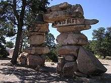
Hermits Rest Concession Building |
|
000000001974-08-07-0000August 7, 1974
(#74000335) |
Grand Canyon National Park
36°03′40″N 112°12′40″W / 36.061111°N 112.211111°W / 36.061111; -112.211111 (Hermits Rest Concession Building) |
Grand Canyon National Park |
|
| 69 |
The Homestead |
|
000000001975-05-27-0000May 27, 1975
(#75000341) |
3 miles (4.8 km) north of Flagstaff on U.S. Route 180
35°14′05″N 111°39′48″W / 35.234722°N 111.663333°W / 35.234722; -111.663333 (The Homestead) |
Flagstaff |
Oldest home in Flagstaff, home of Thomas McMillan. Part of the Museum of Northern Arizona
|
| 70 |
House at 310 South Beaver |
|
000000001986-04-30-0000April 30, 1986
(#86000913) |
310 S. Beaver
35°11′37″N 111°39′03″W / 35.193611°N 111.650833°W / 35.193611; -111.650833 (House at 310 South Beaver) |
Flagstaff |
|
| 71 |
House at 720 Grand Canyon Avenue |
Upload image |
000000001986-04-30-0000April 30, 1986
(#86000909) |
720 Grand Canyon Ave.
35°11′58″N 111°39′26″W / 35.199444°N 111.657222°W / 35.199444; -111.657222 (House at 720 Grand Canyon Avenue) |
Flagstaff |
|
| 72 |
Hull Cabin Historic District |
|
000000001985-10-23-0000October 23, 1985
(#85003370) |
1.5 miles (2.4 km) south of Grand Canyon South Rim in the Kaibab National Forest
35°58′05″N 111°56′46″W / 35.96803°N 111.94618°W / 35.96803; -111.94618 (Hull Cabin Historic District) |
Grand Canyon National Park |
|
| 73 |
Hull Tank Lookout Tree |
|
000000001992-01-13-0000January 13, 1992
(#91001947) |
Southeast of Grandview Point, Grand Canyon National Park, in the Kaibab National Forest
35°56′25″N 111°57′28″W / 35.940278°N 111.957778°W / 35.940278; -111.957778 (Hull Tank Lookout Tree) |
Grand Canyon National Park |
|
| 74 |
The Ice House |
|
000000002009-04-08-0000April 8, 2009
(#09000174) |
201 East Birch Avenue
35°11′54″N 111°38′44″W / 35.19828°N 111.64568°W / 35.19828; -111.64568 (The Ice House) |
Flagstaff |
|
| 75 |
Jacob Lake Lookout Tower |
|
000000001988-01-28-0000January 28, 1988
(#87002477) |
Grand Canyon Highway
36°41′59″N 112°12′47″W / 36.699722°N 112.213056°W / 36.699722; -112.213056 (Jacob Lake Lookout Tower) |
Jacob Lake |
|
| 76 |
Jacob Lake Ranger Station |
|
000000001987-07-13-0000July 13, 1987
(#87001151) |
N. Kaibab Ranger District off State Route 67 in the Kaibab National Forest
36°42′23″N 112°13′43″W / 36.70649°N 112.22848°W / 36.70649; -112.22848 (Jacob Lake Ranger Station) |
Jacob Lake |
Historic cabin and barn
|
| 77 |
Jordan Ranch |
Upload image |
000000002004-01-28-0000January 28, 2004
(#03001489) |
735 Jordan Rd.
34°52′42″N 111°45′40″W / 34.878333°N 111.761111°W / 34.878333; -111.761111 (Jordan Ranch) |
Sedona |
|
| 78 |
Kane Ranch Headquarters |
Upload image |
000000002008-01-02-0000January 2, 2008
(#07001348) |
Approximately 11 miles (18 km) south of U.S. Route 89A on Forest Rd. 8910
36°34′05″N 112°00′14″W / 36.5680°N 112.0038°W / 36.5680; -112.0038 (Kane Ranch Headquarters) |
House Rock Valley |
|
| 79 |
Kendrick Lookout Cabin |
|
000000001988-01-28-0000January 28, 1988
(#87002480) |
Kaibab National Forest
35°24′30″N 111°50′46″W / 35.408333°N 111.846111°W / 35.408333; -111.846111 (Kendrick Lookout Cabin) |
Pumpkin Center |
Built in 1911[9]
|
| 80 |
I.B. Koch House |
Upload image |
000000001986-04-30-0000April 30, 1986
(#86000901) |
7 Riordan Rd.
35°11′27″N 111°39′56″W / 35.190833°N 111.665556°W / 35.190833; -111.665556 (I.B. Koch House) |
Flagstaff |
|
| 81 |
Krenz-Kerley Trading Post |
Upload image |
000000001998-08-24-0000August 24, 1998
(#98001040) |
78 N. Main St.
36°07′53″N 111°14′21″W / 36.131389°N 111.239167°W / 36.131389; -111.239167 (Krenz-Kerley Trading Post) |
Tuba City |
Now the Tuba City Public Library
|
| 82 |
La Cuidad de Mexico Grocery |
|
000000001986-04-30-0000April 30, 1986
(#86000906) |
217 S. San Francisco
35°11′38″N 111°38′59″W / 35.1939°N 111.64977°W / 35.1939; -111.64977 (La Cuidad de Mexico Grocery) |
Flagstaff |
|
| 83 |
La Iglesia Metodista Mexicana, El Divino Redentor |
|
000000001985-01-30-0000January 30, 1985
(#85000147) |
319 S. San Francisco St.
35°11′34″N 111°39′01″W / 35.19286°N 111.65031°W / 35.19286; -111.65031 (La Iglesia Metodista Mexicana, El Divino Redentor) |
Flagstaff |
|
| 84 |
Laws Spring |
|
000000001984-07-05-0000July 5, 1984
(#84000645) |
Kaibab National Forest
35°25′36″N 112°04′07″W / 35.426667°N 112.068611°W / 35.426667; -112.068611 (Laws Spring) |
Williams |
|
| 85 |
Lee Butte Lookout Tower and Cabin |
Upload image |
000000001988-01-28-0000January 28, 1988
(#87002461) |
Woods Canyon
34°50′04″N 111°32′10″W / 34.834444°N 111.536111°W / 34.834444; -111.536111 (Lee Butte Lookout Tower and Cabin) |
Happy Jack |
|
| 86 |
Lee's Ferry and Lonely Dell Ranch |
|
000000001997-11-04-0000November 4, 1997
(#97001234) |
Confluence of Colorado and Paria Rivers, near the Utah-Arizona border
36°51′53″N 111°35′40″W / 36.864722°N 111.594444°W / 36.864722; -111.594444 (Lee's Ferry and Lonely Dell Ranch) |
Marble Canyon |
|
| 87 |
Lees Ferry |
|
000000001976-03-15-0000March 15, 1976
(#76000374) |
Southwest of Page at the Colorado River
36°52′02″N 111°34′53″W / 36.867222°N 111.581389°W / 36.867222; -111.581389 (Lees Ferry) |
Page |
|
| 88 |
Little Mountain Lookout Tree |
Upload image |
000000001992-01-13-0000January 13, 1992
(#91001950) |
Roughly 30 miles (48 km) southeast of Fredonia in the Kaibab National Forest
36°35′22″N 112°21′30″W / 36.589444°N 112.358333°W / 36.589444; -112.358333 (Little Mountain Lookout Tree) |
Fredonia |
|
| 89 |
Lonely Dell Ranch Historic District |
|
000000001978-05-19-0000May 19, 1978
(#78000277) |
Southwest of Page in the Glen Canyon National Recreation Area
36°52′15″N 111°35′41″W / 36.870833°N 111.594722°W / 36.870833; -111.594722 (Lonely Dell Ranch Historic District) |
Page |
|
| 90 |
Lowell Observatory |
|
000000001966-10-15-0000October 15, 1966
(#66000172) |
1 mile (1.6 km) west of Flagstaff on Mars Hill
35°12′08″N 111°39′46″W / 35.202222°N 111.662778°W / 35.202222; -111.662778 (Lowell Observatory) |
Flagstaff |
|
| 91 |
Mary Jane Colter Buildings (Hopi House, The Lookout, Hermit's Rest, and the Desert View Watchtower) |
|
000000001987-05-28-0000May 28, 1987
(#87001436) |
Several locations along the South Rim
36°03′15″N 112°03′18″W / 36.054167°N 112.055°W / 36.054167; -112.055 (Mary Jane Colter Buildings (Hopi House, The Lookout, Hermit's Rest, and the Desert View Watchtower)) |
Grand Canyon National Park |
|
| 92 |
C. Hart Merriam Base Camp Site |
|
000000001966-10-15-0000October 15, 1966
(#66000173) |
20 miles (32 km) northwest of Flagstaff in the Coconino National Forest
35°22′30″N 111°43′30″W / 35.375°N 111.725°W / 35.375; -111.725 (C. Hart Merriam Base Camp Site) |
Flagstaff |
|
| 93 |
W.W. Midgley Bridge |
|
000000001989-03-31-0000March 31, 1989
(#88001614) |
Milepost 375.7 on Alternate U.S. Route 89 over Wilson Canyon
34°53′07″N 111°44′30″W / 34.885278°N 111.741667°W / 34.885278; -111.741667 (W.W. Midgley Bridge) |
Sedona |
|
| 94 |
Milligan House |
|
000000001984-11-29-0000November 29, 1984
(#84000389) |
323 W. Aspen
35°11′59″N 111°39′11″W / 35.19964°N 111.65304°W / 35.19964; -111.65304 (Milligan House) |
Flagstaff |
|
| 95 |
Moqui Lookout Cabin |
Upload image |
000000001988-01-28-0000January 28, 1988
(#87002457) |
Coconino National Forest
34°33′52″N 111°09′57″W / 34.564444°N 111.165833°W / 34.564444; -111.165833 (Moqui Lookout Cabin) |
Blue Ridge |
|
| 96 |
Moqui Ranger Station |
|
000000001993-06-10-0000June 10, 1993
(#93000521) |
Off U.S. Route 180 north of Tusayan in the Kaibab National Forest
35°59′17″N 112°07′13″W / 35.988056°N 112.120278°W / 35.988056; -112.120278 (Moqui Ranger Station) |
Tusayan |
|
| 97 |
Mormon Lake Lookout Cabin |
Upload image |
000000001988-01-28-0000January 28, 1988
(#87002459) |
Coconino National Forest
34°53′12″N 111°25′42″W / 34.886667°N 111.428333°W / 34.886667; -111.428333 (Mormon Lake Lookout Cabin) |
Mormon Lake |
|
| 98 |
Museum of Northern Arizona Exhibition Building |
|
000000001993-04-27-0000April 27, 1993
(#93000305) |
3001 N. Fort Valley Rd.
35°14′04″N 111°39′53″W / 35.234444°N 111.664722°W / 35.234444; -111.664722 (Museum of Northern Arizona Exhibition Building) |
Flagstaff |
|
| 99 |
Navajo National Monument |
|
000000001966-10-15-0000October 15, 1966
(#66000176) |
30 miles (48 km) southwest of Kayenta
36°41′07″N 110°32′07″W / 36.685278°N 110.535278°W / 36.685278; -110.535278 (Navajo National Monument) |
Kayenta |
|
| 100 |
Navajo Steel Arch Highway Bridge |
|
000000001981-08-13-0000August 13, 1981
(#81000134) |
Southwest of Lee
36°49′05″N 111°37′52″W / 36.818056°N 111.631111°W / 36.818056; -111.631111 (Navajo Steel Arch Highway Bridge) |
Lee's Ferry |
|
| 101 |
Negrette House |
|
000000002014-10-08-0000October 8, 2014
(#14000823) |
120 S. 6th St.
35°14′54″N 112°11′33″W / 35.2482°N 112.1926°W / 35.2482; -112.1926 (Negrette House) |
Williams |
|
| 102 |
North End Historic Residential District |
Upload image |
000000001986-04-30-0000April 30, 1986
(#86000899) |
Roughly bounded by Hunt, San Francisco and Verde, Elm and Cherry, and Beaver and Humphreys Sts.
35°12′06″N 111°39′04″W / 35.201667°N 111.651111°W / 35.201667; -111.651111 (North End Historic Residential District) |
Flagstaff |
Flagstaff MRA
|
| 103 |
Northern Arizona Normal School Historic District |
|
000000001986-05-22-0000May 22, 1986
(#86001107) |
Northern Arizona University campus, near Route 66 (Milton Rd.)
35°11′35″N 111°39′18″W / 35.193056°N 111.655°W / 35.193056; -111.655 (Northern Arizona Normal School Historic District) |
Flagstaff |
Old Main and other historic buildings
|
| 104 |
Nuvakwewtaqa |
Upload image |
000000001977-08-02-0000August 2, 1977
(#77000233) |
Address Restricted
|
Winslow |
|
| 105 |
Buckey O'Neill Cabin |
|
000000001975-10-29-0000October 29, 1975
(#75000227) |
Off State Route 64 in Grand Canyon National Park
36°03′26″N 112°08′26″W / 36.057222°N 112.140556°W / 36.057222; -112.140556 (Buckey O'Neill Cabin) |
Grand Canyon National Park |
|
| 106 |
Old Headquarters |
|
000000001975-03-31-0000March 31, 1975
(#75000220) |
2 miles (3.2 km) east of Flagstaff in Walnut Canyon National Monument
35°10′30″N 111°31′02″W / 35.175°N 111.517222°W / 35.175; -111.517222 (Old Headquarters) |
Flagstaff |
|
| 107 |
Our Lady of Guadaloupe Church |
|
000000001986-04-30-0000April 30, 1986
(#86000907) |
302 S. Kendrick
35°11′44″N 111°39′10″W / 35.195556°N 111.652778°W / 35.195556; -111.652778 (Our Lady of Guadaloupe Church) |
Flagstaff |
|
| 108 |
Pendley Homestead Historic District |
|
000000001991-12-23-0000December 23, 1991
(#91001857) |
State Route 89A, 7 miles (11 km) north of Sedona
34°56′54″N 111°45′10″W / 34.948333°N 111.752778°W / 34.948333; -111.752778 (Pendley Homestead Historic District) |
Sedona |
Within Slide Rock State Park
|
| 109 |
Picture Canyon Archaeological Site |
Upload image |
000000002008-01-10-0000January 10, 2008
(#07001349) |
Address Restricted
|
Flagstaff |
|
| 110 |
Presbyterian Church Parsonage |
|
000000001986-04-30-0000April 30, 1986
(#86000911) |
15 E. Cherry
35°12′00″N 111°38′50″W / 35.19995°N 111.64726°W / 35.19995; -111.64726 (Presbyterian Church Parsonage) |
Flagstaff |
|
| 111 |
Prochnow House |
Upload image |
000000001986-04-30-0000April 30, 1986
(#86000898) |
304 S. Elden
35°11′32″N 111°38′42″W / 35.192222°N 111.645°W / 35.192222; -111.645 (Prochnow House) |
Flagstaff |
|
| 112 |
Promontory Butte Lookout Complex |
Upload image |
000000001988-01-28-0000January 28, 1988
(#87002455) |
Rim Rd. in the Apache-Sitgreaves National Forest
34°22′03″N 111°00′43″W / 34.3675°N 111.011944°W / 34.3675; -111.011944 (Promontory Butte Lookout Complex) |
Beaver Park |
|
| 113 |
Pumphouse Wash Bridge |
|
000000001988-09-30-0000September 30, 1988
(#88001605) |
Milepost 387.4 on U.S. Route 89 over Pumphouse Wash
35°01′30″N 111°44′06″W / 35.025°N 111.735°W / 35.025; -111.735 (Pumphouse Wash Bridge) |
Flagstaff |
|
| 114 |
Railroad Addition Historic District |
|
000000001983-01-18-0000January 18, 1983
(#83002989) |
15 W. Aspen; also roughly bounded by Santa Fe railroad tracks, Agassiz and Beaver Sts., Birch and Aspen Aves.; also 122 E. Old U.S. Route 66
35°11′52″N 111°38′50″W / 35.197778°N 111.647222°W / 35.197778; -111.647222 (Railroad Addition Historic District) |
Flagstaff |
Additional addresses represent two boundary increases
|
| 115 |
Ranger's Dormitory |
|
000000001975-09-05-0000September 5, 1975
(#75000219) |
Off State Route 64 in Grand Canyon National Park
36°03′20″N 112°08′11″W / 36.055556°N 112.136389°W / 36.055556; -112.136389 (Ranger's Dormitory) |
Grand Canyon National Park |
|
| 116 |
Ridge Ruin Archeological District |
Upload image |
000000001992-04-20-0000April 20, 1992
(#92000339) |
Address Restricted
|
Flagstaff |
|
| 117 |
Riordan Estate |
|
000000001979-02-28-0000February 28, 1979
(#79000416) |
2 Kinlichi Knoll
35°11′14″N 111°39′33″W / 35.187222°N 111.659167°W / 35.187222; -111.659167 (Riordan Estate) |
Flagstaff |
|
| 118 |
Rock Family |
Upload image |
000000001992-11-21-0000November 21, 1992
(#92001550) |
Address Restricted
|
Fredonia |
|
| 119 |
Rocketeers |
Upload image |
000000001992-11-21-0000November 21, 1992
(#92001547) |
Address Restricted
|
Fredonia |
|
| 120 |
Rural Route 66, Brannigan Park |
Upload image |
000000001989-05-19-0000May 19, 1989
(#89000375) |
Forest Rd. 146 east of Parks to Brannigan Park
35°15′46″N 111°53′40″W / 35.262778°N 111.894444°W / 35.262778; -111.894444 (Rural Route 66, Brannigan Park) |
Parks |
|
| 121 |
Rural Route 66, Parks |
Upload image |
000000001989-05-19-0000May 19, 1989
(#89000374) |
Forest Rd. 146 between Beacon Hill and Parks
35°15′50″N 112°02′45″W / 35.263889°N 112.045833°W / 35.263889; -112.045833 (Rural Route 66, Parks) |
Parks |
|
| 122 |
Rural Route 66, Pine Springs |
Upload image |
000000001989-05-19-0000May 19, 1989
(#89000379) |
Forest Rd. 108 at Pine Springs Ranch
35°12′55″N 112°16′42″W / 35.215278°N 112.278333°W / 35.215278; -112.278333 (Rural Route 66, Pine Springs) |
Williams |
|
| 123 |
Saginaw & Manistee Camp 2 |
Upload image |
000000001995-02-24-0000February 24, 1995
(#95000148) |
Address Restricted
|
Flagstaff |
|
| 124 |
Sedona Ranger Station |
|
000000002008-08-29-0000August 29, 2008
(#08000810) |
Brewer Road, south of Hart Road
34°51′45″N 111°45′57″W / 34.86245°N 111.7657°W / 34.86245; -111.7657 (Sedona Ranger Station) |
Sedona |
|
| 125 |
South Beaver School |
|
000000001987-08-06-0000August 6, 1987
(#87001342) |
506 S. Beaver St.
35°11′30″N 111°39′06″W / 35.191667°N 111.651667°W / 35.191667; -111.651667 (South Beaver School) |
Flagstaff |
|
| 126 |
Summit Mountain Lookout Tree |
Upload image |
000000001992-01-13-0000January 13, 1992
(#91001948) |
Off Perkinsville Rd. southeast of Williams in the Kaibab National Forest
35°07′51″N 112°07′56″W / 35.130833°N 112.132222°W / 35.130833; -112.132222 (Summit Mountain Lookout Tree) |
Williams |
|
| 127 |
Superintendent's Residence |
|
000000001974-09-06-0000September 6, 1974
(#74000450) |
Off Route 8A in Grand Canyon National Park
36°03′22″N 112°08′05″W / 36.056111°N 112.134722°W / 36.056111; -112.134722 (Superintendent's Residence) |
Grand Canyon National Park |
|
| 128 |
Tater Point Lookout Tree |
Upload image |
000000001992-01-13-0000January 13, 1992
(#91001946) |
Forest Rd. 240 east of State Route 67 and south of U.S. Route 89A in the Kaibab National Forest
36°32′22″N 112°06′05″W / 36.539444°N 112.101389°W / 36.539444; -112.101389 (Tater Point Lookout Tree) |
Fredonia |
|
| 129 |
Taylor Cabin Line Camp |
Upload image |
000000001985-07-16-0000July 16, 1985
(#85001580) |
Sycamore Canyon Wilderness Area
34°59′18″N 111°59′19″W / 34.988333°N 111.988611°W / 34.988333; -111.988611 (Taylor Cabin Line Camp) |
Sedona |
|
| 130 |
Telephone Hill Lookout Tree |
Upload image |
000000001992-01-13-0000January 13, 1992
(#91001952) |
Off State Route 67 south of its junction with U.S. Route 89A in the Kaibab National Forest
36°32′50″N 112°10′33″W / 36.547222°N 112.175833°W / 36.547222; -112.175833 (Telephone Hill Lookout Tree) |
Fredonia |
|
| 131 |
Tipover Lookout Tree |
Upload image |
000000001992-01-13-0000January 13, 1992
(#91001953) |
Northwest of North Rim Entrance Station, Grand Canyon National Park, in the Kaibab National Forest
36°21′56″N 112°08′19″W / 36.365556°N 112.138611°W / 36.365556; -112.138611 (Tipover Lookout Tree) |
Fredonia |
|
| 132 |
Trans-Canyon Telephone Line, Grand Canyon National Park |
|
000000001986-05-13-0000May 13, 1986
(#86001102) |
Grand Canyon along the Bright Angel and North Kaibab Trails from the South Rim to Roaring Springs and the South Kaibab Trail to Tipoff
36°06′36″N 112°05′34″W / 36.11°N 112.092778°W / 36.11; -112.092778 (Trans-Canyon Telephone Line, Grand Canyon National Park) |
Grand Canyon National Park |
|
| 133 |
Tuba Trading Post |
Upload image |
000000001996-11-29-0000November 29, 1996
(#96001362) |
10 N. Main St.
36°07′49″N 111°14′23″W / 36.130278°N 111.239722°W / 36.130278; -111.239722 (Tuba Trading Post) |
Tuba City |
|
| 134 |
Tusayan Lookout Tree |
Upload image |
000000001992-01-13-0000January 13, 1992
(#91001951) |
West of U.S. Route 180, southwest of Tusayan in the Kaibab National Forest
35°58′16″N 112°08′11″W / 35.971111°N 112.136389°W / 35.971111; -112.136389 (Tusayan Lookout Tree) |
Tusayan |
|
| 135 |
Tusayan Ruins |
|
000000001974-07-10-0000July 10, 1974
(#74000285) |
Grand Canyon National Park
36°00′49″N 111°51′56″W / 36.013611°N 111.865556°W / 36.013611; -111.865556 (Tusayan Ruins) |
Grand Canyon National Park |
|
| 136 |
Tutuveni |
Upload image |
000000001986-12-03-0000December 3, 1986
(#86003283) |
Address Restricted
|
Cameron |
|
| 137 |
Twins |
Upload image |
000000001992-11-21-0000November 21, 1992
(#92001545) |
Address Restricted
|
Fredonia |
|
| 138 |
Two Spot Logging Train |
|
000000001999-09-14-0000September 14, 1999
(#99001066) |
Junction of San Francisco St. and BNSF Railroad
35°11′48″N 111°38′46″W / 35.196667°N 111.646111°W / 35.196667; -111.646111 (Two Spot Logging Train) |
Flagstaff |
|
| 139 |
Urban Route 66, Williams |
|
000000001989-05-19-0000May 19, 1989
(#89000376) |
Bill Williams Ave. between 6th St. and Pine St.
35°14′56″N 112°11′31″W / 35.248889°N 112.191944°W / 35.248889; -112.191944 (Urban Route 66, Williams) |
Williams |
|
| 140 |
USFS Fort Valley Experimental Forest Station Historic District |
Upload image |
000000002001-07-25-0000July 25, 2001
(#01000002) |
1⁄3 mile (0.54 km) west of the junction of U.S. Route 180 and Bader Rd.
35°16′04″N 111°44′34″W / 35.267778°N 111.742778°W / 35.267778; -111.742778 (USFS Fort Valley Experimental Forest Station Historic District) |
Flagstaff |
|
| 141 |
Volunteer Lookout Cabin |
Upload image |
000000001988-01-28-0000January 28, 1988
(#87002481) |
Kaibab National Forest
35°13′05″N 111°53′41″W / 35.218056°N 111.894722°W / 35.218056; -111.894722 (Volunteer Lookout Cabin) |
Bellemont |
|
| 142 |
Walnut Canyon Bridge |
|
000000001988-09-30-0000September 30, 1988
(#88001660) |
Townsend-Winona Highway
35°12′42″N 111°25′14″W / 35.211667°N 111.420556°W / 35.211667; -111.420556 (Walnut Canyon Bridge) |
Winona |
|
| 143 |
Walnut Canyon Dam |
|
000000001979-01-18-0000January 18, 1979
(#79000417) |
Southeast of Flagstaff
35°09′59″N 111°28′30″W / 35.166389°N 111.475°W / 35.166389; -111.475 (Walnut Canyon Dam) |
Flagstaff |
|
| 144 |
Walnut Canyon National Monument |
|
000000001966-10-15-0000October 15, 1966
(#66000174) |
8 miles (13 km) east of Flagstaff off Old U.S. Route 66
35°09′51″N 111°30′03″W / 35.164167°N 111.500833°W / 35.164167; -111.500833 (Walnut Canyon National Monument) |
Flagstaff |
|
| 145 |
Water Reclamation Plant |
|
000000001974-09-06-0000September 6, 1974
(#74000348) |
South of Grand Canyon National Park, Route 8A
36°02′54″N 112°09′19″W / 36.048333°N 112.155278°W / 36.048333; -112.155278 (Water Reclamation Plant) |
Grand Canyon National Park |
|
| 146 |
Weatherford Hotel |
|
000000001978-03-30-0000March 30, 1978
(#78000543) |
23 N. Leroux St.
35°11′54″N 111°38′53″W / 35.198333°N 111.648056°W / 35.198333; -111.648056 (Weatherford Hotel) |
Flagstaff |
|
| 147 |
White Man Cave |
Upload image |
000000001992-11-21-0000November 21, 1992
(#92001543) |
Address Restricted
|
Fredonia |
|
| 148 |
Williams Historic Business District |
|
000000001984-12-20-0000December 20, 1984
(#84000436) |
Roughly bounded by Grant and Railroad Aves. and 1st and 4th Sts.
35°15′03″N 112°11′20″W / 35.250833°N 112.188889°W / 35.250833; -112.188889 (Williams Historic Business District) |
Williams |
|
| 149 |
Williams Residential Historic District |
|
000000001998-01-08-0000January 8, 1998
(#97001603) |
Roughly bounded by Grant and Fairview Aves. and Taber and 6th Sts.
35°14′47″N 112°11′12″W / 35.246389°N 112.186667°W / 35.246389; -112.186667 (Williams Residential Historic District) |
Williams |
|
| 150 |
Willow Springs |
Upload image |
000000001986-12-03-0000December 3, 1986
(#86003285) |
Address Restricted
|
Cameron |
|
| 151 |
Charles Wilson, Jr. House |
|
000000001986-04-30-0000April 30, 1986
(#86000904) |
100 Wilson Dr.
35°12′01″N 111°39′41″W / 35.20034°N 111.66135°W / 35.20034; -111.66135 (Charles Wilson, Jr. House) |
Flagstaff |
|
| 152 |
Winona |
Upload image |
000000001966-10-15-0000October 15, 1966
(#66000177) |
Address Restricted
|
Winona |
Archaeological site.
|
| 153 |
Wise Men |
Upload image |
000000001992-11-21-0000November 21, 1992
(#92001549) |
Address Restricted
|
Fredonia |
|
| 154 |
Woody Mountain Lookout Tower |
|
000000001988-01-28-0000January 28, 1988
(#87002458) |
Rogers Lake
35°08′32″N 111°44′57″W / 35.142222°N 111.749167°W / 35.142222; -111.749167 (Woody Mountain Lookout Tower) |
Flagstaff |
|
| 155 |
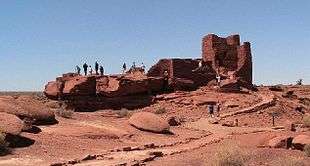
Wupatki National Monument |
|
000000001966-10-15-0000October 15, 1966
(#66000175) |
30 miles (48 km) north of Flagstaff off U.S. Route 89
35°33′01″N 111°23′02″W / 35.550278°N 111.383889°W / 35.550278; -111.383889 (Wupatki National Monument) |
Flagstaff |
|



%2C_Flagstaff%2C_AZ%2C_September_16_2016.jpg)





.jpg)











.jpg)








.jpg)
