| [3] |
Name on the Register[4] |
Image |
Date listed[5] |
Location |
City or town |
Description |
|---|
| 1 |
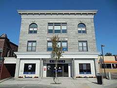
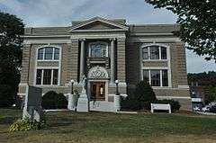
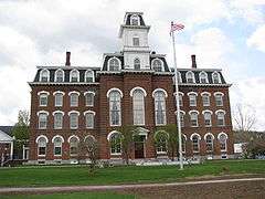
Aldrich Public Library |
|
000000002015-01-05-0000January 5, 2015
(#15000961) |
6 Washington St.
44°11′51″N 72°30′04″W / 44.197524°N 72.501002°W / 44.197524; -72.501002 (Aldrich Public Library) |
Barre |
|
| 2 |
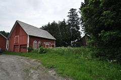
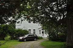
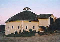
Allenwood Farm |
|
000000001983-12-22-0000December 22, 1983
(#83004229) |
U.S. Route 2
44°16′42″N 72°26′02″W / 44.278333°N 72.433889°W / 44.278333; -72.433889 (Allenwood Farm) |
Plainfield |
|
| 3 |
Athenwood and Thomas W. Wood Studio |
|
000000001974-06-13-0000June 13, 1974
(#74000259) |
41 and 39 Northfield St.
44°15′21″N 72°34′47″W / 44.255833°N 72.579722°W / 44.255833; -72.579722 (Athenwood and Thomas W. Wood Studio) |
Montpelier |
|
| 4 |
Barre City Hall and Opera House |
|
000000001973-01-18-0000January 18, 1973
(#73000198) |
12 N. Main St.
44°11′48″N 72°30′10″W / 44.196667°N 72.502778°W / 44.196667; -72.502778 (Barre City Hall and Opera House) |
Barre City |
|
| 5 |
Barre Downtown Historic District |
|
000000001979-09-04-0000September 4, 1979
(#79000227) |
United States Route 302
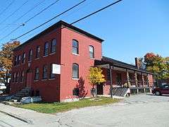
44°11′50″N 72°30′09″W / 44.197222°N 72.5025°W / 44.197222; -72.5025 (Barre Downtown Historic District) |
Barre City |
|
| 6 |
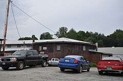
Beck and Beck Granite Shed |
|
000000002011-09-29-0000September 29, 2011
(#11000714) |
30 Granite St.
44°11′58″N 72°30′23″W / 44.199444°N 72.506389°W / 44.199444; -72.506389 (Beck and Beck Granite Shed) |
Barre City |
|
| 7 |
Bridge 31 |
|
000000002006-08-09-0000August 9, 2006
(#06000703) |
Winooski St.
44°20′21″N 72°45′51″W / 44.339167°N 72.764167°W / 44.339167; -72.764167 (Bridge 31) |
Waterbury |
|
| 8 |
Bridge No. 27 |
|
000000002006-01-11-0000January 11, 2006
(#05001523) |
Town Highway 61, Lover's Ln.
44°11′15″N 72°38′27″W / 44.1876°N 72.6407°W / 44.1876; -72.6407 (Bridge No. 27) |
Berlin |
|
| 9 |
Central Vermont Railway Depot |
Upload image |
000000001975-04-01-0000April 1, 1975
(#75000145) |
Western end of Depot Sq.
44°08′55″N 72°39′30″W / 44.148611°N 72.658333°W / 44.148611; -72.658333 (Central Vermont Railway Depot) |
Northfield |
|
| 10 |
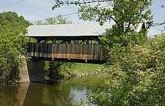
Coburn Covered Bridge |
|
000000001974-10-09-0000October 9, 1974
(#74000260) |
Northeast of East Montpelier between Vermont Route 14 and U.S. Route 2, over the Winooski River
44°16′51″N 72°27′18″W / 44.280833°N 72.455°W / 44.280833; -72.455 (Coburn Covered Bridge) |
East Montpelier |
|
| 11 |
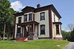
Colby Mansion |
|
000000001979-09-10-0000September 10, 1979
(#79000228) |
VT 100
44°20′59″N 72°44′35″W / 44.349722°N 72.743056°W / 44.349722; -72.743056 (Colby Mansion) |
Waterbury |
|
| 12 |
College Hall |
|
000000001975-04-23-0000April 23, 1975
(#75000146) |
Vermont College campus, Ridge St.
44°15′19″N 72°34′04″W / 44.255278°N 72.567778°W / 44.255278; -72.567778 (College Hall) |
Montpelier |
|
| 13 |
Currier Park Historic District |
|
000000001990-09-27-0000September 27, 1990
(#90001454) |
Properties bordering Currier Park on Park, North, East and Academy Sts. and adjacent properties on Averill and Cliff Sts
44°11′50″N 72°29′52″W / 44.1971°N 72.4977°W / 44.1971; -72.4977 (Currier Park Historic District) |
Barre City |
|
| 14 |
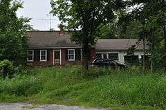
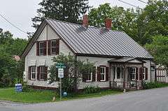
Parley Davis House |
|
000000001989-09-18-0000September 18, 1989
(#89000242) |
Center Road
44°17′01″N 72°31′46″W / 44.283604°N 72.529583°W / 44.283604; -72.529583 (Parley Davis House) |
East Montpelier |
|
| 15 |
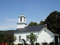
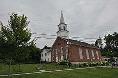
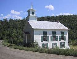
East Village Meetinghouse |
|
000000001980-06-30-0000June 30, 1980
(#80000341) |
US 2 and VT 14
44°16′18″N 72°29′12″W / 44.271694°N 72.486742°W / 44.271694; -72.486742 (East Village Meetinghouse) |
East Montpelier |
|
| 16 |
Gale-Bancroft House |
|
000000001984-11-15-0000November 15, 1984
(#84000741) |
Brook Rd.
44°16′32″N 72°25′23″W / 44.275418°N 72.423119°W / 44.275418; -72.423119 (Gale-Bancroft House) |
Plainfield |
|
| 17 |
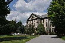
Goddard College Greatwood Campus |
|
000000001996-03-07-0000March 7, 1996
(#96000253) |
Junction of U.S. Route 2 and Vermont Route 214
44°16′43″N 72°26′04″W / 44.278611°N 72.434444°W / 44.278611; -72.434444 (Goddard College Greatwood Campus) |
Plainfield |
|
| 18 |
Great Eddy Covered Bridge |
|
000000001974-09-06-0000September 6, 1974
(#74000261) |
Bridge St., east of Vermont Route 100 over Mad River
44°11′22″N 72°49′26″W / 44.189444°N 72.823889°W / 44.189444; -72.823889 (Great Eddy Covered Bridge) |
Waitsfield |
Also known as the Waitsfield Village Covered Bridge.
|
| 19 |
Green Mountain Seminary |
|
000000001978-01-30-0000January 30, 1978
(#78000245) |
Hollow Rd.
44°22′39″N 72°43′05″W / 44.3775°N 72.718056°W / 44.3775; -72.718056 (Green Mountain Seminary) |
Waterbury Center |
|
| 20 |
Italian Baptist Church |
|
000000001975-04-23-0000April 23, 1975
(#75000147) |
10 N. Brook St.
44°12′13″N 72°30′30″W / 44.203592°N 72.508314°W / 44.203592; -72.508314 (Italian Baptist Church) |
Barre City |
|
| 21 |
Jones Brothers Granite Shed |
|
000000002002-04-26-0000April 26, 2002
(#02000413) |
7 Jones Bros. Way
44°12′42″N 72°31′15″W / 44.211721°N 72.520820°W / 44.211721; -72.520820 (Jones Brothers Granite Shed) |
Barre City |
Now the Vermont Granite Museum.
|
| 22 |
Jones-Pestle Farmstead |
|
000000002015-09-08-0000September 8, 2015
(#15000582) |
339 Bridge St.
44°11′11″N 72°49′11″W / 44.1863°N 72.8198°W / 44.1863; -72.8198 (Jones-Pestle Farmstead) |
Waitsfield |
|
| 23 |
Joslin Farm |
|
000000001988-10-27-0000October 27, 1988
(#88002058) |
E. Warren Rd., 1.5 mi (2.4 km) east of junction with Bridge St.
44°10′07″N 72°48′36″W / 44.168611°N 72.81°W / 44.168611; -72.81 (Joslin Farm) |
Waitsfield |
|
| 24 |
Kents Corner Historic District |
|
000000001973-05-08-0000May 8, 1973
(#73000199) |
Kent's Corner; also Kent Hill, Old West Church, Robinson Cemetery, Fowler, and Bliss Pond Roads
44°21′54″N 72°29′18″W / 44.365°N 72.488333°W / 44.365; -72.488333 (Kents Corner Historic District) |
Calais |
Second set of addresses represents a boundary increase June 30, 2006
|
| 25 |
Chauncey B. Leonard House |
|
000000001995-03-09-0000March 9, 1995
(#95000176) |
Northern side of Shed Rd., about 0.2 mi (0.32 km) west of Scott Hill Rd.
44°12′39″N 72°34′46″W / 44.2108°N 72.5794°W / 44.2108; -72.5794 (Chauncey B. Leonard House) |
Berlin |
|
| 26 |
Mad River Glen Ski Area Historic District |
|
000000002012-07-05-0000July 5, 2012
(#12000409) |
VT 17 (McCullough Turnpike)
44°12′07″N 72°55′02″W / 44.202082°N 72.91734°W / 44.202082; -72.91734 (Mad River Glen Ski Area Historic District) |
Fayston |
Extends into Buels Gore in Chittenden County
|
| 27 |
Lower Cox Brook Covered Bridge |
|
000000001974-10-15-0000October 15, 1974
(#74000262) |
Off Vermont Route 12
44°10′21″N 72°39′12″W / 44.1725°N 72.653333°W / 44.1725; -72.653333 (Lower Cox Brook Covered Bridge) |
Northfield Falls |
|
| 28 |
Mad River Valley Rural Historic District |
|
000000001994-08-05-0000August 5, 1994
(#94000836) |
Roughly along Vermont Routes 100 and 100B from Waitsfield to Moretown and parts of North and River Rds.
44°13′16″N 72°47′29″W / 44.221111°N 72.791389°W / 44.221111; -72.791389 (Mad River Valley Rural Historic District) |
Moretown and Waitsfield |
|
| 29 |
Martin Covered Bridge |
|
000000001974-10-09-0000October 9, 1974
(#74000358) |
Northeast of Plainfield, over the Winooski River off US 2
44°17′07″N 72°24′48″W / 44.285278°N 72.413333°W / 44.285278; -72.413333 (Martin Covered Bridge) |
Marshfield |
|
| 30 |
Mayo Building |
|
000000001983-07-14-0000July 14, 1983
(#83003222) |
Main and East Sts.
44°08′54″N 72°39′22″W / 44.148333°N 72.656111°W / 44.148333; -72.656111 (Mayo Building) |
Northfield |
|
| 31 |
McLaughlin Farm |
|
000000001996-01-22-0000January 22, 1996
(#95001556) |
Town Highway 17 (Bragg Hill Rd.)
44°11′37″N 72°50′45″W / 44.193611°N 72.845833°W / 44.193611; -72.845833 (McLaughlin Farm) |
Fayston |
Now known as Knoll Farm.
|
| 32 |
Middlesex-Winooski River Bridge |
|
000000001991-11-14-0000November 14, 1991
(#91001610) |
U.S. Route 2 over the Winooski River
44°18′22″N 72°41′48″W / 44.306111°N 72.696667°W / 44.306111; -72.696667 (Middlesex-Winooski River Bridge) |
Middlesex and Moretown |
Historic bridge replaced in 2010.
|
| 33 |
Mill Village Historic District |
|
000000001979-06-12-0000June 12, 1979
(#79000229) |
Roughly bounded by Vermont Route 100, Interstate 89, and Stowe St.
44°20′35″N 72°44′52″W / 44.343056°N 72.747778°W / 44.343056; -72.747778 (Mill Village Historic District) |
Waterbury |
|
| 34 |
Montpelier Historic District |
|
000000001978-11-03-0000November 3, 1978
(#78000246) |
U.S. Route 2 and Vermont Route 12; also 70–101 E. State St. and 1 West St.
44°15′41″N 72°34′37″W / 44.261389°N 72.576944°W / 44.261389; -72.576944 (Montpelier Historic District) |
Montpelier |
Second set of addresses represents a boundary increase
|
| 35 |
National Clothespin Factory |
|
000000002005-12-16-0000December 16, 2005
(#05001422) |
One Granite St.
44°15′08″N 72°34′16″W / 44.252222°N 72.571111°W / 44.252222; -72.571111 (National Clothespin Factory) |
Montpelier |
Was the last manufacturer of wooden clothespins in the US; building now houses martial arts studios and other businesses; see also Grave of Jack Crowell
|
| 36 |
Nichols House |
|
000000001978-01-31-0000January 31, 1978
(#78000247) |
Southwest of East Barre off Vermont Route 110
44°08′59″N 72°27′31″W / 44.149722°N 72.458611°W / 44.149722; -72.458611 (Nichols House) |
East Barre |
|
| 37 |
North Calais Village Historic District |
Upload image |
000000002010-09-24-0000September 24, 2010
(#10000772) |
N. Calais Rd., Foster Hill Rd., Upper Rd., Moscow Hills Rd., G.A.R. Rd.
44°23′27″N 72°26′37″W / 44.390833°N 72.443611°W / 44.390833; -72.443611 (North Calais Village Historic District) |
Calais |
|
| 38 |
Northfield Falls Covered Bridge |
|
000000001974-08-13-0000August 13, 1974
(#74000263) |
North of Northfield off Vermont Route 12, over Dog River
44°10′20″N 72°39′18″W / 44.172222°N 72.655°W / 44.172222; -72.655 (Northfield Falls Covered Bridge) |
Northfield |
|
| 39 |
Old Red Mill |
|
000000001977-10-20-0000October 20, 1977
(#77000102) |
Vermont Route 12
44°07′07″N 72°39′27″W / 44.118611°N 72.6575°W / 44.118611; -72.6575 (Old Red Mill) |
South Northfield |
|
| 40 |
Old West Church |
|
000000001973-05-08-0000May 8, 1973
(#73000200) |
0.8 mi (1.3 km) south of Kent's Corner
44°21′31″N 72°29′37″W / 44.358611°N 72.493611°W / 44.358611; -72.493611 (Old West Church) |
Calais |
|
| 41 |
Pine Brook Covered Bridge |
|
000000001974-06-13-0000June 13, 1974
(#74000264) |
Northeast of Waitsfield over Pine Brook
44°12′21″N 72°47′32″W / 44.205833°N 72.792222°W / 44.205833; -72.792222 (Pine Brook Covered Bridge) |
Waitsfield |
|
| 42 |
Plainfield Village Historic District |
|
000000001983-02-03-0000February 3, 1983
(#83003223) |
High, School, Main and Water Sts., and Brook Rd.
44°16′43″N 72°25′32″W / 44.278611°N 72.425556°W / 44.278611; -72.425556 (Plainfield Village Historic District) |
Plainfield and Marshfield |
|
| 43 |
Roxbury Fish Hatchery |
|
000000001994-03-24-0000March 24, 1994
(#94000177) |
Western side of Vermont Route 12A, about 1 mile (1.6 km) south of Roxbury
44°03′46″N 72°44′38″W / 44.062778°N 72.743889°W / 44.062778; -72.743889 (Roxbury Fish Hatchery) |
Roxbury |
Vermont Fish and Wildlife Department's Roxbury Fish Culture Station, the first fish culture station in Vermont, built in 1891
|
| 44 |
Scampini Block |
|
000000002007-03-13-0000March 13, 2007
(#07000160) |
289 N. Main St.
44°12′07″N 72°30′16″W / 44.201944°N 72.504444°W / 44.201944; -72.504444 (Scampini Block) |
Barre City |
|
| 45 |
Slaughter House Covered Bridge |
|
000000001974-06-13-0000June 13, 1974
(#74000265) |
North of Northfield off Vermont Route 12 over Dog River
44°10′07″N 72°39′17″W / 44.168611°N 72.654722°W / 44.168611; -72.654722 (Slaughter House Covered Bridge) |
Northfield |
|
| 46 |
E. L. Smith Roundhouse Granite Shed |
|
000000002011-09-26-0000September 26, 2011
(#11000704) |
23 Burnham Meadows
44°11′51″N 72°30′19″W / 44.1975°N 72.505278°W / 44.1975; -72.505278 (E. L. Smith Roundhouse Granite Shed) |
Barre City |
|
| 47 |
Socialist Labor Party Hall |
|
000000001998-10-22-0000October 22, 1998
(#98001267) |
46 Granite St.
44°11′54″N 72°30′27″W / 44.198333°N 72.5075°W / 44.198333; -72.5075 (Socialist Labor Party Hall) |
Barre City |
|
| 48 |
Stony Brook Covered Bridge |
|
000000001974-11-20-0000November 20, 1974
(#74000266) |
Southwest of Northfield off Vermont Route 12A, over Stony Brook
44°07′16″N 72°41′25″W / 44.121111°N 72.690278°W / 44.121111; -72.690278 (Stony Brook Covered Bridge) |
Northfield |
|
| 49 |
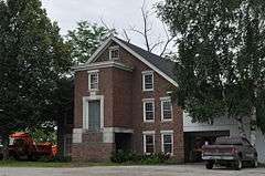
Joshua Twing Gristmill |
|
000000001978-12-29-0000December 29, 1978
(#78000248) |
450 N. Main St.
44°12′18″N 72°30′41″W / 44.205061°N 72.511298°W / 44.205061; -72.511298 (Joshua Twing Gristmill) |
Barre City |
|
| 50 |
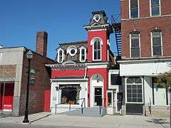
Union Co-operative Store Bakery |
|
000000002003-11-13-0000November 13, 2003
(#03001166) |
46½ Granite St.
44°11′55″N 72°30′24″W / 44.198516°N 72.506633°W / 44.198516; -72.506633 (Union Co-operative Store Bakery) |
Barre City |
|
| 51 |
Union Meetinghouse |
|
000000001980-06-30-0000June 30, 1980
(#80000342) |
Center Rd.
44°17′00″N 72°31′39″W / 44.283333°N 72.5275°W / 44.283333; -72.5275 (Union Meetinghouse) |
East Montpelier |
|
| 52 |
Upper Cox Brook Covered Bridge |
|
000000001974-10-01-0000October 1, 1974
(#74000267) |
North of Northfield off Vermont Route 12 over Cox Brook
44°10′25″N 72°39′20″W / 44.173611°N 72.655556°W / 44.173611; -72.655556 (Upper Cox Brook Covered Bridge) |
Northfield |
|
| 53 |
Vermont State Hospital Historic District |
|
000000002016-11-08-0000November 8, 2016
(#16000765) |
Horseshoe & State Drs., Park Row
44°19′55″N 72°45′14″W / 44.331897°N 72.753861°W / 44.331897; -72.753861 (Vermont State Hospital Historic District) |
Waterbury |
|
| 54 |
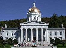
Vermont Statehouse |
|
000000001970-12-30-0000December 30, 1970
(#70000739) |
State St.
44°15′44″N 72°34′51″W / 44.262222°N 72.580833°W / 44.262222; -72.580833 (Vermont Statehouse) |
Montpelier |
|
| 55 |
Waitsfield Common Historic District |
|
000000002001-11-08-0000November 8, 2001
(#01001227) |
Joslin Hill Rd., North Rd., East Rd., and Common Rd.
44°11′16″N 72°47′47″W / 44.187778°N 72.796389°W / 44.187778; -72.796389 (Waitsfield Common Historic District) |
Waitsfield |
|
| 56 |
Waitsfield Village Historic District |
|
000000001983-08-11-0000August 11, 1983
(#83003224) |
Vermont Route 100 and Bridge St.
44°11′26″N 72°49′22″W / 44.190556°N 72.822778°W / 44.190556; -72.822778 (Waitsfield Village Historic District) |
Waitsfield |
|
| 57 |
Warren Covered Bridge |
|
000000001974-08-07-0000August 7, 1974
(#74000269) |
Off Vermont Route 100, over the Mad River
44°06′40″N 72°51′26″W / 44.111111°N 72.857222°W / 44.111111; -72.857222 (Warren Covered Bridge) |
Warren |
|
| 58 |
Warren Village Historic District |
|
000000001992-11-20-0000November 20, 1992
(#92001532) |
Along Town Highways 1, 4, 16 and 17
44°06′49″N 72°51′24″W / 44.113611°N 72.856667°W / 44.113611; -72.856667 (Warren Village Historic District) |
Warren |
|
| 59 |
Waterbury Center Methodist Church |
|
000000001978-01-09-0000January 9, 1978
(#78000251) |
Vermont Route 100
44°22′51″N 72°43′13″W / 44.380833°N 72.720278°W / 44.380833; -72.720278 (Waterbury Center Methodist Church) |
Waterbury Center |
|
| 60 |
Waterbury Village Historic District |
|
000000001978-08-24-0000August 24, 1978
(#78000249) |
U.S. Route 2
44°20′06″N 72°45′17″W / 44.335°N 72.754722°W / 44.335; -72.754722 (Waterbury Village Historic District) |
Waterbury |
|
| 61 |
Wheelock Law Office |
|
000000001975-06-18-0000June 18, 1975
(#75000148) |
135 N. Main St.
44°11′53″N 72°30′13″W / 44.198056°N 72.503611°W / 44.198056; -72.503611 (Wheelock Law Office) |
Barre City |
|
| 62 |
Theodore Wood House |
|
000000002005-02-10-0000February 10, 2005
(#05000037) |
1420 Hollister Hill Rd.
44°18′07″N 72°24′51″W / 44.301944°N 72.414167°W / 44.301944; -72.414167 (Theodore Wood House) |
Marshfield |
|
| 63 |
Woodbury Graded School |
Upload image |
000000001993-09-30-0000September 30, 1993
(#93001008) |
Junction of Town Highway 22 and Vermont Route 14
44°26′24″N 72°24′59″W / 44.440008°N 72.416291°W / 44.440008; -72.416291 (Woodbury Graded School) |
Woodbury |
|
| 64 |
Woodbury Town Hall |
Upload image |
000000001995-03-31-0000March 31, 1995
(#95000296) |
Vermont Route 14
44°26′26″N 72°24′57″W / 44.440556°N 72.415833°W / 44.440556; -72.415833 (Woodbury Town Hall) |
Woodbury |
|
| 65 |
Worcester Town Hall |
Upload image |
000000002005-11-09-0000November 9, 2005
(#05001234) |
12 Worcester Village Rd.
44°22′23″N 72°33′00″W / 44.372925°N 72.550021°W / 44.372925; -72.550021 (Worcester Town Hall) |
Worcester |
|
| 66 |
Worcester Village School |
Upload image |
000000002005-11-09-0000November 9, 2005
(#05001235) |
17 Calais Rd.
44°22′21″N 72°32′55″W / 44.3725°N 72.548611°W / 44.3725; -72.548611 (Worcester Village School) |
Worcester |
|













.jpg)

