Pakyong Airport
| Pakyong Airport पाकयोंग हवाई अड्डे / पाक्योङ्ग बिमानस्थल | |||||||||||
|---|---|---|---|---|---|---|---|---|---|---|---|
| IATA: none – ICAO: VEPY | |||||||||||
| Summary | |||||||||||
| Airport type | Public | ||||||||||
| Operator | AAI | ||||||||||
| Serves | Gangtok | ||||||||||
| Location | Pakyong, Sikkim, India | ||||||||||
| Elevation AMSL | 1,399 m / 4,590 ft | ||||||||||
| Coordinates | 27°13′40″N 088°35′13″E / 27.22778°N 88.58694°ECoordinates: 27°13′40″N 088°35′13″E / 27.22778°N 88.58694°E | ||||||||||
| Map | |||||||||||
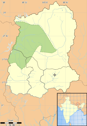
 Pakyong Airport Location in Sikkim | |||||||||||
| Runways | |||||||||||
| |||||||||||
Pakyong Airport is an airport under construction near Gangtok, the state capital of Sikkim, India. The airport, spread over 400 ha (990 acres), is located at Pakyong village about 35km (21.75 mi) south of Gangtok. It is the first greenfield airport to be constructed in the Northeastern Region of India and the only airport in the state of Sikkim.[1] Frequent protests by locals and landslides upslope of the runway have resulted in suspension of work twice, escalating the cost of the project from Rs. 309 crore (3.09 billion) to Rs. 605 crore (6.05 billion) (US$47 million to US$91 million).[2] Airport construction including a passenger terminal is now expected to be functional by March 2017.[3] Presently, the nearest airports to Sikkim are Bagdogra, located 124 km (77 mi) away in the neighbouring state of West Bengal, and Paro Airport in Bhutan.
History
The project was approved by the Cabinet Committee on Economic Affairs in October 2008. The Punj Lloyd Group was awarded the Rs. 264-crore (2.64 billion) (US$53 million) contract to construct a runway, taxiway, apron drainage system, and electrical work for the greenfield airport in January 2009. The foundation stone for the greenfield airport was laid by the then Civil Aviation Minister, Praful Patel, in February 2009.[4]
The project was initially slated to be completed by 2012. Protests by local villagers, demanding proper rehabilitation and compensation, had resulted in suspension of work in January 2014. The AAI intervened and held discussions with agitating villagers and paid part compensation allowing work to resume in October 2014. However, in January 2015, work came to a halt once again as villagers took to protests.[5] In July 2015, AAI and the State Government signed an MoU with AAI, promising to shift the affected households by August 15 so that AAI could resume work from October 2015.[2]
Landslides upslope of the airport have further delayed construction. Maximally ecological slope-stabilization techniques are being used to remedy this.[6]
When completed, the airport will be one of the five highest airports in India.[7]
Structure
The airport is being built by the AAI at an estimated cost of 605 crore[2] featuring a 1,700 m × 30 m (5,577 ft × 98 ft) runway and a 116 m (381 ft) long taxiway connecting it to an apron measuring 106 by 76 metres (348 ft × 249 ft) that can accommodate two ATR 72 aircraft at a time.
Also under construction are a terminal building measuring 2,380 m2 (25,600 sq ft) with a capacity of 100 passengers, a car park for 80 vehicles and a fire station cum Air Traffic Control Tower. The airport is expected to have navigation facilities such as NDB, DVOR, High Intensity Runway Lights (HIRL), airport beacon, and a PAPI.[8]
The land for the airport was carved from the mountainside using massive geotechnical 'cut and fill' engineering works. These state-of-the-art geogrid soil reinforcement and slope stabilisation techniques were employed as traditional retaining structures and embankments were ruled out as being unfeasible. Irish geotechnical company Maccaferri executed the project that envisaged a 550 m (1,800 ft) wide, 1.7 km (1.1 mi) long corridor on which the runway and airport buildings are to be constructed. The company, which completed the project with partners Mott MacDonald and Punj Lloyd, won the 'International Project of the Year' award at the Ground Engineering Awards 2012 for its work in constructing 70 m (230 ft) high reinforced soil walls and slopes at the site. The project is among the tallest reinforced soil structures in the world.[9]
References
- ↑ "Sikkim to get its first airport at Pakyong". The Indian Express. 17 November 2007. Retrieved 4 August 2012.
- 1 2 3 "AAI, Sikkim govt sign MoU for Pakyong Airport". Business Standard. 3 July 2015. Retrieved 6 July 2015.
- ↑ Press Trust of India (2015-10-15). "Sikkim's First Airport to be Operational by Next Year: Union Minister Mahesh Sharma". NDTV. Retrieved 2016-04-03.
- ↑ "Pakyong, first-ever airport in Sikkim, makes steady progress". ProjectsMonitor. 6 December 2010. Retrieved 4 August 2012.
- ↑ "North East's first greenfield airport comes to a halt". Business Standard. 30 January 2015. Retrieved 7 May 2015.
- ↑ http://blogs.agu.org/landslideblog/2015/01/29/the-pakyong-airport-landslide-issue-in-india/
- ↑ "Sikkim's Greenfield Airport". Punjlloyd. Retrieved 4 August 2012.
- ↑ "Civil aviation sec. inspects airport construction in Sikkim". iSikkim. 9 June 2011. Retrieved 4 August 2012.
- ↑ "Sikkim airport project wins UK award". The Economic Times. 15 May 2012. Retrieved 4 August 2012.
External links
- Pakyong Airport - India Airport Global Website
- Sikkim's Greenfield Airport on the Punj Lloyd Website