Pomfret, Maryland
| Pomfret, Maryland | |
|---|---|
| Census-designated place | |
 Pomfret  Pomfret Location within the state of Maryland | |
| Coordinates: 38°34′38″N 77°1′53″W / 38.57722°N 77.03139°WCoordinates: 38°34′38″N 77°1′53″W / 38.57722°N 77.03139°W | |
| Country | United States |
| State | Maryland |
| County | Charles |
| Area | |
| • Total | 2.7 sq mi (7.1 km2) |
| • Land | 2.7 sq mi (7.1 km2) |
| • Water | 0.0 sq mi (0.0 km2) |
| Population (2010) | |
| • Total | 517 |
| • Density | 190/sq mi (73/km2) |
| Time zone | Eastern (EST) (UTC-5) |
| • Summer (DST) | EDT (UTC-4) |
| ZIP codes | 20675 |
| GNIS feature ID | 586631 |
Pomfret is a small census-designated place in Charles County, Maryland, United States.[1] As of the 2010 census, it had a population of 517.[2]
Maurice J. McDonough High School is located at the south end of the CDP, just north of Maryland Route 225.[3] The active historic Catholic church established by Father George Hunter, S.J. in 1763[4] is located in Pomfret. The current structure dates from 1849. Mother Catherine Spalding was a native of Pomfret, according to a brass plaque inside the front entrance to St. Joseph's. In 2009 a new fire department was built in the community.
Acquinsicke, Green's Inheritance, McPherson's Purchase and Pleasant Hill are listed on the National Register of Historic Places.[5]
References
- ↑ U.S. Geological Survey Geographic Names Information System: Pomfret, Maryland
- ↑ "Profile of General Population and Housing Characteristics: 2010 Demographic Profile Data (DP-1): Pomfret CDP, Maryland". U.S. Census Bureau, American Factfinder. Retrieved August 3, 2012.
- ↑ Charles County Public Schools - McDonough High School
- ↑ St. Joseph's Catholic Church
- ↑ National Park Service (2010-07-09). "National Register Information System". National Register of Historic Places. National Park Service.
External links
Municipalities and communities of Charles County, Maryland, United States | ||
|---|---|---|
| Towns | 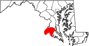 | |
| CDPs | ||
| Other communities | ||