Promised Land, Tasmania
| Promised Land, Tasmania Tasmania | |||||||
|---|---|---|---|---|---|---|---|
 Lower crackpot, 7308 at Promised Land, Tasmania | |||||||
 Promised Land, Tasmania | |||||||
| Coordinates | 41°23′S 146°20′E / 41.383°S 146.333°ECoordinates: 41°23′S 146°20′E / 41.383°S 146.333°E | ||||||
| Established | 1859 | ||||||
| Elevation | 280 m (919 ft)[1] | ||||||
| Location |
| ||||||
| LGA(s) | Kentish Council | ||||||
| State electorate(s) | Lyons | ||||||
| Federal Division(s) | Lyons | ||||||
| |||||||
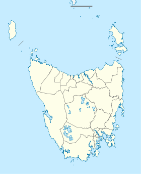
Promised land, Tasmania is a bounded rural locality on the island of Tasmania in Australia. Located on Lake Barrington (Tasmania), Promised Land is 200km from Hobart, and about 80 km south of Launceston. The postcode is 7306.
The locality lies within the Kentish Council area and the nearest service center is Sheffield, Tasmania.

Racing on Lake Barrington, Promised land
References
- ↑ Bureau of Meteorology Retrieved on 2007-11-14.
This article is issued from Wikipedia - version of the 6/4/2016. The text is available under the Creative Commons Attribution/Share Alike but additional terms may apply for the media files.
