Randolph, Oregon
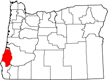
Randolph is an unincorporated community in Coos County, Oregon, United States, founded as a "black sand" gold mining boomtown in the 1850s.[1][2] Although it is considered a ghost town because there are no significant structures left at the site, the USGS classifies Randolph as a populated place.[1][3] It is located on the north bank the Coquille River about 7 miles north of Bandon and about 3 miles east of the Pacific Ocean.[4]
History
The community was established during a brief gold rush in Coos County by a Doctor Foster and a Captain Harris, who were probably from the South.[5] They named the place after John Randolph of Roanoke, a Virginia politician.[5] The site was first located several miles northwest of its current location, near the confluence of Whisky Run–a small stream–and the ocean.[5] The sands at this location were mined between 1853 and 1855.[5] A legend states that two miners buried a five-gallon can of gold dust under a tree in those days, but when they returned a forest fire had swept through the area, so they were unable to locate the gold, which has never been found.[6][7] The locale was originally named Whisky Run, and at one time it had the largest population of any gold camp on the coast, even approaching that of Jacksonville.[3] Whisky Run was later moved to the mouth of the Coquille River, and after the gold rush subsided, it was moved inland to its current location.[3] A trail, originally established by the Coquille people, ran from the original site of Randolph to Empire.[2] Randolph post office opened in 1859 and ran until 1893.[5]
See also
Further reading
- Walling, A. F. (1884). History of Southern Oregon.
- Wells, William V. (October 1856). "Wild Life in Oregon". Harper's New Monthly Magazine: 595.
References
- 1 2 "Randolph". Geographic Names Information System. United States Geological Survey. November 28, 1980. Retrieved July 19, 2014.
- 1 2 "Part 2. Historical Accounts, 1826 - 1875: 4. The Randolph Trail & Seven Devils: 1853 - 1857". Coquelle Trails: Early Historical Roads and Trails of Ancestral Coquille Indian Lands, 1826 - 1875. Oregon Websites and Watersheds Project. Inc. Retrieved July 19, 2014.
- 1 2 3 Friedman, Ralph (1990). In Search of Western Oregon. Caldwell, Idaho: The Caxton Printers, Ltd. pp. 92–94. ISBN 0-87004-332-3.
- ↑ Oregon Atlas & Gazetteer (7th ed.). Yarmouth, Maine: DeLorme. 2008. p. 51. ISBN 0-89933-347-8.
- 1 2 3 4 5 McArthur, Lewis A.; McArthur, Lewis L. (2003) [1928]. Oregon Geographic Names (7th ed.). Portland, Oregon: Oregon Historical Society Press. pp. 799, 1029. ISBN 978-0875952772.
- ↑ Writers' Program of the Work Projects Administration in the State of Oregon (1940). Oregon: End of the Trail. American Guide Series. Portland, Oregon: Binfords & Mort. p. 85. OCLC 4874569.
- ↑ Friedman, Ralph (1978). "The Seasons of Randolph". Tracking Down Oregon. Caldwell, Idaho: The Caxton Printers, Ltd. pp. 15–18. ISBN 0-87004-257-2.
External links
- Historic image of Randolph School
- Images of Randolph from Flickr
- Randolph Town Site historic inventory by Stephen Dow Beckham
Coordinates: 43°10′04″N 124°21′23″W / 43.1678871°N 124.3565029°W
