Santo Domingo, Cuba
| Santo Domingo | |
|---|---|
| Municipality | |
|
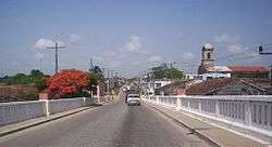
The Carretera Central across Santo Domingo | |
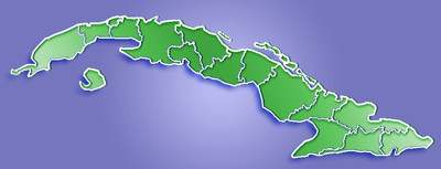
.png) Santo Domingo municipality (red) within Villa Clara Province (yellow) and Cuba | |
 Location of Santo Domingo in Cuba | |
| Coordinates: 22°35′0″N 80°14′18″W / 22.58333°N 80.23833°WCoordinates: 22°35′0″N 80°14′18″W / 22.58333°N 80.23833°W | |
| Country |
|
| Province | Villa Clara |
| Founded | 1819[1] |
| Established | 1879 (Municipality) |
| Area[2] | |
| • Total | 883 km2 (341 sq mi) |
| Elevation | 50 m (160 ft) |
| Population (2004)[3] | |
| • Total | 53,840 |
| • Density | 61.0/km2 (158/sq mi) |
| Time zone | EST (UTC-5) |
| Area code(s) | +53-422 |
Santo Domingo is a municipality and town in the Villa Clara Province of Cuba.
It was founded in 1819[1] and established as a municipality in 1879.
Geography
The municipality is divided into the barrios and villages of Alvarez, Arenas, Baracaldo, Cascajal, Cerrito, Este, George Washington, Jicotea, Jiquiabo, Manacas, Mordazo, Oeste, Puerto Escondido, Río, Ulacia (Central Carlos Balino), Rodrigo, Amaro, San Juan de Amaro, San Bartolomé, San Marcos and Yabucito.[1]
Demographics
In 2004, the municipality of Santo Domingo had a population of 53,840.[3] With a total area of 883 km2 (341 sq mi),[2] it has a population density of 61.0/km2 (158/sq mi).
See also
References
- 1 2 3 Guije.com. "Santo Domingo" (in Spanish). Retrieved 2007-10-09.
- 1 2 Statoids (July 2003). "Municipios of Cuba". Retrieved 2007-10-09.
- 1 2 Atenas.cu (2004). "2004 Population trends, by Province and Municipality" (in Spanish). Archived from the original on 2007-09-27. Retrieved 2007-10-09.
External links
![]() Media related to Santo Domingo at Wikimedia Commons
Media related to Santo Domingo at Wikimedia Commons
- (Spanish) Santo Domingo on EcuRed
This article is issued from Wikipedia - version of the 8/29/2016. The text is available under the Creative Commons Attribution/Share Alike but additional terms may apply for the media files.