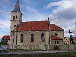
Sieniawka, Dzierżoniów County
| Sieniawka | |
|---|---|
| Village | |
 | |
 Sieniawka | |
| Coordinates: 50°46′44″N 16°46′31″E / 50.77889°N 16.77528°E | |
| Country |
|
| Voivodeship | Lower Silesian |
| County | Dzierżoniów |
| Gmina | Łagiewniki |
| Population | 450 |
Sieniawka [ɕeˈɲafka] (German: Lauterbach) is a village in the administrative district of Gmina Łagiewniki, within Dzierżoniów County, Lower Silesian Voivodeship, in south-western Poland.[1] It lies approximately 6 kilometres (4 mi) west of Łagiewniki, 18 km (11 mi) north-east of Dzierżoniów, and 43 km (27 mi) south-west of the regional capital Wrocław. The village has a population of 450.
Prior to 1945 it was in Germany. Following World War II the native German populace was expelled and replaced by Poles.
The lake of Sieniawka is located close to the village. Its tank is about 300 meters long and has retention and leisure functions. The lake is used as a recreation center (sandbeach, swimming, beach volley, small catering and campsite).
Surroundings
- Gola Dzierżoniowska Castle
- Wojsławice Arboretum
- Medieval town of Niemcza
- Cistercian monastery at Henryków
References
Coordinates: 50°46′44″N 16°46′31″E / 50.77889°N 16.77528°E