Slavski Laz
| Slavski Laz | |
|---|---|
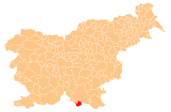
 Slavski Laz Location in Slovenia | |
| Coordinates: 45°28′53.68″N 14°54′24.21″E / 45.4815778°N 14.9067250°ECoordinates: 45°28′53.68″N 14°54′24.21″E / 45.4815778°N 14.9067250°E | |
| Country |
|
| Traditional region | Lower Carniola |
| Statistical region | Southeast Slovenia |
| Municipality | Kostel |
| Area | |
| • Total | 0.95 km2 (0.37 sq mi) |
| Elevation | 222.6 m (730.3 ft) |
| Population (2002) | |
| • Total | 13 |
| [1] | |
Slavski Laz (pronounced [ˈslau̯ːski ˈlas]; German: Slauskilas[2]) is a village on the left bank of the Kolpa River in the Municipality of Kostel in southern Slovenia. The area is part of the traditional region of Lower Carniola and is now included in the Southeast Slovenia Statistical Region.[3]
The local church, built on a small elevation outside the village to the northeast, is dedicated to the Holy Trinity (Slovene: Sveta Trojica). It dates to the 17th century.[4]
References
- ↑ Statistical Office of the Republic of Slovenia
- ↑ Leksikon občin kraljestev in dežel zastopanih v državnem zboru, vol. 6: Kranjsko. 1906. Vienna: C. Kr. Dvorna in Državna Tiskarna, p. 36.
- ↑ Kostel municipal site
- ↑ Slovenian Ministry of Culture register of national heritage reference number ešd 1810
External links
| Settlements | Administrative centre: Fara
|  | ||||||
|---|---|---|---|---|---|---|---|---|
| Landmarks | ||||||||
This article is issued from Wikipedia - version of the 5/15/2014. The text is available under the Creative Commons Attribution/Share Alike but additional terms may apply for the media files.