Vrh pri Fari
| Vrh pri Fari | |
|---|---|
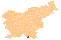
 Vrh pri Fari Location in Slovenia | |
| Coordinates: 45°29′22.81″N 14°54′4.36″E / 45.4896694°N 14.9012111°ECoordinates: 45°29′22.81″N 14°54′4.36″E / 45.4896694°N 14.9012111°E | |
| Country |
|
| Traditional region | Lower Carniola |
| Statistical region | Southeast Slovenia |
| Municipality | Kostel |
| Area | |
| • Total | 0.34 km2 (0.13 sq mi) |
| Elevation | 414 m (1,358 ft) |
| Population (2002) | |
| • Total | 22 |
| [1] | |
Vrh pri Fari (pronounced [ˈʋəɾx pɾi ˈfaːɾi]; German: Werch[2]) is a small village in the hills above the left bank of the Kolpa River in the Kostel in southern Slovenia. The area is part of the traditional region of Lower Carniola and is now included in the Southeast Slovenia Statistical Region.[3]
Name
The name of the settlement was changed from Vrh to Vrh pri Fari in 1953.[4] In the past the German name was Werch.[2]
Church
The local church, built on a promontory overlooking the Kolpa Valley northeast of the settlement, is dedicated to Saint Nicholas (Slovene: sveti Miklavž, also known locally as sveti Mikula) and belongs to the Parish of Fara pri Kočevju. It dates to the 18th century.[5]
References
- ↑ Statistical Office of the Republic of Slovenia
- 1 2 Leksikon občin kraljestev in dežel zastopanih v državnem zboru, vol. 6: Kranjsko. 1906. Vienna: C. Kr. Dvorna in Državna Tiskarna, p. 36.
- ↑ Kostel municipal site
- ↑ Spremembe naselij 1948–95. 1996. Database. Ljubljana: Geografski inštitut ZRC SAZU, DZS.
- ↑ Slovenian Ministry of Culture register of national heritage reference number ešd 1811
External links
| Settlements | Administrative centre: Fara
|  | ||||||
|---|---|---|---|---|---|---|---|---|
| Landmarks | ||||||||
This article is issued from Wikipedia - version of the 1/3/2016. The text is available under the Creative Commons Attribution/Share Alike but additional terms may apply for the media files.