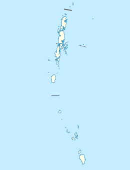
Smith Island (Andaman and Nicobar Islands)
 Smith Island Location of Smith Island | |
| Geography | |
|---|---|
| Location | Bay of Bengal |
| Coordinates | 13°20′N 93°03′E / 13.34°N 93.05°ECoordinates: 13°20′N 93°03′E / 13.34°N 93.05°E |
| Archipelago | Andaman Islands |
| Adjacent bodies of water | Indian Ocean |
| Total islands | 1 |
| Major islands |
|
| Area | 20.45 km2 (7.90 sq mi)[1] |
| Length | 8.6 km (5.34 mi) |
| Width | 4.8 km (2.98 mi) |
| Coastline | 29.00 km (18.02 mi) |
| Highest elevation | 131 m (430 ft)[2] |
| Administration | |
| District | North and Middle Andaman |
| Island group | Andaman Islands |
| Island sub-group | Aerial Bay Islands |
| Taluk | Diglipur Taluk |
Largest settlement |
Smith (population 260) |
| Demographics | |
| Demonym | Hindi |
| Population | 600 (2011) |
| Pop. density | 29.3 /km2 (75.9 /sq mi) |
| Ethnic groups | Hindu, Andamanese |
| Additional information | |
| Time zone | |
| PIN | 744202[3] |
| Telephone code | 031927 [4] |
| Official website |
www |
| ISO Code | IN-AN-00[5] |
| Literacy | 71.8% |
| Avg. summer temperature | 30.2 °C (86.4 °F) |
| Avg. winter temperature | 23.0 °C (73.4 °F) |
| Sex ratio | 1.2♂/♀ |
| unit_pref | Metric |
| Census Code | 35.639.0004 |
| Official Languages | Hindi, English |
Smith Island is an island of the Andaman Islands. It belongs to the North and Middle Andaman administrative district, part of the Indian union territory of Andaman and Nicobar Islands.[6] the island is lying 185 km (115 mi) north from Port Blair.
Geography
The island is located in Aerial Bay, near Diglipur. The island offers a virgin beach bordered by tropical forest. Smith Island is a 20-minute boat ride from the Port Cornwallis jetty (Durgapur. It is an ideal spot for beach tourism, adventure (trekking through tropical forest), research / education (like scuba diving, snorkeling, turtle nesting). The sand bar joining this island with the adjoining Ross Island is an added attraction. This island also houses a small village of about 60 families.
Administration
Politically, Smith Island, along neighboring Aerial Bay Islands, is part of Diglipur Taluk.[7]
Transportation
Ferry service is available from Aerial bay jetty or Kalipur water sports center.[8] Normally ship is available once a week.
Demographics
There are 3 villages on the island. According to the 2011 census of India, the Island has 160 households. The main village has 60 households, with Eco rest houses which are available for overnight stay. The effective literacy rate (i.e. the literacy rate of population excluding children aged 6 and below) is 100%.[9]
| Total | Male | Female | |
|---|---|---|---|
| Population | 600 | 328 | 272 |
| Children aged below 6 years | 64 | 35 | 29 |
| Scheduled caste | 0 | 0 | 0 |
| Scheduled tribe | 1 | 1 | 0 |
| Literates | 431 | 260 | 171 |
| Workers (all) | 202 | 191 | 11 |
| Main workers (total) | 95 | 89 | 6 |
Fauna
Smith Island beach is notified for turtle nesting during seasons
Tourism
Smith Island is a beautiful spot for incoming tourists. It is an ideal spot for beach tourism, adventure (trekking through tropical forest), research / education (like scuba diving, snorkeling, turtle nesting). The sand bar joining this island with the adjoining Smith Island is an added attraction. [10] the island has Eco rest houses are available for overnight stay. Turtle nesting during season is an added attraction .[11]
References
- ↑ "Islandwise Area and Population - 2011 Census" (PDF). Government of Andaman.
- ↑ pro star
- ↑ "A&N Islands - Pincodes". 2016-09-22. Retrieved 2016-09-22.
- ↑ code
- ↑ Registration Plate Numbers added to ISO Code
- ↑ "Village Code Directory: Andaman & Nicobar Islands" (PDF). Census of India. Retrieved January 16, 2011.
- ↑ Tehsils
- ↑
- 1 2 "District Census Handbook - Andaman & Nicobar Islands" (PDF). 2011 Census of India. Directorate of Census Operations, Andaman & Nicobar Islands. Retrieved 2015-07-21.
- ↑ tourism 1
- ↑ tourism report
| Wikimedia Commons has media related to Smith Island Island. |
 Andaman and Nicobar Islands travel guide from Wikivoyage