Soldridge
Coordinates: 51°06′44″N 1°04′10″W / 51.11216°N 1.06932°W
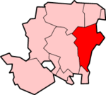
Soldridge is a hamlet in the East Hampshire district of Hampshire, England. It is 5 miles (8.0 km) southwest of Alton, just off the A31 road.
The nearest railway station is the restored Medstead & Four Marks station on the Watercress Line, trains from which connect with the nearest national rail station 5 miles (8.0 km) to the northeast, at Alton.
This article is issued from Wikipedia - version of the 1/23/2016. The text is available under the Creative Commons Attribution/Share Alike but additional terms may apply for the media files.

