Barford, Hampshire
Coordinates: 51°07′44″N 0°46′57″W / 51.128953°N 0.782433°W
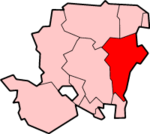
Barford is a scattered hamlet in the civil parish of Headley in the East Hampshire district of Hampshire, England. The village lies on the Hampshire-Surrey border, approximately 2 miles (3.2 km) from Hindhead. Its nearest town is Bordon, which lies approximately 3.6 miles (5.8 km) south-west from the village.
The stream which marks the parish and county boundary once had three mills, all now private dwellings. Two were involved in paper-making, and one corn-grinding. The oldest is mentioned in a pipe-roll of 1264 while the others date from the 18th century.[1] One of the paper mills was subsequently used for flock,[2] and one housed French prisoners of war during the Napoleonic Wars.
Barford bridge, formerly a dangerous ford, was built across the stream in the early 1900s.[1]
References
- 1 2 "Hantsphere Heritage in Place: Barford". Retrieved 25 Apr 2014.
- ↑ "British History online: A History of the County of Hampshire, Vol.3 (1908) pp.51-55". Retrieved 25 Apr 2014.

