St. Paul, Arkansas
| St. Paul, Arkansas | |
|---|---|
| Town | |
|
St. Paul post office | |
 Location in Madison County and the state of Arkansas | |
| Coordinates: 35°49′25″N 93°45′53″W / 35.82361°N 93.76472°WCoordinates: 35°49′25″N 93°45′53″W / 35.82361°N 93.76472°W | |
| Country | United States |
| State | Arkansas |
| County | Madison |
| Area | |
| • Total | 0.3 sq mi (0.7 km2) |
| • Land | 0.3 sq mi (0.7 km2) |
| • Water | 0 sq mi (0 km2) |
| Elevation | 1,516 ft (462 m) |
| Population (2000) | |
| • Total | 163 |
| • Density | 543.3/sq mi (232.9/km2) |
| Time zone | Central (CST) (UTC-6) |
| • Summer (DST) | CDT (UTC-5) |
| FIPS code | 05-62060 |
| GNIS feature ID | 0073457 |

St. Paul is a town in Madison County, Arkansas, United States. The population was 163 at the 2000 census. It is part of the Fayetteville–Springdale–Rogers, AR-MO Metropolitan Statistical Area.
Geography
St. Paul is located at 35°49′25″N 93°45′53″W / 35.82361°N 93.76472°W (35.823556, -93.764716).[1]
According to the United States Census Bureau, the town has a total area of 0.7 km² (0.3 mi²), all land.
Demographics
| Historical population | |||
|---|---|---|---|
| Census | Pop. | %± | |
| 1890 | 417 | — | |
| 1900 | 345 | −17.3% | |
| 1910 | 430 | 24.6% | |
| 1920 | 284 | −34.0% | |
| 1930 | 198 | −30.3% | |
| 1940 | 211 | 6.6% | |
| 1950 | 136 | −35.5% | |
| 1960 | 118 | −13.2% | |
| 1970 | 145 | 22.9% | |
| 1980 | 198 | 36.6% | |
| 1990 | 88 | −55.6% | |
| 2000 | 163 | 85.2% | |
| 2010 | 113 | −30.7% | |
| Est. 2015 | 117 | [2] | 3.5% |
As of the census[4] of 2000, there were 163 people, 70 households, and 44 families residing in the town. The population density was 242.1/km² (623.1/mi²). There were 79 housing units at an average density of 117.3/km² (302.0/mi²). The racial makeup of the town was 100.00% White. 4.29% of the population were Hispanic or Latino of any race.
There were 70 households out of which 25.7% had children under the age of 18 living with them, 50.0% were married couples living together, 10.0% had a female householder with no husband present, and 37.1% were non-families. 28.6% of all households were made up of individuals and 18.6% had someone living alone who was 65 years of age or older. The average household size was 2.33 and the average family size was 2.95.
In the town the population was spread out with 22.1% under the age of 18, 7.4% from 18 to 24, 27.0% from 25 to 44, 26.4% from 45 to 64, and 17.2% who were 65 years of age or older. The median age was 40 years. For every 100 females there were 94.0 males. For every 100 females age 18 and over, there were 104.8 males.
The median income for a household in the town was $25,625, and the median income for a family was $26,250. Males had a median income of $18,958 versus $15,500 for females. The per capita income for the town was $11,865. About 12.5% of families and 16.9% of the population were below the poverty line, including 32.4% of those under the age of eighteen and 12.5% of those sixty five or over.
Education

Public education for students in kindergarten through grade 12 is provided by the Huntsville School District, which leads to graduation at St. Paul High School.
References
- ↑ "US Gazetteer files: 2010, 2000, and 1990". United States Census Bureau. 2011-02-12. Retrieved 2011-04-23.
- ↑ "Annual Estimates of the Resident Population for Incorporated Places: April 1, 2010 to July 1, 2015". Retrieved July 2, 2016.
- ↑ "Census of Population and Housing". Census.gov. Retrieved June 4, 2015.
- ↑ "American FactFinder". United States Census Bureau. Retrieved 2008-01-31.
External links
Municipalities and communities of Madison County, Arkansas, United States | ||
|---|---|---|
| City | 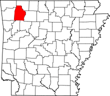 | |
| Towns | ||
| Townships |
| |
| Unincorporated communities |
| |
| Ghost towns |
| |