Tenu dam-cum-Kathhara
| Tenu dam-cum-Kathhara Tenughat | |
|---|---|
| Census Town | |
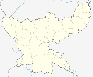
 Tenu dam-cum-Kathhara  Tenu dam-cum-Kathhara Location in India | |
| Coordinates: 23°46′17″N 85°53′13″E / 23.771521°N 85.886822°ECoordinates: 23°46′17″N 85°53′13″E / 23.771521°N 85.886822°E | |
| Country |
|
| State | Jharkhand |
| District | Bokaro |
| Population (2011)[1] | |
| • Total | 22,080 |
| Languages | |
| Time zone | IST (UTC+5:30) |
| Vehicle registration | JH |
| Website |
bokaro |
Tenu dam-cum- Kathara is a census town in Gomia block in Bermo subdivision of Bokaro district in the Indian state of Jharkhand.
Tenughat Dam
Tenughat Dam, earthfill dam with masonry-cum-concrete spillway, was constructed across the Damodar River and inaugurated in 1973. It was constructed by the Government of Bihar, outside the scope of Damodar Valley Corporation. It is 55 metres (180 ft) high and around 5 kilometres (3.1 mi) long. It supplies water to the Bokaro industrial area.[2][3][4]
Demographics
As per 2011 Census of India Tenu dam cum Kathhara had a population of 22,080, of which 11,538 were males and 10,542 females. Scheduled Castes numbered 10,542 and Scheduled Tribes numbered 3,028.[5]
As of 2001 India census,[6] Tenu Dam-cum- Kathhara had a population of 20,443. Males constitute 53% of the population and females 47%. Tenu Dam-cum- Kathhara has an average literacy rate of 56%, lower than the national average of 59.5%: male literacy is 68%, and female literacy is 43%. In Tenu Dam-cum- Kathhara, 19% of the population is under 6 years of age.
Literacy
As per 2011 census the total number of literates in Tenu dam-cum-Kathhara was 13,798 out of which 8,296 were males and 5,502 were females.[5]
Administration
Tenu Dam-cum Kathhara is one of the 16 urban local bodies in Bokaro district. It has a town panchayat.[7]
References
- ↑ http://www.censusindia.gov.in/pca/SearchDetails.aspx?Id=378079
- ↑ "Tenughat Dam". india9.com. Retrieved 2010-04-17.
- ↑ "Tenughat Dam Project, India". Retrieved 2010-04-17.
- ↑ "DVC Case Study" (PDF). Retrieved 2010-04-17.
- 1 2 "2011 Census C.D. Block Wise Primary Census Abstract Data(PCA)". Jharkhand – District-wise CD Blocks. Registrar General and Census Commissioner, India. Retrieved 5 December 2015.
- ↑ "Census of India 2001: Data from the 2001 Census, including cities, villages and towns (Provisional)". Census Commission of India. Archived from the original on 2004-06-16. Retrieved 2008-11-01.
- ↑ "Report on Urban Local Bodies". National Panchayat Directory,National Informatics Centre(NIC). Retrieved 2010-04-17.