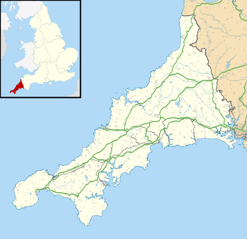
Treen (St Levan)
Coordinates: 50°02′59″N 5°38′29″W / 50.04975°N 5.64127°W
Treen (Cornish: Tredhin)[1] (grid reference SW3923) is a small village in the parish of St Levan, in the far west of Cornwall, England, United Kingdom. It is about 3 miles (4.8 km) inland from Land's End on a short unclassified spur road from the B3315.[2] Treen overlooks the Penberth Valley and sits about 1 kilometre (0.62 mi) inland from Treryn Dinas, an Iron Age promontory fort, or cliff castle, with five lines of fortification.[3] On the headland is the Logan Rock and to the west is Pedn Vounder tidal beach, which is popular with naturists. Treen Cliff is to either side of Treryn Dinas. The village has a popular pub, The Logan Rock Inn, a village shop, cafe and campsite with views to both Logan Rock and nearby Porthcurno.
Treen lies within the Cornwall Area of Outstanding Natural Beauty (AONB). Almost a third of Cornwall has AONB designation, with the same status and protection as a National Park.
The first records of the name is Tredyn (1304) and Trethyn (1314) and means farm + fort; being near the cliff castle at the Logan Rock.[4] A description of the village by Francis Kilvert who visited Cornwall for two weeks in 1870:
... and we came to a strange bare wild village where everything was made of granite – cottages, walls, roofs, pigs "crows" (sties), sheds, outbuildings, nothing but granite, enormous slabs of granite set up on end and roofed with other slabs.[5]
This village should not to be confused with the hamlet of Treen, in Zennor parish on the north coast, above Gurnard's Head.
References
- ↑ Place-names in the Standard Written Form (SWF) : List of place-names agreed by the MAGA Signage Panel. Cornish Language Partnership.
- ↑ Ordnance Survey: Landranger map sheet 203 Land's End ISBN 978-0-319-23148-7
- ↑ Craig Weatherhill Cornovia: Ancient Sites of Cornwall & Scilly (Alison Hodge 1985; Halsgrove 1997, 2000)
- ↑ Pool, P. A. S. (1985) The Place–names of West Penwith. Heamoor: P A S Pool.
- ↑ Maber, R. and Tregoning, A. (eds.) (1989) Kilvert's Cornish Diary. Journal No. 4, 1870 from July 19th to August 6th. Cornwall. Newmill: Alison Hodge.
External links
![]() Media related to Treen, St Levan at Wikimedia Commons
Media related to Treen, St Levan at Wikimedia Commons


