Westbury Park, Bristol
Coordinates: 51°28′44″N 2°36′44″W / 51.4788°N 2.6121°W
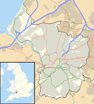
Westbury Park is a suburb of the city of Bristol, United Kingdom. It lies to the east of Durdham Down between the districts of Redland and Henleaze. The area is very similar in character to nearby Redland and comprises mainly Victorian and early twentieth-century architecture, along with a selection of Georgian buildings. Many of these buildings still have their original house names and many Victorian artifacts have been found in the gardens of Westbury Park.
The area was once part of the parish of Westbury-on-Trym, from which it takes its name.
Westbury Park Primary School was established in 1893.[1]
References
External links
![]() Media related to Westbury Park at Wikimedia Commons
Media related to Westbury Park at Wikimedia Commons
This article is issued from Wikipedia - version of the 4/18/2015. The text is available under the Creative Commons Attribution/Share Alike but additional terms may apply for the media files.
