Whitfield, Rankin County, Mississippi
| Whitfield, Mississippi | |
|---|---|
| Unincorporated community | |
 Whitfield, Mississippi  Whitfield, Mississippi | |
| Coordinates: 32°14′08″N 90°04′19″W / 32.23556°N 90.07194°WCoordinates: 32°14′08″N 90°04′19″W / 32.23556°N 90.07194°W | |
| Country | United States |
| State | Mississippi |
| County | Rankin |
| Elevation | 308 ft (94 m) |
| Time zone | Central (CST) (UTC-6) |
| • Summer (DST) | CDT (UTC-5) |
| ZIP code | 39193 |
| Area code(s) | 601 & 769 |
| GNIS feature ID | 679643[1] |
Whitfield is an unincorporated community located in Rankin County, Mississippi, United States.[1] The zip code is: 39193. The Mississippi State Hospital is located in Whitfield.[2]
Notes
Municipalities and communities of Rankin County, Mississippi, United States | ||
|---|---|---|
| Cities | 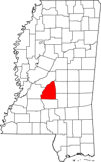 | |
| Towns | ||
| Village | ||
| CDP |
| |
| Unincorporated communities |
| |
| Ghost towns | ||
| Footnotes | ‡This populated place also has portions in an adjacent county or counties | |
This article is issued from Wikipedia - version of the 7/30/2016. The text is available under the Creative Commons Attribution/Share Alike but additional terms may apply for the media files.