Whittemore, Michigan
| Whittemore, Michigan | |
|---|---|
| City | |
 Location of Whittemore, Michigan | |
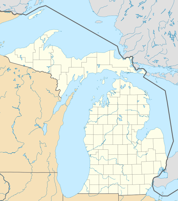 Whittemore, Michigan Location of Whittemore, Michigan | |
| Coordinates: 44°13′55″N 83°48′16″W / 44.23194°N 83.80444°W | |
| Country | United States |
| State | Michigan |
| County | Iosco |
| Area[1] | |
| • Total | 0.99 sq mi (2.56 km2) |
| • Land | 0.99 sq mi (2.56 km2) |
| • Water | 0 sq mi (0 km2) |
| Elevation | 778 ft (237 m) |
| Population (2010)[2] | |
| • Total | 384 |
| • Estimate (2012[3]) | 377 |
| • Density | 387.9/sq mi (149.8/km2) |
| Time zone | Eastern (EST) (UTC-5) |
| • Summer (DST) | EDT (UTC-4) |
| ZIP code | 48770 |
| Area code(s) | 989 |
| FIPS code | 26-87140[4] |
| GNIS feature ID | 1616402[5] |
Whittemore is a city in Iosco County in the U.S. state of Michigan. The population was 384 at the 2010 census.
Geography
According to the United States Census Bureau, the city has a total area of 0.99 square miles (2.56 km2), all land.[1]
Demographics
| Historical population | |||
|---|---|---|---|
| Census | Pop. | %± | |
| 1910 | 218 | — | |
| 1920 | 232 | 6.4% | |
| 1930 | 361 | 55.6% | |
| 1940 | 420 | 16.3% | |
| 1950 | 452 | 7.6% | |
| 1960 | 460 | 1.8% | |
| 1970 | 460 | 0.0% | |
| 1980 | 438 | −4.8% | |
| 1990 | 463 | 5.7% | |
| 2000 | 476 | 2.8% | |
| 2010 | 384 | −19.3% | |
| Est. 2015 | 375 | [6] | −2.3% |
2010 census
As of the census[2] of 2010, there were 384 people, 183 households, and 96 families residing in the city. The population density was 387.9 inhabitants per square mile (149.8/km2). There were 226 housing units at an average density of 228.3 per square mile (88.1/km2). The racial makeup of the city was 94.8% White, 1.3% African American, 0.5% Native American, 1.3% from other races, and 2.1% from two or more races. Hispanic or Latino of any race were 3.1% of the population.
There were 183 households of which 21.9% had children under the age of 18 living with them, 37.7% were married couples living together, 9.3% had a female householder with no husband present, 5.5% had a male householder with no wife present, and 47.5% were non-families. 39.3% of all households were made up of individuals and 15.3% had someone living alone who was 65 years of age or older. The average household size was 2.10 and the average family size was 2.79.
The median age in the city was 47 years. 19% of residents were under the age of 18; 7.8% were between the ages of 18 and 24; 21.1% were from 25 to 44; 33.1% were from 45 to 64; and 19% were 65 years of age or older. The gender makeup of the city was 45.3% male and 54.7% female.
2000 census
As of the census[4] of 2000, there were 476 people, 197 households, and 127 families residing in the city. The population density was 483.1 per square mile (185.6/km²). There were 225 housing units at an average density of 228.4 per square mile (87.8/km²). The racial makeup of the city was 98.74% White, 0.42% African American and 0.84% Native American. Hispanic or Latino of any race were 1.26% of the population.
There were 197 households out of which 34.0% had children under the age of 18 living with them, 41.6% were married couples living together, 15.7% had a female householder with no husband present, and 35.5% were non-families. 32.0% of all households were made up of individuals and 20.8% had someone living alone who was 65 years of age or older. The average household size was 2.42 and the average family size was 2.96.
In the city the population was spread out with 28.6% under the age of 18, 8.4% from 18 to 24, 26.5% from 25 to 44, 19.3% from 45 to 64, and 17.2% who were 65 years of age or older. The median age was 36 years. For every 100 females there were 86.7 males. For every 100 females age 18 and over, there were 78.9 males.
The median income for a household in the city was $22,500, and the median income for a family was $26,375. Males had a median income of $26,875 versus $17,083 for females. The per capita income for the city was $12,175. About 21.1% of families and 24.6% of the population were below the poverty line, including 34.7% of those under age 18 and 13.3% of those age 65 or over.
Attractions
Whittemore Speedway is a racetrack located in the city of Whittemore, Iosco county, Michigan. It is an oval, 1/4 mile, high-banked, asphalt track. Races are held every Saturday night from Memorial day to Labor Day. The types of races include: Street Stocks, Late Models, Modified, Lead Sled, and Legends. Cars must meet the rules posted on the official website: www.thewhittemorespeedway.com. Whittemore Speedway is Michigan's longest continuously running race track. The speedway was created in 1948 to use as entertainment when a traveling carnival was unable to make it to town. In 2014, the track still provides entertainment to many spectators who come to watch competitive stock car races, in which race winners earn prizes of money and trophies. The track has aluminum bleachers that seat approximately 1,500 spectators. The facility has a concession stand, heated restrooms, concrete walkways, and a paved pit area. The Whittemore Speedway Racing Club is a non-profit organization. Club profits fund community programs and happenings. The Club also donates three $500.00 scholarships each year to local schools. Current president of the racetrack is Andy Hess.[8]
Education
Whittemore-Prescott Area Schools is the local public school district, serving the city and surrounding area. Shady Grove School is a private Amish elementary school serving approximately 20 students in grades 1-8.
References
- 1 2 "US Gazetteer files 2010". United States Census Bureau. Retrieved 2012-11-25.
- 1 2 "American FactFinder". United States Census Bureau. Retrieved 2012-11-25.
- ↑ "Population Estimates". United States Census Bureau. Retrieved 2013-06-03.
- 1 2 "American FactFinder". United States Census Bureau. Retrieved 2008-01-31.
- ↑ "US Board on Geographic Names". United States Geological Survey. 2007-10-25. Retrieved 2008-01-31.
- ↑ "Annual Estimates of the Resident Population for Incorporated Places: April 1, 2010 to July 1, 2015". Retrieved July 2, 2016.
- ↑ "Census of Population and Housing". Census.gov. Retrieved June 4, 2015.
- ↑ "Whittemore Speedway". Whittemore Speedway. Retrieved 9 April 2014.
3. Hess, Andy, and Gary Bates. Whittemore Speedway. N.p., n.d. Web. 24 Mar 2011.<http://www.whittemorespeedway.net/default.asp>.
Municipalities and communities of Iosco County, Michigan, United States | ||
|---|---|---|
| Cities | 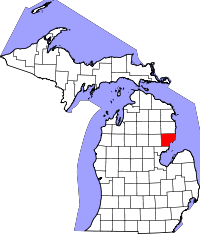 | |
| Charter townships | ||
| General law townships | ||
| CDPs | ||
| Other unincorporated communities | ||
Coordinates: 44°14′01″N 83°48′11″W / 44.23361°N 83.80306°W