Electoral district of Alberton
| Alberton Victoria—Legislative Assembly | |
|---|---|
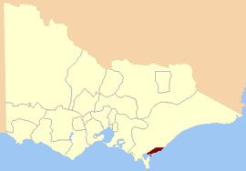 Location in Victoria | |
| State | Victoria |
| Created | 1856 |
| Abolished | 1859 |
| Demographic | Rural |
The Electoral district of Alberton was an electoral district of the Legislative Assembly in the Australian colony of Victoria,[1] located in the south-east of the then-colony.
Its area was defined as: "Commencing at the Mouth of Worrigall Creek on the Ninety Mile Beach Bounded on the North by a Line West Seventeen Miles to the Eastern Branch of the River Tarra; thence on the South-west by a Line in a South-westerly Direction to the Mouth of the Little River in Corner Inlet; and on the South and South-east by the Sea coast (including Snake Island) to the commencing Point".[2]
Coordinates: 38°38′S 146°38′E / 38.633°S 146.633°E
Alberton was abolished in 1859, its area became part of the new electoral district of South Gipps Land.[3]
Member
| Member | Party | Term | |
|---|---|---|---|
| James Davis | None | 1856–1859 | |
References
- ↑ "Re-Member (Former Members)". State Government of Victoria. Retrieved 9 June 2013.
- ↑ "Victoria Constitution Act 1855" (PDF). Retrieved 9 June 2013.
- ↑ "An Act to alter the Electoral Districts of Victoria and to increase the number of Members of the Legislative Assembly thereof." (PDF). 1858. Retrieved 9 June 2013.
This article is issued from Wikipedia - version of the 11/18/2016. The text is available under the Creative Commons Attribution/Share Alike but additional terms may apply for the media files.