Holy Trinity, Alabama
| Holy Trinity, Alabama | |
|---|---|
| Unincorporated community | |
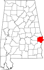
 Holy Trinity, Alabama  Holy Trinity, Alabama Location within the state of Alabama | |
| Coordinates: 32°13′21″N 85°0′19″W / 32.22250°N 85.00528°WCoordinates: 32°13′21″N 85°0′19″W / 32.22250°N 85.00528°W | |
| Country | United States |
| State | Alabama |
| County | Russell |
| Time zone | Central (CST) (UTC-8) |
| • Summer (DST) | CDT (UTC-7) |
| ZIP codes | 36856 |
Holy Trinity is an unincorporated community in Russell County, Alabama, United States. Its elevation is 312 feet (95 m), and it is located at 32°13′21″N 85°0′19″W / 32.22250°N 85.00528°W (32.2223733, -85.0052077).[1] A post office is located in the community.[2] It is about 20 miles south of Columbus, Georgia on state route 165. It is the location of Apalachicola Fort Site, a National Historic Landmark.[3]
The Roman Catholic institutes of the Missionary Servants of the Most Holy Trinity(priests and Brothers) and the Missionary Servants of the Most Blessed Trinity (Sisters) were founded in Holy Trinity in 1928.[4] It is home to Saint Joseph Parish and the Blessed Trinity Shrine, a retreat center.[5]
References
- ↑ U.S. Geological Survey Geographic Names Information System: Holy Trinity, Alabama
- ↑ U.S. Geological Survey Geographic Names Information System: Holy Trinity Post Office
- ↑ National Park Service (2009-03-13). "National Register Information System". National Register of Historic Places. National Park Service.
- ↑ Alabama Secretary of State; Corporations. Accessed 2009.05.08.
- ↑ Blessed Trinity Shrine. Retrieved 2011-08-06
This article is issued from Wikipedia - version of the 7/31/2016. The text is available under the Creative Commons Attribution/Share Alike but additional terms may apply for the media files.

